Property Record
7726 Ne 33Rd Dr, Portland, OR 97211
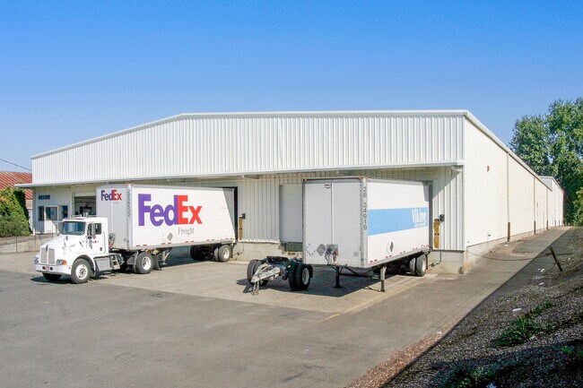


Property Detail
7726 Ne 33Rd Dr
Portland-Vancouver-Hillsboro, OR-WA
SUNDERLAND AC & PLAT 3, N 30 OF LOT 31, S 120 OF LOT 32
R280023
Multnomah
Industrialgeneral
Oregon
IG2
31,32
2025
2.27 AC
2025
Airport Way
007300
Portland
51,600 SF
NEARBY LISTINGS FOR SALE OR LEASE
DEMOGRAPHICS near 7726 Ne 33Rd Dr
1 mile
3 mile
5 mile
2025 Total Population
5,778
109,516
354,965
2030 Population
5,699
108,607
355,166
Pop Growth 2025-2030
(1.37%)
(0.83%)
+ 0.06%
Average Age
41
41
40
2025 Total Households
2,153
46,386
161,976
HH Growth 2025-2030
(1.81%)
(0.95%)
+ 0.03%
Median Household Inc
$107,528
$105,800
$86,695
Avg Household Size
2.40
2.20
2.10
2025 Avg HH Vehicles
2.00
2.00
1.00
Median Home Value
$696,794
$700,955
$639,219
Median Year Built
1948
1948
1962
Nearby Places
Map Layers
Map Styles
 Street
 Aerial
Layers
 Traffic
 Biking
Places
Listings with unknown addresses are not visible on the map
- Restaurants
- Banks
- Shops
- Fitness
- Groceries
PUBLIC TRANSPORTATION
COMMUTER RAIL
Drive
Walk
Distance
14 min
6.8 mi
Drive
Walk
Distance
16 min
7.2 mi
AIRPORT
Portland International
Drive
Walk
Distance
Portland International
14 min
5.5 mi
SALE & LEASE HISTORY
LISTING DATE
SALE/LEASE

Sep 24, 2016
For Lease
Sep 23, 2016
For Sale
Nov 12, 2019
For Lease
May 15, 2020
For Lease
Jul 28, 2021
For Lease
Feb 18, 2021
For Lease
Nearby Properties
Address
Land Use
TOTAL SIZE
Lot Size
Zoning
Address
Land Use
TOTAL SIZE
Lot Size
Zoning
1,405,000 SF
16.51 AC
IG2
Address
Land Use
TOTAL SIZE
Lot Size
Zoning
15,473 SF
192.67 AC
IG2
Address
Land Use
TOTAL SIZE
Lot Size
Zoning
178,785 SF
10.20 AC
R5
Address
Land Use
TOTAL SIZE
Lot Size
Zoning
817,845 SF
22.54 AC
IG2
Address
Land Use
TOTAL SIZE
Lot Size
Zoning
Address
Land Use
TOTAL SIZE
Lot Size
Zoning
134,398 SF
3.17 AC
CG
Address
Land Use
TOTAL SIZE
Lot Size
Zoning
23.95 AC
IG2
Address
Land Use
TOTAL SIZE
Lot Size
Zoning
352,865 SF
10.10 AC
R-30
Address
Land Use
TOTAL SIZE
Lot Size
Zoning
126.43 AC
IG2
Address
Land Use
TOTAL SIZE
Lot Size
Zoning
1,660,710 SF
110.33 AC
IG2
Address
Land Use
TOTAL SIZE
Lot Size
Zoning
126.40 AC
IG2
Address
Land Use
TOTAL SIZE
Lot Size
Zoning
105.72 AC
IG2
Address
Land Use
TOTAL SIZE
Lot Size
Zoning
85,000 SF
1.65 AC
CI2
Address
Land Use
TOTAL SIZE
Lot Size
Zoning
97,000 SF
NULL
Address
Land Use
TOTAL SIZE
Lot Size
Zoning
107,958 SF
2.48 AC
IG2
Address
Land Use
TOTAL SIZE
Lot Size
Zoning
40,595 SF
1.99 AC
IRD
Address
Land Use
TOTAL SIZE
Lot Size
Zoning
11,375 SF
1.46 AC
CI2
Address
Land Use
TOTAL SIZE
Lot Size
Zoning
133.11 AC
IG2
Address
Land Use
TOTAL SIZE
Lot Size
Zoning
1,256 SF
103.58 AC
IG2
Address
Land Use
TOTAL SIZE
Lot Size
Zoning
47.70 AC
IG2
Address
Land Use
TOTAL SIZE
Lot Size
Zoning
112,578 SF
2.94 AC
CI2
Address
Land Use
TOTAL SIZE
Lot Size
Zoning
118,469 SF
47.45 AC
IG2
Address
Land Use
TOTAL SIZE
Lot Size
Zoning
62,100 SF
4.50 AC
OS
Address
Land Use
TOTAL SIZE
Lot Size
Zoning
263,159 SF
2.07 AC
CM3
Address
Land Use
TOTAL SIZE
Lot Size
Zoning
141,560 SF
8.12 AC
R5
Address
Land Use
TOTAL SIZE
Lot Size
Zoning
24.54 AC
IH
Address
Land Use
TOTAL SIZE
Lot Size
Zoning
151,815 SF
2.10 AC
CM3
Address
Land Use
TOTAL SIZE
Lot Size
Zoning
186,161 SF
1.30 AC
EXD
Address
Land Use
TOTAL SIZE
Lot Size
Zoning
67.55 AC
IG2
Address
Land Use
TOTAL SIZE
Lot Size
Zoning
118,040 SF
10.29 AC
EG2
The World's #1 Commercial Real Estate Marketplace
Connect with us
© 2026 CoStar Group
The information above has been obtained from sources believed reliable. While we do not doubt its accuracy we have not verified it and make no guarantee, warranty or representation about it. It is your responsibility to independently confirm its accuracy and completeness. Any projections, opinions, assumptions, or estimates used are for example only and do not represent the current or future performance of the property. The value of this transaction to you depends on tax and other factors which should be evaluated by your tax, financial, and legal advisors. You and your advisors should conduct a careful, independent investigation of the property to determine to your satisfaction the suitability of the property for your needs.