Property Record
7727 Union Mills Rd Se, Lacey, WA 98503


NEARBY LISTINGS FOR SALE OR LEASE
Property Detail
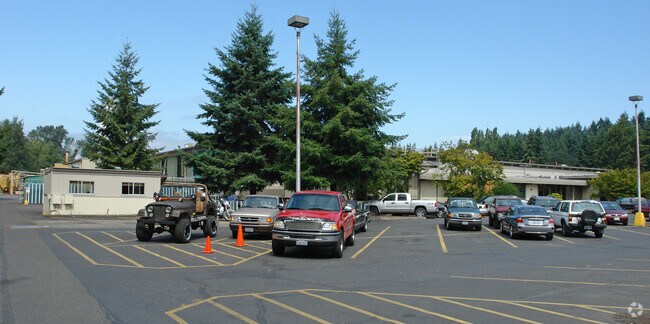
7727 Union Mills Rd Se
Olympia-Tumwater, WA
State Plat
76100004600
SECTION 23 TOWNSHIP 18 RANGE 1W QUARTER SW NW, NW SW, NE SW PLAT STATE PLAT LT 46 010/018 LY E OF E LN WATER PIPE EASEMENT & LY N OF LN 510F & PARALLEL TO N LN LT 46, LESS PTN LY E OF LN BEG X
Industrialgeneral
Thurston
AE
Washington
53067C0192F
46
2024
22.52 AC
2024
Outlying Thurston County
011410
Olympia
158,671 SF
DEMOGRAPHICS near 7727 Union Mills Rd Se
1 Mile
3 Mile
5 Mile
2024 Total Population
8,659
74,440
134,980
2029 Population
9,106
78,754
142,652
Pop Growth 2024-2029
+ 5.16%
+ 5.80%
+ 5.68%
Average Age
40
40
41
2024 Total Households
3,241
28,470
52,182
HH Growth 2024-2029
+ 5.15%
+ 5.91%
+ 5.77%
Median Household Inc
$83,035
$79,438
$81,661
Avg Household Size
2.60
2.50
2.50
2024 Avg HH Vehicles
2.00
2.00
2.00
Median Home Value
$383,380
$374,319
$403,560
Median Year Built
1990
1988
1991
Nearby Places
Map Layers
Map Styles
 Street
 Aerial
- Restaurants
- Banks
- Shops
- Fitness
- Groceries
PUBLIC TRANSPORTATION
COMMUTER RAIL
DRIVE
WALK
Distance
17 min
7.8 mi
Freight Ports
Port of Tacoma
DRIVE
WALK
Distance
Port of Tacoma
40 min
27.1 mi
Nearby Properties
Address
Land Use
TOTAL SIZE
Lot Size
Zoning
Address
Land Use
TOTAL SIZE
Lot Size
Zoning
497,558 SF
28.57 AC
CBD 7
Address
Land Use
TOTAL SIZE
Lot Size
Zoning
660,544 SF
44.67 AC
MD
Address
Land Use
TOTAL SIZE
Lot Size
Zoning
203,039 SF
38.05 AC
OSI-S
Address
Land Use
TOTAL SIZE
Lot Size
Zoning
224,544 SF
14.36 AC
OSI-S
Address
Land Use
TOTAL SIZE
Lot Size
Zoning
214,214 SF
12.06 AC
MHDC
Address
Land Use
TOTAL SIZE
Lot Size
Zoning
160,106 SF
39.73 AC
OSI-S
Address
Land Use
TOTAL SIZE
Lot Size
Zoning
272,388 SF
4.69 AC
HD
Address
Land Use
TOTAL SIZE
Lot Size
Zoning
209,986 SF
11.21 AC
MHDC
Address
Land Use
TOTAL SIZE
Lot Size
Zoning
171,420 SF
63.61 AC
SMU
Address
Land Use
TOTAL SIZE
Lot Size
Zoning
180,132 SF
6.66 AC
HD
Address
Land Use
TOTAL SIZE
Lot Size
Zoning
173,239 SF
7.66 AC
HD
Address
Land Use
TOTAL SIZE
Lot Size
Zoning
64.18 AC
HPBDBC
Address
Land Use
TOTAL SIZE
Lot Size
Zoning
115,977 SF
35.61 AC
OSI-S
Address
Land Use
TOTAL SIZE
Lot Size
Zoning
62.35 AC
HPBDBC
Address
Land Use
TOTAL SIZE
Lot Size
Zoning
159,103 SF
8.44 AC
HD
Address
Land Use
TOTAL SIZE
Lot Size
Zoning
185,054 SF
6.29 AC
HD
Address
Land Use
TOTAL SIZE
Lot Size
Zoning
194,020 SF
9.49 AC
MHDC
Address
Land Use
TOTAL SIZE
Lot Size
Zoning
213,391 SF
9.91 AC
MHDC
Address
Land Use
TOTAL SIZE
Lot Size
Zoning
164,498 SF
8.80 AC
MHDC
Address
Land Use
TOTAL SIZE
Lot Size
Zoning
221,642 SF
4.96 AC
CBD 5
Address
Land Use
TOTAL SIZE
Lot Size
Zoning
357,949 SF
28.17 AC
WD
Address
Land Use
TOTAL SIZE
Lot Size
Zoning
158,221 SF
9.55 AC
HD
Address
Land Use
TOTAL SIZE
Lot Size
Zoning
163,167 SF
8.20 AC
CBD 5
Address
Land Use
TOTAL SIZE
Lot Size
Zoning
69,898 SF
19.70 AC
CBD 7
Address
Land Use
TOTAL SIZE
Lot Size
Zoning
273,214 SF
19.54 AC
WD
Address
Land Use
TOTAL SIZE
Lot Size
Zoning
192,392 SF
16.15 AC
MD
Address
Land Use
TOTAL SIZE
Lot Size
Zoning
53.54 AC
HPBD-C
Address
Land Use
TOTAL SIZE
Lot Size
Zoning
213,880 SF
21.75 AC
GC
Address
Land Use
TOTAL SIZE
Lot Size
Zoning
128,982 SF
6.53 AC
V(U)C
Address
Land Use
TOTAL SIZE
Lot Size
Zoning
161,184 SF
15.36 AC
GC
The World's #1 Commercial Real Estate Marketplace
Connect with us
© 2025 CoStar Group
The information above has been obtained from sources believed reliable. While we do not doubt its accuracy we have not verified it and make no guarantee, warranty or representation about it. It is your responsibility to independently confirm its accuracy and completeness. Any projections, opinions, assumptions, or estimates used are for example only and do not represent the current or future performance of the property. The value of this transaction to you depends on tax and other factors which should be evaluated by your tax, financial, and legal advisors. You and your advisors should conduct a careful, independent investigation of the property to determine to your satisfaction the suitability of the property for your needs.