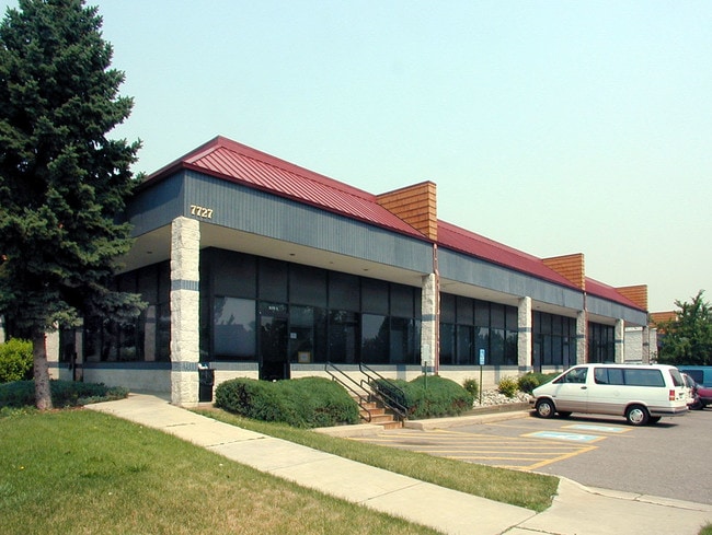
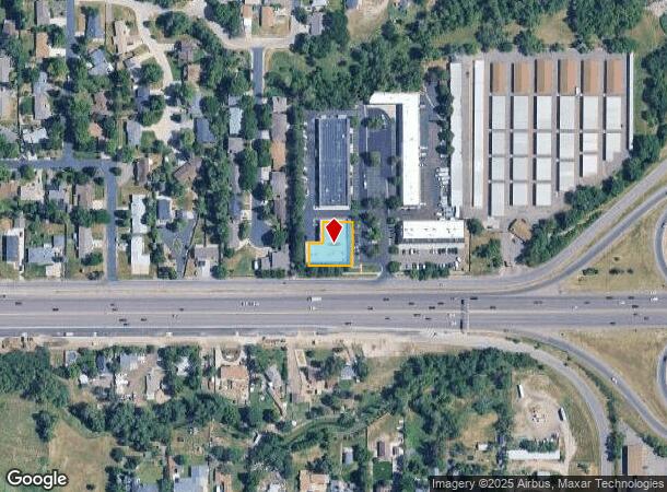
Property Record
7727 W 6Th Ave Frontage Rd, Lakewood, CO 80214
Current Lease Availabilities
NEARBY LISTINGS FOR SALE OR LEASE
Property Detail
7727 W 6Th Ave Frontage Rd
Denver-Aurora-Lakewood, CO
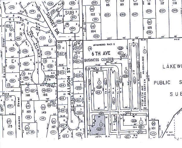
6Th Avenue Business Center Flg No 2
49-023-14-007
SECTION 02 TOWNSHIP 04 RANGE 69 QTR SW SUBDIVISIONCD 000300 SUBDIVISIONNAME 6TH AVENUE BUSINESS CENTER FLG NO 2 BLOCK 001 LOT 0001 SIZE: 11979 TRACT VALUE: .275
Industrialgeneral
Jefferson
X
Colorado
08059C0302G
1
2023
0.28 AC
2024
West Denver
011402
Denver
12,000 SF
DEMOGRAPHICS near 7727 W 6Th Ave Frontage Rd
1 Mile
3 Mile
5 Mile
2024 Total Population
13,952
141,499
378,692
2029 Population
13,799
141,222
379,003
Pop Growth 2024-2029
(1.10%)
(0.20%)
+ 0.08%
Average Age
40
39
39
2024 Total Households
5,702
59,147
162,914
HH Growth 2024-2029
(1.23%)
(0.17%)
+ 0.17%
Median Household Inc
$69,007
$68,065
$77,578
Avg Household Size
2.20
2.30
2.20
2024 Avg HH Vehicles
2.00
2.00
2.00
Median Home Value
$538,419
$469,447
$499,848
Median Year Built
1964
1967
1970
Nearby Places
Map Layers
Map Styles
 Street
 Aerial
- Restaurants
- Banks
- Shops
- Fitness
- Groceries
PUBLIC TRANSPORTATION
TRANSIT/SUBWAY
Lakewood/Wadsworth (W Line - Denver Regional Transportation District Light Rail (TheRide))
DRIVE
WALK
Distance
Lakewood/Wadsworth (W Line - Denver Regional Transportation District Light Rail (TheRide))
4 min
19 min
1.0 mi
COMMUTER RAIL
DRIVE
WALK
Distance
14 min
6.5 mi
Union Station: LoDo-Coors Field-16th Street Mall (C Line - Denver Regional Transportation District Light Rail (TheRide), E Line - Denver Regional Transportation District Light Rail (TheRide), W Line - Denver Regional Transportation District Light Rail (TheRide))
DRIVE
WALK
Distance
Union Station: LoDo-Coors Field-16th Street Mall (C Line - Denver Regional Transportation District Light Rail (TheRide), E Line - Denver Regional Transportation District Light Rail (TheRide), W Line - Denver Regional Transportation District Light Rail (TheRide))
15 min
8.0 mi
AIRPORT
Denver International
DRIVE
WALK
Distance
Denver International
44 min
32.1 mi
Nearby Properties
Address
Land Use
TOTAL SIZE
Lot Size
Zoning
Address
Land Use
TOTAL SIZE
Lot Size
Zoning
943,179 SF
23.96 AC
Address
Land Use
TOTAL SIZE
Lot Size
Zoning
3,195,026 SF
562.97 AC
Address
Land Use
TOTAL SIZE
Lot Size
Zoning
198,081 SF
Address
Land Use
TOTAL SIZE
Lot Size
Zoning
111,673 SF
29.06 AC
Address
Land Use
TOTAL SIZE
Lot Size
Zoning
232,678 SF
27.50 AC
Address
Land Use
TOTAL SIZE
Lot Size
Zoning
233,688 SF
22.37 AC
Address
Land Use
TOTAL SIZE
Lot Size
Zoning
199,685 SF
27.73 AC
Address
Land Use
TOTAL SIZE
Lot Size
Zoning
187,095 SF
23.42 AC
Address
Land Use
TOTAL SIZE
Lot Size
Zoning
247,459 SF
2.31 AC
C-MX-8
Address
Land Use
TOTAL SIZE
Lot Size
Zoning
202,867 SF
2.28 AC
C-MX
Address
Land Use
TOTAL SIZE
Lot Size
Zoning
238,452 SF
8.03 AC
Address
Land Use
TOTAL SIZE
Lot Size
Zoning
738 SF
3.69 AC
Address
Land Use
TOTAL SIZE
Lot Size
Zoning
298,767 SF
4.43 AC
Address
Land Use
TOTAL SIZE
Lot Size
Zoning
397,700 SF
14.45 AC
Address
Land Use
TOTAL SIZE
Lot Size
Zoning
135,372 SF
11.66 AC
Address
Land Use
TOTAL SIZE
Lot Size
Zoning
284,413 SF
3.82 AC
Address
Land Use
TOTAL SIZE
Lot Size
Zoning
167,420 SF
5.84 AC
Address
Land Use
TOTAL SIZE
Lot Size
Zoning
214,839 SF
8.17 AC
Address
Land Use
TOTAL SIZE
Lot Size
Zoning
100,615 SF
2.28 AC
Address
Land Use
TOTAL SIZE
Lot Size
Zoning
82,756 SF
14.95 AC
Address
Land Use
TOTAL SIZE
Lot Size
Zoning
147,609 SF
9.22 AC
Address
Land Use
TOTAL SIZE
Lot Size
Zoning
391,227 SF
5.77 AC
Address
Land Use
TOTAL SIZE
Lot Size
Zoning
143,603 SF
4.71 AC
Address
Land Use
TOTAL SIZE
Lot Size
Zoning
311,200 SF
0.85 AC
Address
Land Use
TOTAL SIZE
Lot Size
Zoning
138,204 SF
3.68 AC
Address
Land Use
TOTAL SIZE
Lot Size
Zoning
146,133 SF
3.75 AC
Address
Land Use
TOTAL SIZE
Lot Size
Zoning
230,285 SF
3.21 AC
Address
Land Use
TOTAL SIZE
Lot Size
Zoning
330,357 SF
15.16 AC
Address
Land Use
TOTAL SIZE
Lot Size
Zoning
241,243 SF
9.08 AC
Address
Land Use
TOTAL SIZE
Lot Size
Zoning
41,263 SF
7.94 AC
The World's #1 Commercial Real Estate Marketplace
Connect with us
© 2026 CoStar Group
The information above has been obtained from sources believed reliable. While we do not doubt its accuracy we have not verified it and make no guarantee, warranty or representation about it. It is your responsibility to independently confirm its accuracy and completeness. Any projections, opinions, assumptions, or estimates used are for example only and do not represent the current or future performance of the property. The value of this transaction to you depends on tax and other factors which should be evaluated by your tax, financial, and legal advisors. You and your advisors should conduct a careful, independent investigation of the property to determine to your satisfaction the suitability of the property for your needs.