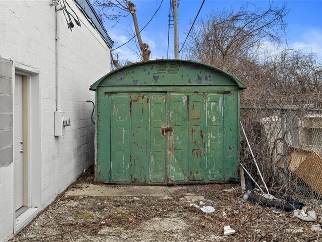
Property Record
7740 W Florist Ave, Milwaukee, WI 53218
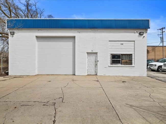
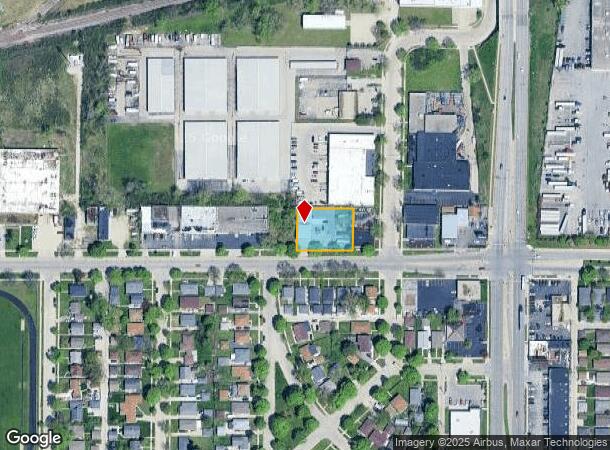
This Property Is For Sale
NEARBY LISTINGS FOR SALE OR LEASE
Property Detail
7740 W Florist Ave
153-9984-100-0
LANDS IN NE 1/4 SEC 28-8-21 COM 452 W OF SE COR SD 1/4 SEC-TH N 165-TH W 160-TH S 165-TH E 160 TO BEG EXC S 45 FOR ST. BID #31
Autorepair
Milwaukee
X
Wisconsin
55089C0245G
0.44 AC
2024
Milwaukee NW
2024
Milwaukee/Madison
001500
Milwaukee-Waukesha-West Allis, WI
3,320 SF
DEMOGRAPHICS near 7740 W Florist Ave
1 Mile
3 Mile
5 Mile
2024 Total Population
18,083
121,252
281,901
2029 Population
17,764
119,078
277,651
Pop Growth 2024-2029
(1.76%)
(1.79%)
(1.51%)
Average Age
34
36
37
2024 Total Households
6,340
46,008
112,717
HH Growth 2024-2029
(1.88%)
(1.85%)
(1.62%)
Median Household Inc
$42,095
$46,997
$51,636
Avg Household Size
2.70
2.50
2.40
2024 Avg HH Vehicles
1.00
1.00
1.00
Median Home Value
$126,720
$137,795
$171,648
Median Year Built
1958
1958
1956
Nearby Places
Map Layers
Map Styles
 Street
 Aerial
- Restaurants
- Banks
- Shops
- Fitness
- Groceries
PUBLIC TRANSPORTATION
AIRPORT
General Mitchell International
DRIVE
WALK
Distance
General Mitchell International
33 min
16.7 mi
Freight Ports
Port Milwaukee
DRIVE
WALK
Distance
Port Milwaukee
25 min
12.5 mi
Nearby Properties
Address
Land Use
TOTAL SIZE
Lot Size
Zoning
Address
Land Use
TOTAL SIZE
Lot Size
Zoning
33.49 AC
TL
Address
Land Use
TOTAL SIZE
Lot Size
Zoning
0.71 AC
RM2
Address
Land Use
TOTAL SIZE
Lot Size
Zoning
8.03 AC
RM1
Address
Land Use
TOTAL SIZE
Lot Size
Zoning
0.71 AC
RM2
Address
Land Use
TOTAL SIZE
Lot Size
Zoning
197,426 SF
26.34 AC
PD
Address
Land Use
TOTAL SIZE
Lot Size
Zoning
206,529 SF
7.88 AC
PD
Address
Land Use
TOTAL SIZE
Lot Size
Zoning
298,666 SF
5.09 AC
PD
Address
Land Use
TOTAL SIZE
Lot Size
Zoning
326,619 SF
30.69 AC
PD
Address
Land Use
TOTAL SIZE
Lot Size
Zoning
12.49 AC
TL
Address
Land Use
TOTAL SIZE
Lot Size
Zoning
12.48 AC
IL1
Address
Land Use
TOTAL SIZE
Lot Size
Zoning
104,365 SF
9.85 AC
PD
Address
Land Use
TOTAL SIZE
Lot Size
Zoning
66.42 AC
IL1
Address
Land Use
TOTAL SIZE
Lot Size
Zoning
17.84 AC
TL
Address
Land Use
TOTAL SIZE
Lot Size
Zoning
221,548 SF
11.80 AC
PD
Address
Land Use
TOTAL SIZE
Lot Size
Zoning
169,550 SF
12.04 AC
RB2
Address
Land Use
TOTAL SIZE
Lot Size
Zoning
18.54 AC
RS6
Address
Land Use
TOTAL SIZE
Lot Size
Zoning
17.91 AC
RS5
Address
Land Use
TOTAL SIZE
Lot Size
Zoning
297,894 SF
19.67 AC
IL1
Address
Land Use
TOTAL SIZE
Lot Size
Zoning
333,971 SF
16.93 AC
IL1
Address
Land Use
TOTAL SIZE
Lot Size
Zoning
166,245 SF
55 AC
PD
Address
Land Use
TOTAL SIZE
Lot Size
Zoning
28.12 AC
RM1
Address
Land Use
TOTAL SIZE
Lot Size
Zoning
116,862 SF
14.39 AC
RM1
Address
Land Use
TOTAL SIZE
Lot Size
Zoning
23.38 AC
RS6
Address
Land Use
TOTAL SIZE
Lot Size
Zoning
163,539 SF
7.17 AC
PUD
Address
Land Use
TOTAL SIZE
Lot Size
Zoning
49.03 AC
PK
Address
Land Use
TOTAL SIZE
Lot Size
Zoning
88,259 SF
14.70 AC
PD
Address
Land Use
TOTAL SIZE
Lot Size
Zoning
9.94 AC
IL1
Address
Land Use
TOTAL SIZE
Lot Size
Zoning
1.40 AC
RM1
Address
Land Use
TOTAL SIZE
Lot Size
Zoning
92,303 SF
19.02 AC
PD
Address
Land Use
TOTAL SIZE
Lot Size
Zoning
118,520 SF
7.69 AC
RM1
The World's #1 Commercial Real Estate Marketplace
Connect with us
© 2025 CoStar Group
The information above has been obtained from sources believed reliable. While we do not doubt its accuracy we have not verified it and make no guarantee, warranty or representation about it. It is your responsibility to independently confirm its accuracy and completeness. Any projections, opinions, assumptions, or estimates used are for example only and do not represent the current or future performance of the property. The value of this transaction to you depends on tax and other factors which should be evaluated by your tax, financial, and legal advisors. You and your advisors should conduct a careful, independent investigation of the property to determine to your satisfaction the suitability of the property for your needs.