Property Record
7747 Eckhert Rd, San Antonio, TX 78240
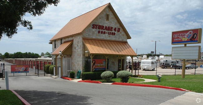


Property Detail
7747 Eckhert Rd
San Antonio-New Braunfels, TX
NCB 17971 BLK LOT NW IRR 405.62 FT OF 1 & NW 103.26 FT OF 2 (ALEXIS JEAN SUBD) 2013-MERGED PIDS 684688, 684692 PER APPRAISER REQUEST CR #28356. JF/GIS/10-9-12
17971-000-0011
BEXAR
Publicstorage
Texas
B and X Area of moderate flood hazard, usually the area between the limits of the 100-year and 500-year floods.
11
2025
5.04 AC
2025
Northwest
181503
San Antonio
104,914 SF
NEARBY LISTINGS FOR SALE OR LEASE
DEMOGRAPHICS near 7747 Eckhert Rd
1 mile
3 mile
5 mile
2025 Total Population
11,553
132,185
363,266
2030 Population
12,065
137,918
378,974
Pop Growth 2025-2030
+ 4.43%
+ 4.34%
+ 4.32%
Average Age
40
38
37
2025 Total Households
4,765
54,390
144,987
HH Growth 2025-2030
+ 4.49%
+ 4.63%
+ 4.60%
Median Household Inc
$59,550
$69,454
$66,717
Avg Household Size
2.40
2.40
2.40
2025 Avg HH Vehicles
2.00
2.00
2.00
Median Home Value
$252,614
$267,195
$267,232
Median Year Built
1988
1987
1988
Nearby Places
Map Layers
Map Styles
 Street
 Aerial
Layers
 Traffic
 Biking
Places
Listings with unknown addresses are not visible on the map
- Restaurants
- Banks
- Shops
- Fitness
- Groceries
PUBLIC TRANSPORTATION
AIRPORT
San Antonio International
Drive
Walk
Distance
San Antonio International
17 min
11.8 mi
Freight Ports
Calhoun Port
Drive
Walk
Distance
Calhoun Port
198 min
159.8 mi
Nearby Properties
Address
Land Use
TOTAL SIZE
Lot Size
Zoning
Address
Land Use
TOTAL SIZE
Lot Size
Zoning
97.47 AC
Address
Land Use
TOTAL SIZE
Lot Size
Zoning
352,231 SF
19.54 AC
Address
Land Use
TOTAL SIZE
Lot Size
Zoning
301,817 SF
12.22 AC
Address
Land Use
TOTAL SIZE
Lot Size
Zoning
284,359 SF
21.53 AC
Address
Land Use
TOTAL SIZE
Lot Size
Zoning
227,744 SF
3.99 AC
Address
Land Use
TOTAL SIZE
Lot Size
Zoning
239,623 SF
26.63 AC
Address
Land Use
TOTAL SIZE
Lot Size
Zoning
213,968 SF
21.30 AC
Address
Land Use
TOTAL SIZE
Lot Size
Zoning
288,719 SF
14.66 AC
Address
Land Use
TOTAL SIZE
Lot Size
Zoning
253,862 SF
14.78 AC
Address
Land Use
TOTAL SIZE
Lot Size
Zoning
495,484 SF
5.81 AC
Address
Land Use
TOTAL SIZE
Lot Size
Zoning
61.64 AC
Address
Land Use
TOTAL SIZE
Lot Size
Zoning
451,205 SF
33.82 AC
Address
Land Use
TOTAL SIZE
Lot Size
Zoning
264,676 SF
11.91 AC
Address
Land Use
TOTAL SIZE
Lot Size
Zoning
259,934 SF
9.81 AC
Address
Land Use
TOTAL SIZE
Lot Size
Zoning
285,150 SF
13.62 AC
Address
Land Use
TOTAL SIZE
Lot Size
Zoning
308,010 SF
9.93 AC
Address
Land Use
TOTAL SIZE
Lot Size
Zoning
340,653 SF
19.27 AC
Address
Land Use
TOTAL SIZE
Lot Size
Zoning
8,508 SF
3.34 AC
Address
Land Use
TOTAL SIZE
Lot Size
Zoning
243,251 SF
10 AC
Address
Land Use
TOTAL SIZE
Lot Size
Zoning
221,778 SF
16.31 AC
Address
Land Use
TOTAL SIZE
Lot Size
Zoning
272,456 SF
21.53 AC
Address
Land Use
TOTAL SIZE
Lot Size
Zoning
536,162 SF
25.11 AC
Address
Land Use
TOTAL SIZE
Lot Size
Zoning
63.25 AC
Address
Land Use
TOTAL SIZE
Lot Size
Zoning
232,398 SF
12.66 AC
Address
Land Use
TOTAL SIZE
Lot Size
Zoning
299,088 SF
15.66 AC
Address
Land Use
TOTAL SIZE
Lot Size
Zoning
211,182 SF
6.73 AC
Address
Land Use
TOTAL SIZE
Lot Size
Zoning
291,385 SF
16.19 AC
Address
Land Use
TOTAL SIZE
Lot Size
Zoning
226,172 SF
5.80 AC
Address
Land Use
TOTAL SIZE
Lot Size
Zoning
230,048 SF
10.70 AC
Address
Land Use
TOTAL SIZE
Lot Size
Zoning
291,713 SF
14.51 AC
The World's #1 Commercial Real Estate Marketplace
Connect with us
© 2026 CoStar Group
The information above has been obtained from sources believed reliable. While we do not doubt its accuracy we have not verified it and make no guarantee, warranty or representation about it. It is your responsibility to independently confirm its accuracy and completeness. Any projections, opinions, assumptions, or estimates used are for example only and do not represent the current or future performance of the property. The value of this transaction to you depends on tax and other factors which should be evaluated by your tax, financial, and legal advisors. You and your advisors should conduct a careful, independent investigation of the property to determine to your satisfaction the suitability of the property for your needs.