Property Record
775 Daedalian Dr, Rome, NY 13441
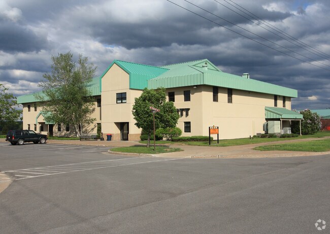


Property Detail
775 Daedalian Dr
243-000-0001-001-009-0001
ONEIDA
Officebuilding
New York
GB
1.043
B and X Area of moderate flood hazard, usually the area between the limits of the 100-year and 500-year floods.
0.99 AC
0
Greater Rome
2024
Utica/Rome
980100
Utica-Rome, NY
20,280 SF
NEARBY LISTINGS FOR SALE OR LEASE
DEMOGRAPHICS near 775 Daedalian Dr
1 mile
3 mile
5 mile
2025 Total Population
193
16,693
35,807
2030 Population
194
16,708
35,709
Pop Growth 2025-2030
+ 0.52%
+ 0.09%
(0.27%)
Average Age
43
41
41
2025 Total Households
77
7,361
14,928
HH Growth 2025-2030
0.00%
(0.24%)
(0.44%)
Median Household Inc
$90,972
$55,544
$56,158
Avg Household Size
2.50
2.20
2.20
2025 Avg HH Vehicles
2.00
2.00
2.00
Median Home Value
$179,629
$158,528
$160,040
Median Year Built
1957
1954
1955
Nearby Places
Map Layers
Map Styles
 Street
 Aerial
Transit
 Traffic
 Biking
Places
Listings with unknown addresses are not visible on the map
- Restaurants
- Banks
- Shops
- Fitness
- Groceries
PUBLIC TRANSPORTATION
COMMUTER RAIL
Rome Amtrak Station (Empire Service - Amtrak, Maple Leaf - Amtrak)
Drive
Walk
Distance
Rome Amtrak Station (Empire Service - Amtrak, Maple Leaf - Amtrak)
8 min
4.0 mi
Freight Ports
Albany, NY Port
Drive
Walk
Distance
Albany, NY Port
131 min
108.5 mi
SALE & LEASE HISTORY
LISTING DATE
SALE/LEASE

Sep 25, 2016
For Lease
May 23, 2017
For Lease
Jun 02, 2017
For Lease
Aug 28, 2017
For Lease
Nearby Properties
Address
Land Use
TOTAL SIZE
Lot Size
Zoning
Address
Land Use
TOTAL SIZE
Lot Size
Zoning
16,970 SF
1,263.52 AC
GB
Address
Land Use
TOTAL SIZE
Lot Size
Zoning
234,767 SF
7.70 AC
I
Address
Land Use
TOTAL SIZE
Lot Size
Zoning
273,250 SF
78.37 AC
GB
Address
Land Use
TOTAL SIZE
Lot Size
Zoning
70,000 SF
126.93 AC
GB
Address
Land Use
TOTAL SIZE
Lot Size
Zoning
70,000 SF
126.93 AC
GB
Address
Land Use
TOTAL SIZE
Lot Size
Zoning
777,552 SF
63.78 AC
GB
Address
Land Use
TOTAL SIZE
Lot Size
Zoning
918,608 SF
86.69 AC
GB
Address
Land Use
TOTAL SIZE
Lot Size
Zoning
11,842 SF
18.34 AC
GB
Address
Land Use
TOTAL SIZE
Lot Size
Zoning
385,216 SF
30.87 AC
GB
Address
Land Use
TOTAL SIZE
Lot Size
Zoning
195,839 SF
22.69 AC
GB
Address
Land Use
TOTAL SIZE
Lot Size
Zoning
77,604 SF
4.34 AC
GB
Address
Land Use
TOTAL SIZE
Lot Size
Zoning
80 AC
GB
Address
Land Use
TOTAL SIZE
Lot Size
Zoning
60,450 SF
2.95 AC
R-P
Address
Land Use
TOTAL SIZE
Lot Size
Zoning
58,560 SF
2.44 AC
R-P
Address
Land Use
TOTAL SIZE
Lot Size
Zoning
10,836 SF
11.24 AC
R-3
Address
Land Use
TOTAL SIZE
Lot Size
Zoning
6,104 SF
123.23 AC
GB
Address
Land Use
TOTAL SIZE
Lot Size
Zoning
75,547 SF
12.17 AC
GB
Address
Land Use
TOTAL SIZE
Lot Size
Zoning
41,262 SF
16.30 AC
R-1-8
Address
Land Use
TOTAL SIZE
Lot Size
Zoning
113,024 SF
10.39 AC
GB
Address
Land Use
TOTAL SIZE
Lot Size
Zoning
2,630 SF
13.09 AC
R-3
Address
Land Use
TOTAL SIZE
Lot Size
Zoning
32,156 SF
6.14 AC
GB
Address
Land Use
TOTAL SIZE
Lot Size
Zoning
52,721 SF
4.16 AC
GB
Address
Land Use
TOTAL SIZE
Lot Size
Zoning
Address
Land Use
TOTAL SIZE
Lot Size
Zoning
70,456 SF
9.74 AC
C-2
Address
Land Use
TOTAL SIZE
Lot Size
Zoning
47,173 SF
3 AC
GB
Address
Land Use
TOTAL SIZE
Lot Size
Zoning
45,984 SF
2.84 AC
GB
Address
Land Use
TOTAL SIZE
Lot Size
Zoning
119,611 SF
35.50 AC
NA
Address
Land Use
TOTAL SIZE
Lot Size
Zoning
55,224 SF
18.65 AC
GB
Address
Land Use
TOTAL SIZE
Lot Size
Zoning
56,220 SF
1.67 AC
GB
Address
Land Use
TOTAL SIZE
Lot Size
Zoning
63,788 SF
6.65 AC
GB
The World's #1 Commercial Real Estate Marketplace
Connect with us
© 2026 CoStar Group
The information above has been obtained from sources believed reliable. While we do not doubt its accuracy we have not verified it and make no guarantee, warranty or representation about it. It is your responsibility to independently confirm its accuracy and completeness. Any projections, opinions, assumptions, or estimates used are for example only and do not represent the current or future performance of the property. The value of this transaction to you depends on tax and other factors which should be evaluated by your tax, financial, and legal advisors. You and your advisors should conduct a careful, independent investigation of the property to determine to your satisfaction the suitability of the property for your needs.