Property Record
775 Malabar Rd, Malabar, FL 32950
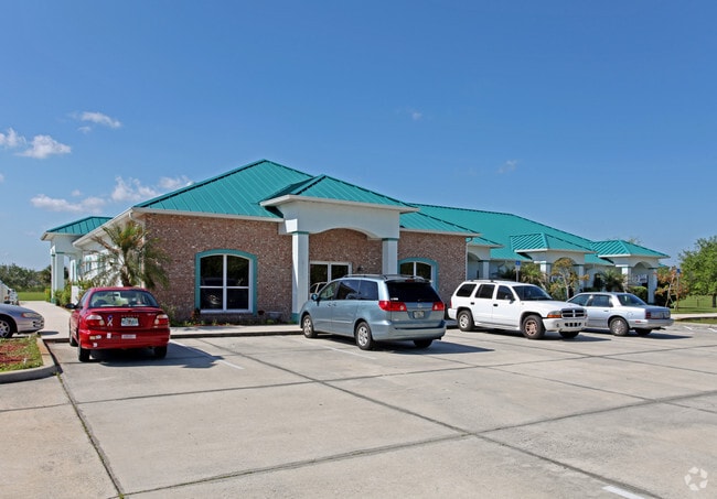


Property Detail
775 Malabar Rd
29-37-03-02-00000.0-0001.01
PIERCE MANGURIAN SUBDIVISION E 5 ACRES OF LOT 1 AS DESC IN ORB 3871 PG 3959
Storesoffices
Brevard
OI
Florida
A Areas with a 1% annual chance of flooding and a 26% chance of flooding over the life of a 30-year mortgage.
1
2024
5 AC
2025
Brevard County
065231
Orlando
8,336 SF
Palm Bay-Melbourne-Titusville, FL
NEARBY LISTINGS FOR SALE OR LEASE
DEMOGRAPHICS near 775 Malabar Rd
1 mile
3 mile
5 mile
2025 Total Population
4,245
43,062
123,283
2030 Population
4,547
46,190
133,302
Pop Growth 2025-2030
+ 7.11%
+ 7.26%
+ 8.13%
Average Age
44
43
43
2025 Total Households
1,596
17,647
50,449
HH Growth 2025-2030
+ 6.89%
+ 6.93%
+ 7.88%
Median Household Inc
$85,084
$66,580
$70,420
Avg Household Size
2.50
2.30
2.30
2025 Avg HH Vehicles
2.00
2.00
2.00
Median Home Value
$297,334
$281,459
$295,886
Median Year Built
1987
1985
1989
Nearby Places
Map Layers
Map Styles
 Street
 Aerial
Layers
 Traffic
 Biking
Places
Listings with unknown addresses are not visible on the map
- Restaurants
- Banks
- Shops
- Fitness
- Groceries
PUBLIC TRANSPORTATION
AIRPORT
Melbourne Orlando International
Drive
Walk
Distance
Melbourne Orlando International
21 min
9.4 mi
Freight Ports
Port Canaveral
Drive
Walk
Distance
Port Canaveral
54 min
43.4 mi
Nearby Properties
Address
Land Use
TOTAL SIZE
Lot Size
Zoning
Address
Land Use
TOTAL SIZE
Lot Size
Zoning
1,695,838 SF
106.06 AC
Address
Land Use
TOTAL SIZE
Lot Size
Zoning
292,165 SF
24.39 AC
RM15
Address
Land Use
TOTAL SIZE
Lot Size
Zoning
282,680 SF
16 AC
IU
Address
Land Use
TOTAL SIZE
Lot Size
Zoning
326,454 SF
14.20 AC
RM20
Address
Land Use
TOTAL SIZE
Lot Size
Zoning
393,147 SF
38.03 AC
RM20
Address
Land Use
TOTAL SIZE
Lot Size
Zoning
294,170 SF
70.66 AC
IU
Address
Land Use
TOTAL SIZE
Lot Size
Zoning
257,044 SF
14.99 AC
Address
Land Use
TOTAL SIZE
Lot Size
Zoning
260,331 SF
9.90 AC
RM10
Address
Land Use
TOTAL SIZE
Lot Size
Zoning
201,017 SF
13.77 AC
RM20
Address
Land Use
TOTAL SIZE
Lot Size
Zoning
560,257 SF
118.47 AC
LI
Address
Land Use
TOTAL SIZE
Lot Size
Zoning
267,548 SF
23.10 AC
RM10
Address
Land Use
TOTAL SIZE
Lot Size
Zoning
4,000 SF
12.20 AC
IU
Address
Land Use
TOTAL SIZE
Lot Size
Zoning
1,380 SF
21.87 AC
IU
Address
Land Use
TOTAL SIZE
Lot Size
Zoning
408,025 SF
24.10 AC
LI
Address
Land Use
TOTAL SIZE
Lot Size
Zoning
136,201 SF
11.93 AC
RM20
Address
Land Use
TOTAL SIZE
Lot Size
Zoning
143,529 SF
7.76 AC
RM20
Address
Land Use
TOTAL SIZE
Lot Size
Zoning
242,454 SF
14.13 AC
LI
Address
Land Use
TOTAL SIZE
Lot Size
Zoning
216,692 SF
28.97 AC
CC
Address
Land Use
TOTAL SIZE
Lot Size
Zoning
135,917 SF
2.92 AC
HC
Address
Land Use
TOTAL SIZE
Lot Size
Zoning
118,747 SF
11.43 AC
RM10
Address
Land Use
TOTAL SIZE
Lot Size
Zoning
166,648 SF
13.01 AC
RM20
Address
Land Use
TOTAL SIZE
Lot Size
Zoning
104,620 SF
12.82 AC
IU
Address
Land Use
TOTAL SIZE
Lot Size
Zoning
103,507 SF
24.90 AC
IU
Address
Land Use
TOTAL SIZE
Lot Size
Zoning
222,925 SF
12.75 AC
PUD
Address
Land Use
TOTAL SIZE
Lot Size
Zoning
76,534 SF
4.33 AC
HC
Address
Land Use
TOTAL SIZE
Lot Size
Zoning
202,908 SF
34.94 AC
LI
Address
Land Use
TOTAL SIZE
Lot Size
Zoning
48,492 SF
17.45 AC
OI
Address
Land Use
TOTAL SIZE
Lot Size
Zoning
150,810 SF
15.11 AC
CC
Address
Land Use
TOTAL SIZE
Lot Size
Zoning
79,677 SF
13.90 AC
IU
Address
Land Use
TOTAL SIZE
Lot Size
Zoning
108,024 SF
15.15 AC
CC
The World's #1 Commercial Real Estate Marketplace
Connect with us
© 2026 CoStar Group
The information above has been obtained from sources believed reliable. While we do not doubt its accuracy we have not verified it and make no guarantee, warranty or representation about it. It is your responsibility to independently confirm its accuracy and completeness. Any projections, opinions, assumptions, or estimates used are for example only and do not represent the current or future performance of the property. The value of this transaction to you depends on tax and other factors which should be evaluated by your tax, financial, and legal advisors. You and your advisors should conduct a careful, independent investigation of the property to determine to your satisfaction the suitability of the property for your needs.