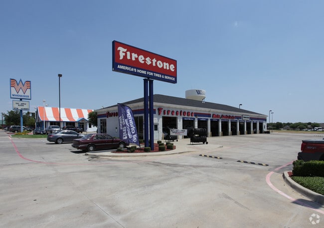
Property Record
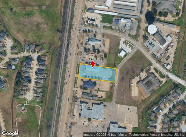
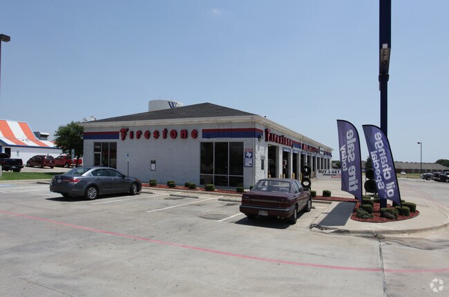
7752 Denton Hwy, Watauga, TX 76148
NEARBY LISTINGS FOR SALE OR LEASE
Property Detail
7752 Denton Hwy
Dallas-Fort Worth-Arlington, TX
Northpark Village Addition
07680902
NORTHPARK VILLAGE ADDITION BLOCK 1R LOT 4RF
Commercialnec
Tarrant
X
Texas
48121C0650G
4
2023
1.37 AC
2025
Watauga/Keller/NRH
113803
Dallas/Ft Worth
7,314 SF
DEMOGRAPHICS near 7752 Denton Hwy
1 Mile
3 Mile
5 Mile
2024 Total Population
16,913
137,855
319,932
2029 Population
17,642
144,366
336,695
Pop Growth 2024-2029
+ 4.31%
+ 4.72%
+ 5.24%
Average Age
37
37
37
2024 Total Households
5,574
46,928
113,538
HH Growth 2024-2029
+ 4.29%
+ 4.84%
+ 5.31%
Median Household Inc
$93,625
$93,087
$89,937
Avg Household Size
3.00
2.90
2.80
2024 Avg HH Vehicles
2.00
2.00
2.00
Median Home Value
$257,132
$268,278
$288,279
Median Year Built
1993
1993
1997
Nearby Places
Map Layers
Map Styles
 Street
 Aerial
- Restaurants
- Banks
- Shops
- Fitness
- Groceries
PUBLIC TRANSPORTATION
COMMUTER RAIL
DRIVE
WALK
Distance
15 min
9.1 mi
Richland Hills (Trinity Railway Express - Dallas Area Rapid Transit (DART))
DRIVE
WALK
Distance
Richland Hills (Trinity Railway Express - Dallas Area Rapid Transit (DART))
15 min
9.6 mi
AIRPORT
Dallas-Fort Worth International
DRIVE
WALK
Distance
Dallas-Fort Worth International
31 min
21.7 mi
Dallas Love Field
DRIVE
WALK
Distance
Dallas Love Field
41 min
30.3 mi
Nearby Properties
Address
Land Use
TOTAL SIZE
Lot Size
Zoning
Address
Land Use
TOTAL SIZE
Lot Size
Zoning
547,836 SF
2 AC
Address
Land Use
TOTAL SIZE
Lot Size
Zoning
524,216 SF
18.59 AC
Address
Land Use
TOTAL SIZE
Lot Size
Zoning
354,787 SF
27.24 AC
Address
Land Use
TOTAL SIZE
Lot Size
Zoning
381,000 SF
8.74 AC
Address
Land Use
TOTAL SIZE
Lot Size
Zoning
350,153 SF
19.73 AC
Address
Land Use
TOTAL SIZE
Lot Size
Zoning
433,894 SF
18.99 AC
Address
Land Use
TOTAL SIZE
Lot Size
Zoning
327,325 SF
16.87 AC
Address
Land Use
TOTAL SIZE
Lot Size
Zoning
285,672 SF
19.20 AC
Address
Land Use
TOTAL SIZE
Lot Size
Zoning
381,489 SF
16.39 AC
Address
Land Use
TOTAL SIZE
Lot Size
Zoning
368,751 SF
19.97 AC
Address
Land Use
TOTAL SIZE
Lot Size
Zoning
301,972 SF
19.32 AC
Address
Land Use
TOTAL SIZE
Lot Size
Zoning
266,403 SF
16.67 AC
Address
Land Use
TOTAL SIZE
Lot Size
Zoning
359,411 SF
17.77 AC
Address
Land Use
TOTAL SIZE
Lot Size
Zoning
261,579 SF
30.93 AC
Address
Land Use
TOTAL SIZE
Lot Size
Zoning
930,000 SF
99.51 AC
Address
Land Use
TOTAL SIZE
Lot Size
Zoning
421,200 SF
73.51 AC
Address
Land Use
TOTAL SIZE
Lot Size
Zoning
248,166 SF
12.05 AC
Address
Land Use
TOTAL SIZE
Lot Size
Zoning
234,084 SF
14.49 AC
Address
Land Use
TOTAL SIZE
Lot Size
Zoning
245,684 SF
18.11 AC
Address
Land Use
TOTAL SIZE
Lot Size
Zoning
130,253 SF
17.92 AC
Address
Land Use
TOTAL SIZE
Lot Size
Zoning
176,242 SF
11.59 AC
Address
Land Use
TOTAL SIZE
Lot Size
Zoning
195,678 SF
12.24 AC
Address
Land Use
TOTAL SIZE
Lot Size
Zoning
197,860 SF
19.82 AC
Address
Land Use
TOTAL SIZE
Lot Size
Zoning
174,898 SF
10.28 AC
Address
Land Use
TOTAL SIZE
Lot Size
Zoning
199,121 SF
10.18 AC
Address
Land Use
TOTAL SIZE
Lot Size
Zoning
132,145 SF
12.26 AC
Address
Land Use
TOTAL SIZE
Lot Size
Zoning
139,050 SF
19.76 AC
Address
Land Use
TOTAL SIZE
Lot Size
Zoning
300,000 SF
33.14 AC
Address
Land Use
TOTAL SIZE
Lot Size
Zoning
350,000 SF
26.71 AC
Address
Land Use
TOTAL SIZE
Lot Size
Zoning
208,143 SF
24.87 AC
The World's #1 Commercial Real Estate Marketplace
Connect with us
© 2026 CoStar Group
The information above has been obtained from sources believed reliable. While we do not doubt its accuracy we have not verified it and make no guarantee, warranty or representation about it. It is your responsibility to independently confirm its accuracy and completeness. Any projections, opinions, assumptions, or estimates used are for example only and do not represent the current or future performance of the property. The value of this transaction to you depends on tax and other factors which should be evaluated by your tax, financial, and legal advisors. You and your advisors should conduct a careful, independent investigation of the property to determine to your satisfaction the suitability of the property for your needs.