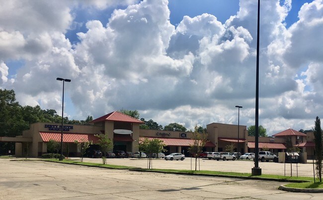
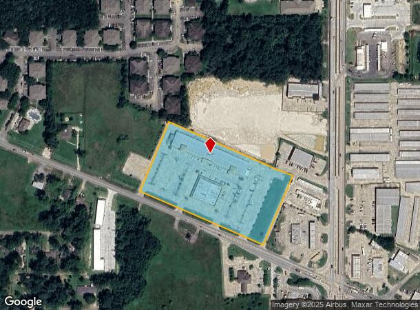
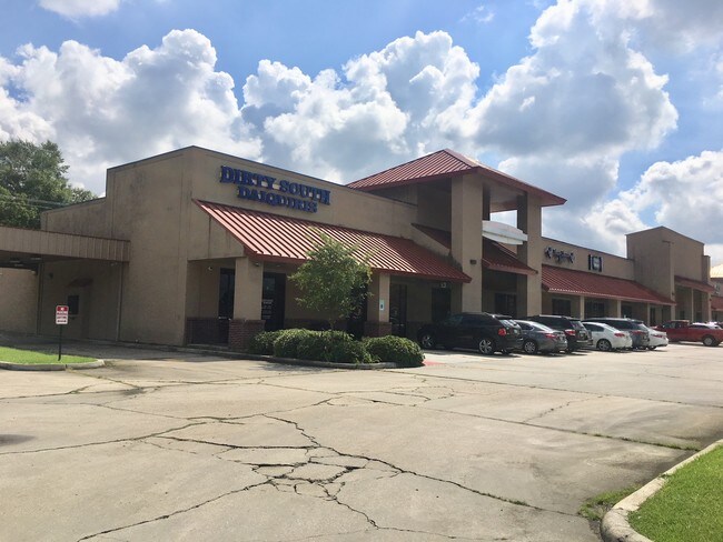
Property Record
7755 Magnolia Beach Rd, Denham Springs, LA 70726

NEARBY LISTINGS FOR SALE OR LEASE
-
-
17070 Greenwell Springs Rd
Greenwell Springs, LA 70739
$10.00 - $14.40 SF/YR
2,500 - 3,577 SF
Retail
-
View all Denham Springs listings for sale on LoopNet.com
Property Detail
7755 Magnolia Beach Rd
Baton Rouge, LA
Not A Subdivision
0445056
TRACT C1A CONTS 1.207 AC SEC 60-6-2 -TRACT CIB CONTS 4.352 AC SEC 60-6-2
Commercialnec
Livingston
AE
Louisiana
22063C0115E
5.56 AC
2024
Livingston Parish
2024
Baton Rouge
040501
DEMOGRAPHICS near 7755 Magnolia Beach Rd
1 Mile
3 Mile
5 Mile
2024 Total Population
4,753
30,543
65,726
2029 Population
5,359
33,156
70,959
Pop Growth 2024-2029
+ 12.75%
+ 8.56%
+ 7.96%
Average Age
37
38
38
2024 Total Households
1,820
11,345
24,247
HH Growth 2024-2029
+ 12.47%
+ 8.40%
+ 7.86%
Median Household Inc
$59,804
$80,254
$79,644
Avg Household Size
2.60
2.70
2.70
2024 Avg HH Vehicles
2.00
2.00
2.00
Median Home Value
$216,537
$240,202
$232,924
Median Year Built
2005
1997
1997
Nearby Places
Map Layers
Map Styles
 Street
 Aerial
- Restaurants
- Banks
- Shops
- Fitness
- Groceries
PUBLIC TRANSPORTATION
AIRPORT
Baton Rouge Metro Ryan Field
DRIVE
WALK
Distance
Baton Rouge Metro Ryan Field
24 min
13.4 mi
Freight Ports
Port of Greater Baton Rouge
DRIVE
WALK
Distance
Port of Greater Baton Rouge
35 min
22.9 mi
SALE & LEASE HISTORY
LISTING DATE
SALE/LEASE

Sep 25, 2016
For Lease
Sep 11, 2017
For Lease
Mar 15, 2019
For Sale
Jan 20, 2017
For Lease
Nearby Properties
Address
Land Use
TOTAL SIZE
Lot Size
Zoning
Address
Land Use
TOTAL SIZE
Lot Size
Zoning
12 AC
Address
Land Use
TOTAL SIZE
Lot Size
Zoning
Address
Land Use
TOTAL SIZE
Lot Size
Zoning
18.52 AC
Address
Land Use
TOTAL SIZE
Lot Size
Zoning
Address
Land Use
TOTAL SIZE
Lot Size
Zoning
Address
Land Use
TOTAL SIZE
Lot Size
Zoning
Address
Land Use
TOTAL SIZE
Lot Size
Zoning
52,530 SF
29.23 AC
Address
Land Use
TOTAL SIZE
Lot Size
Zoning
Address
Land Use
TOTAL SIZE
Lot Size
Zoning
17,046 SF
9.13 AC
Address
Land Use
TOTAL SIZE
Lot Size
Zoning
Address
Land Use
TOTAL SIZE
Lot Size
Zoning
Address
Land Use
TOTAL SIZE
Lot Size
Zoning
Address
Land Use
TOTAL SIZE
Lot Size
Zoning
Address
Land Use
TOTAL SIZE
Lot Size
Zoning
Address
Land Use
TOTAL SIZE
Lot Size
Zoning
Address
Land Use
TOTAL SIZE
Lot Size
Zoning
13,982 SF
2.63 AC
Address
Land Use
TOTAL SIZE
Lot Size
Zoning
2.73 AC
Address
Land Use
TOTAL SIZE
Lot Size
Zoning
Address
Land Use
TOTAL SIZE
Lot Size
Zoning
Address
Land Use
TOTAL SIZE
Lot Size
Zoning
Address
Land Use
TOTAL SIZE
Lot Size
Zoning
Address
Land Use
TOTAL SIZE
Lot Size
Zoning
Address
Land Use
TOTAL SIZE
Lot Size
Zoning
Address
Land Use
TOTAL SIZE
Lot Size
Zoning
Address
Land Use
TOTAL SIZE
Lot Size
Zoning
Address
Land Use
TOTAL SIZE
Lot Size
Zoning
Address
Land Use
TOTAL SIZE
Lot Size
Zoning
17,726 SF
0.06 AC
Address
Land Use
TOTAL SIZE
Lot Size
Zoning
Address
Land Use
TOTAL SIZE
Lot Size
Zoning
The World's #1 Commercial Real Estate Marketplace
Connect with us
© 2026 CoStar Group
The information above has been obtained from sources believed reliable. While we do not doubt its accuracy we have not verified it and make no guarantee, warranty or representation about it. It is your responsibility to independently confirm its accuracy and completeness. Any projections, opinions, assumptions, or estimates used are for example only and do not represent the current or future performance of the property. The value of this transaction to you depends on tax and other factors which should be evaluated by your tax, financial, and legal advisors. You and your advisors should conduct a careful, independent investigation of the property to determine to your satisfaction the suitability of the property for your needs.