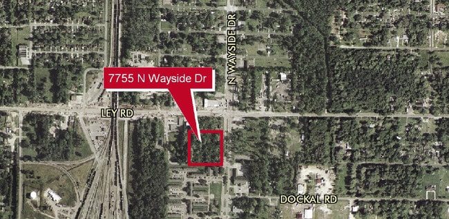
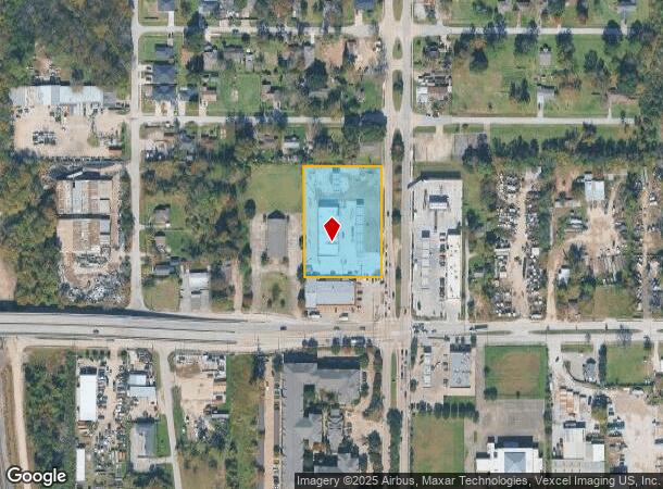
Property Record
7755 N Wayside Dr, Houston, TX 77028
NEARBY LISTINGS FOR SALE OR LEASE
Property Detail
7755 N Wayside Dr
0661130080001
Vuong Place
Servicestationmarket
RES A BLK 1 VUONG PLACE
X
Harris
48201C0685L
Texas
2024
1.92 AC
2025
Northeast Near
231000
Houston
9,300 SF
Houston-The Woodlands-Sugar Land, TX
DEMOGRAPHICS near 7755 N Wayside Dr
1 Mile
3 Mile
5 Mile
2024 Total Population
10,772
69,291
203,134
2029 Population
11,199
71,780
208,907
Pop Growth 2024-2029
+ 3.96%
+ 3.59%
+ 2.84%
Average Age
38
37
37
2024 Total Households
3,508
22,806
65,081
HH Growth 2024-2029
+ 3.88%
+ 3.56%
+ 2.87%
Median Household Inc
$30,368
$33,719
$34,990
Avg Household Size
2.90
2.90
3.00
2024 Avg HH Vehicles
2.00
2.00
2.00
Median Home Value
$72,636
$91,853
$110,552
Median Year Built
1961
1965
1965
Nearby Places
- Restaurants
- Banks
- Shops
- Fitness
- Groceries
PUBLIC TRANSPORTATION
COMMUTER RAIL
Houston (Sunset Limited - Amtrak)
DRIVE
WALK
Distance
Houston (Sunset Limited - Amtrak)
16 min
9.1 mi
AIRPORT
George Bush Intcntl/Houston
DRIVE
WALK
Distance
George Bush Intcntl/Houston
22 min
13.4 mi
William P Hobby
DRIVE
WALK
Distance
William P Hobby
28 min
16.3 mi
Freight Ports
Port of Houston
DRIVE
WALK
Distance
Port of Houston
15 min
8.3 mi
Nearby Properties
Address
Land Use
TOTAL SIZE
Lot Size
Zoning
Address
Land Use
TOTAL SIZE
Lot Size
Zoning
12,206,592 SF
212.18 AC
Address
Land Use
TOTAL SIZE
Lot Size
Zoning
602,940 SF
30.90 AC
Address
Land Use
TOTAL SIZE
Lot Size
Zoning
663,147 SF
40.63 AC
Address
Land Use
TOTAL SIZE
Lot Size
Zoning
228,576 SF
11.46 AC
Address
Land Use
TOTAL SIZE
Lot Size
Zoning
Address
Land Use
TOTAL SIZE
Lot Size
Zoning
357,510 SF
29.15 AC
Address
Land Use
TOTAL SIZE
Lot Size
Zoning
438,196 SF
89.88 AC
Address
Land Use
TOTAL SIZE
Lot Size
Zoning
214,200 SF
12.92 AC
Address
Land Use
TOTAL SIZE
Lot Size
Zoning
215,705 SF
39.58 AC
Address
Land Use
TOTAL SIZE
Lot Size
Zoning
311,550 SF
12.49 AC
Address
Land Use
TOTAL SIZE
Lot Size
Zoning
150,632 SF
36.03 AC
Address
Land Use
TOTAL SIZE
Lot Size
Zoning
300,000 SF
12.83 AC
Address
Land Use
TOTAL SIZE
Lot Size
Zoning
264,866 SF
10.46 AC
Address
Land Use
TOTAL SIZE
Lot Size
Zoning
261,327 SF
19.31 AC
Address
Land Use
TOTAL SIZE
Lot Size
Zoning
296,850 SF
20.04 AC
Address
Land Use
TOTAL SIZE
Lot Size
Zoning
411,028 SF
34.67 AC
Address
Land Use
TOTAL SIZE
Lot Size
Zoning
304,925 SF
10.91 AC
Address
Land Use
TOTAL SIZE
Lot Size
Zoning
254,904 SF
9.27 AC
Address
Land Use
TOTAL SIZE
Lot Size
Zoning
346,320 SF
12.55 AC
Address
Land Use
TOTAL SIZE
Lot Size
Zoning
177,720 SF
14.96 AC
Address
Land Use
TOTAL SIZE
Lot Size
Zoning
199,340 SF
13.27 AC
Address
Land Use
TOTAL SIZE
Lot Size
Zoning
229,050 SF
8.13 AC
Address
Land Use
TOTAL SIZE
Lot Size
Zoning
306,886 SF
45.06 AC
Address
Land Use
TOTAL SIZE
Lot Size
Zoning
138,600 SF
12.29 AC
Address
Land Use
TOTAL SIZE
Lot Size
Zoning
219,230 SF
9.92 AC
Address
Land Use
TOTAL SIZE
Lot Size
Zoning
75,598 SF
27.98 AC
Address
Land Use
TOTAL SIZE
Lot Size
Zoning
254,496 SF
18.22 AC
Address
Land Use
TOTAL SIZE
Lot Size
Zoning
191,567 SF
7.06 AC
Address
Land Use
TOTAL SIZE
Lot Size
Zoning
55,517 SF
13 AC
Address
Land Use
TOTAL SIZE
Lot Size
Zoning
132,800 SF
8 AC
The World's #1 Commercial Real Estate Marketplace
Connect with us
© 2025 CoStar Group
The information above has been obtained from sources believed reliable. While we do not doubt its accuracy we have not verified it and make no guarantee, warranty or representation about it. It is your responsibility to independently confirm its accuracy and completeness. Any projections, opinions, assumptions, or estimates used are for example only and do not represent the current or future performance of the property. The value of this transaction to you depends on tax and other factors which should be evaluated by your tax, financial, and legal advisors. You and your advisors should conduct a careful, independent investigation of the property to determine to your satisfaction the suitability of the property for your needs.