Property Record
777 E 15Th St, Edmond, OK 73013
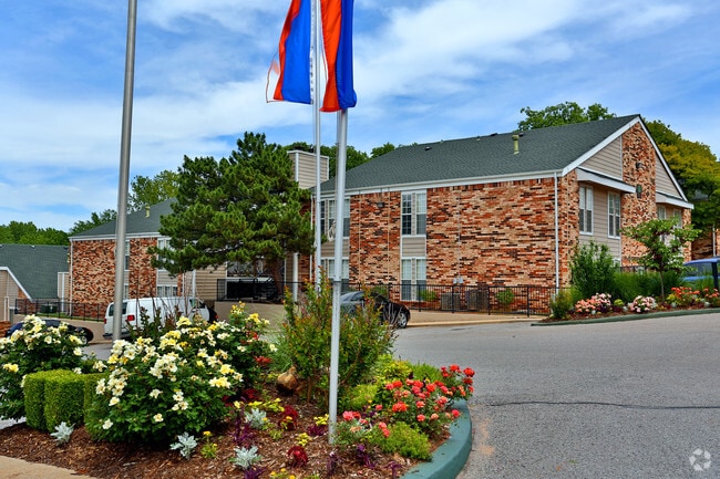


Property Detail
777 E 15Th St
182689320
UNPLTD PT SEC 36 14N 3W 000 000 PT SW4 SEC 36 14N 3W BEG SE/C OF SW4 TH N706.36FT W95.51FT NWLY78.60FT NWLY135.77FT SWLY 255FT SWLY125.12FT SWLY260.45FT SLY51.59FT SWLY211.82FT NWLY211.82FT SLY385.17FT E1150.94FT TO BEG
Multifamilydwelling
Oklahoma
A Areas with a 1% annual chance of flooding and a 26% chance of flooding over the life of a 30-year mortgage.
Oklahoma
2024
13.67 AC
2025
Edmond
108201
Oklahoma City
265,194 SF
Oklahoma City, OK
NEARBY LISTINGS FOR SALE OR LEASE
-
-
View all Edmond listings for sale on LoopNet.com
DEMOGRAPHICS near 777 E 15Th St
1 mile
3 mile
5 mile
2025 Total Population
9,318
70,820
136,796
2030 Population
9,445
71,560
139,047
Pop Growth 2025-2030
+ 1.36%
+ 1.04%
+ 1.65%
Average Age
38
38
38
2025 Total Households
3,750
28,601
53,520
HH Growth 2025-2030
+ 1.49%
+ 1.21%
+ 1.81%
Median Household Inc
$74,578
$86,533
$96,258
Avg Household Size
2.40
2.40
2.50
2025 Avg HH Vehicles
2.00
2.00
2.00
Median Home Value
$255,309
$289,179
$334,262
Median Year Built
1972
1987
1994
Nearby Places
Map Layers
Map Styles
 Street
 Aerial
Transit
 Traffic
 Biking
Places
Listings with unknown addresses are not visible on the map
- Restaurants
- Banks
- Shops
- Fitness
- Groceries
PUBLIC TRANSPORTATION
AIRPORT
Will Rogers World
Drive
Walk
Distance
Will Rogers World
37 min
22.3 mi
Nearby Properties
Address
Land Use
TOTAL SIZE
Lot Size
Zoning
Address
Land Use
TOTAL SIZE
Lot Size
Zoning
200,545 SF
24.93 AC
Address
Land Use
TOTAL SIZE
Lot Size
Zoning
280,581 SF
28.90 AC
Address
Land Use
TOTAL SIZE
Lot Size
Zoning
268,796 SF
45.68 AC
I-2
Address
Land Use
TOTAL SIZE
Lot Size
Zoning
304,744 SF
21.61 AC
Address
Land Use
TOTAL SIZE
Lot Size
Zoning
371,968 SF
30.50 AC
Address
Land Use
TOTAL SIZE
Lot Size
Zoning
32.33 AC
Address
Land Use
TOTAL SIZE
Lot Size
Zoning
285,136 SF
13.04 AC
PUD
Address
Land Use
TOTAL SIZE
Lot Size
Zoning
470,139 SF
80.39 AC
I-2
Address
Land Use
TOTAL SIZE
Lot Size
Zoning
225,492 SF
11.86 AC
R-4
Address
Land Use
TOTAL SIZE
Lot Size
Zoning
402,880 SF
15.39 AC
Address
Land Use
TOTAL SIZE
Lot Size
Zoning
13,101 SF
1.22 AC
PUD
Address
Land Use
TOTAL SIZE
Lot Size
Zoning
164,940 SF
27.04 AC
Address
Land Use
TOTAL SIZE
Lot Size
Zoning
242,196 SF
14.07 AC
Address
Land Use
TOTAL SIZE
Lot Size
Zoning
234,208 SF
8.61 AC
PUD
Address
Land Use
TOTAL SIZE
Lot Size
Zoning
221,364 SF
12.09 AC
Address
Land Use
TOTAL SIZE
Lot Size
Zoning
147,080 SF
10.38 AC
Address
Land Use
TOTAL SIZE
Lot Size
Zoning
82,162 SF
6.13 AC
Address
Land Use
TOTAL SIZE
Lot Size
Zoning
167,664 SF
14.14 AC
Address
Land Use
TOTAL SIZE
Lot Size
Zoning
570,717 SF
44 AC
I-2
Address
Land Use
TOTAL SIZE
Lot Size
Zoning
8,976 SF
1.14 AC
Address
Land Use
TOTAL SIZE
Lot Size
Zoning
6,636 SF
0.18 AC
Address
Land Use
TOTAL SIZE
Lot Size
Zoning
51,176 SF
23.24 AC
PUD
Address
Land Use
TOTAL SIZE
Lot Size
Zoning
68,548 SF
6.90 AC
I-2
Address
Land Use
TOTAL SIZE
Lot Size
Zoning
132,226 SF
11.89 AC
Address
Land Use
TOTAL SIZE
Lot Size
Zoning
64,296 SF
8.43 AC
Address
Land Use
TOTAL SIZE
Lot Size
Zoning
72,273 SF
6.58 AC
Address
Land Use
TOTAL SIZE
Lot Size
Zoning
210,018 SF
25.18 AC
Address
Land Use
TOTAL SIZE
Lot Size
Zoning
7,428 SF
1 AC
Address
Land Use
TOTAL SIZE
Lot Size
Zoning
53,367 SF
8.03 AC
PUD
The World's #1 Commercial Real Estate Marketplace
Connect with us
© 2026 CoStar Group
The information above has been obtained from sources believed reliable. While we do not doubt its accuracy we have not verified it and make no guarantee, warranty or representation about it. It is your responsibility to independently confirm its accuracy and completeness. Any projections, opinions, assumptions, or estimates used are for example only and do not represent the current or future performance of the property. The value of this transaction to you depends on tax and other factors which should be evaluated by your tax, financial, and legal advisors. You and your advisors should conduct a careful, independent investigation of the property to determine to your satisfaction the suitability of the property for your needs.