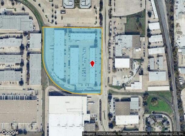
Property Record
777 N Grove Rd, Richardson, TX 75081


NEARBY LISTINGS FOR SALE OR LEASE
Property Detail
777 N Grove Rd
Dallas-Fort Worth-Arlington, TX
Richardson Industrial Park
421965100A0080000
RICHARDSON INDUSTRIAL PARK BLK A LT 8 ACRES 9.64 INT202100376322 DD12162021 CO-DC 1965100A00800 2CR1965100A
Warehouse
Dallas
X
Texas
48085C0505K
8
2024
9.64 AC
2025
Richardson
019102
Dallas/Ft Worth
127,323 SF
DEMOGRAPHICS near 777 N Grove Rd
1 Mile
3 Mile
5 Mile
2024 Total Population
9,254
133,429
370,480
2029 Population
9,174
134,838
386,185
Pop Growth 2024-2029
(0.86%)
+ 1.06%
+ 4.24%
Average Age
37
37
38
2024 Total Households
3,721
49,698
145,596
HH Growth 2024-2029
(1.10%)
+ 1.39%
+ 4.98%
Median Household Inc
$69,142
$72,419
$67,093
Avg Household Size
2.40
2.50
2.40
2024 Avg HH Vehicles
2.00
2.00
2.00
Median Home Value
$262,196
$306,353
$335,589
Median Year Built
1968
1976
1980
Nearby Places
Map Layers
Map Styles
 Street
 Aerial
- Restaurants
- Banks
- Shops
- Fitness
- Groceries
PUBLIC TRANSPORTATION
TRANSIT/SUBWAY
Arapaho Center (DART LIGHT RAIL - ORANGE LINE - Dallas Area Rapid Transit (DART), DART LIGHT RAIL - RED LINE - Dallas Area Rapid Transit (DART), Orange Line - Dallas Area Rapid Transit (DART), Red Line - Dallas Area Rapid Transit (DART))
DRIVE
WALK
Distance
Arapaho Center (DART LIGHT RAIL - ORANGE LINE - Dallas Area Rapid Transit (DART), DART LIGHT RAIL - RED LINE - Dallas Area Rapid Transit (DART), Orange Line - Dallas Area Rapid Transit (DART), Red Line - Dallas Area Rapid Transit (DART))
2 min
13 min
0.7 mi
AIRPORT
Dallas Love Field
DRIVE
WALK
Distance
Dallas Love Field
24 min
16.5 mi
Dallas-Fort Worth International
DRIVE
WALK
Distance
Dallas-Fort Worth International
32 min
25.4 mi
Freight Ports
Port of Shreveport
DRIVE
WALK
Distance
Port of Shreveport
219 min
199.8 mi
SALE & LEASE HISTORY
LISTING DATE
SALE/LEASE

Jan 30, 2018
For Lease
Aug 25, 2023
For Lease
Nearby Properties
Address
Land Use
TOTAL SIZE
Lot Size
Zoning
Address
Land Use
TOTAL SIZE
Lot Size
Zoning
1,049,441 SF
Address
Land Use
TOTAL SIZE
Lot Size
Zoning
1,050,550 SF
18.24 AC
Address
Land Use
TOTAL SIZE
Lot Size
Zoning
7,706,477 SF
245.55 AC
Z116
Address
Land Use
TOTAL SIZE
Lot Size
Zoning
641,243 SF
20.67 AC
Z109
Address
Land Use
TOTAL SIZE
Lot Size
Zoning
1,105,509 SF
92.46 AC
A
Address
Land Use
TOTAL SIZE
Lot Size
Zoning
686,032 SF
9 AC
R2000
Address
Land Use
TOTAL SIZE
Lot Size
Zoning
445,071 SF
107.94 AC
2493-A TO-
Address
Land Use
TOTAL SIZE
Lot Size
Zoning
595,150 SF
17.20 AC
MF-H
Address
Land Use
TOTAL SIZE
Lot Size
Zoning
487,093 SF
6.28 AC
MF-E
Address
Land Use
TOTAL SIZE
Lot Size
Zoning
507,693 SF
32.50 AC
MFL
Address
Land Use
TOTAL SIZE
Lot Size
Zoning
706,061 SF
36.76 AC
Z109
Address
Land Use
TOTAL SIZE
Lot Size
Zoning
428,956 SF
18.76 AC
Z291
Address
Land Use
TOTAL SIZE
Lot Size
Zoning
509,566 SF
34.05 AC
PD
Address
Land Use
TOTAL SIZE
Lot Size
Zoning
324,000 SF
6.67 AC
O-S
Address
Land Use
TOTAL SIZE
Lot Size
Zoning
129,810 SF
14.93 AC
Z236
Address
Land Use
TOTAL SIZE
Lot Size
Zoning
795,714 SF
5.36 AC
Z109
Address
Land Use
TOTAL SIZE
Lot Size
Zoning
249,692 SF
244.62 AC
Z239
Address
Land Use
TOTAL SIZE
Lot Size
Zoning
402,815 SF
5.64 AC
Z236
Address
Land Use
TOTAL SIZE
Lot Size
Zoning
537,928 SF
11.13 AC
Z109
Address
Land Use
TOTAL SIZE
Lot Size
Zoning
426,467 SF
24.12 AC
Z142
Address
Land Use
TOTAL SIZE
Lot Size
Zoning
681,916 SF
4.80 AC
Z31
Address
Land Use
TOTAL SIZE
Lot Size
Zoning
1,464,834 SF
18.37 AC
Z109
Address
Land Use
TOTAL SIZE
Lot Size
Zoning
542,845 SF
3.90 AC
MF-R
Address
Land Use
TOTAL SIZE
Lot Size
Zoning
316,085 SF
13.73 AC
Z107
Address
Land Use
TOTAL SIZE
Lot Size
Zoning
596,546 SF
3.61 AC
Z31
Address
Land Use
TOTAL SIZE
Lot Size
Zoning
371,611 SF
4.48 AC
Z31
Address
Land Use
TOTAL SIZE
Lot Size
Zoning
470,129 SF
4.43 AC
Z112
Address
Land Use
TOTAL SIZE
Lot Size
Zoning
333,963 SF
7.75 AC
MF-E
Address
Land Use
TOTAL SIZE
Lot Size
Zoning
201,226 SF
14.55 AC
Z143
The World's #1 Commercial Real Estate Marketplace
Connect with us
© 2025 CoStar Group
The information above has been obtained from sources believed reliable. While we do not doubt its accuracy we have not verified it and make no guarantee, warranty or representation about it. It is your responsibility to independently confirm its accuracy and completeness. Any projections, opinions, assumptions, or estimates used are for example only and do not represent the current or future performance of the property. The value of this transaction to you depends on tax and other factors which should be evaluated by your tax, financial, and legal advisors. You and your advisors should conduct a careful, independent investigation of the property to determine to your satisfaction the suitability of the property for your needs.