Property Record
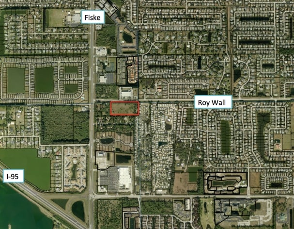
777 Roy Wall Blvd, Rockledge, FL 32955

NEARBY LISTINGS FOR SALE OR LEASE
Property Detail
777 Roy Wall Blvd
Palm Bay-Melbourne-Titusville, FL
PART OF NE 1/4 OF NE 1/4 AS DESC IN DB 410 PG 162 ALSO INCLUDING SOUTH 1 FT OF SE 1/4 OF SE 1/4 OF SECT 17 EXC RD R/W AS DESC IN ORB 5325 PG 4375 EXC ORB 9761 PG 1625 PAR 17-00-774
25-36-20-00-00001.0-0000.00
Brevard
Hospitalprivate
Florida
2024
9.40 AC
2025
Brevard County
063105
Orlando
120,445 SF
DEMOGRAPHICS near 777 Roy Wall Blvd
1 Mile
3 Mile
5 Mile
2024 Total Population
8,932
37,338
85,319
2029 Population
9,675
40,571
92,975
Pop Growth 2024-2029
+ 8.32%
+ 8.66%
+ 8.97%
Average Age
43
43
44
2024 Total Households
3,673
15,154
35,245
HH Growth 2024-2029
+ 8.06%
+ 8.42%
+ 8.77%
Median Household Inc
$86,705
$82,522
$70,424
Avg Household Size
2.40
2.40
2.40
2024 Avg HH Vehicles
2.00
2.00
2.00
Median Home Value
$270,539
$277,766
$293,685
Median Year Built
1996
1996
1993
Nearby Places
Map Layers
Map Styles
 Street
 Aerial
- Restaurants
- Banks
- Shops
- Fitness
- Groceries
PUBLIC TRANSPORTATION
AIRPORT
Melbourne Orlando International
DRIVE
WALK
Distance
Melbourne Orlando International
29 min
19.8 mi
Freight Ports
Port Canaveral
DRIVE
WALK
Distance
Port Canaveral
26 min
15.7 mi
Nearby Properties
Address
Land Use
TOTAL SIZE
Lot Size
Zoning
Address
Land Use
TOTAL SIZE
Lot Size
Zoning
411,148 SF
8.13 AC
HC
Address
Land Use
TOTAL SIZE
Lot Size
Zoning
379,920 SF
19.73 AC
RU215
Address
Land Use
TOTAL SIZE
Lot Size
Zoning
326,407 SF
10 AC
C2
Address
Land Use
TOTAL SIZE
Lot Size
Zoning
308,576 SF
16.41 AC
C2
Address
Land Use
TOTAL SIZE
Lot Size
Zoning
375,112 SF
30.84 AC
PUD
Address
Land Use
TOTAL SIZE
Lot Size
Zoning
181,848 SF
8.20 AC
C2
Address
Land Use
TOTAL SIZE
Lot Size
Zoning
276,665 SF
38.95 AC
R2
Address
Land Use
TOTAL SIZE
Lot Size
Zoning
117,175 SF
8.06 AC
C2
Address
Land Use
TOTAL SIZE
Lot Size
Zoning
176,800 SF
19.23 AC
R3141
Address
Land Use
TOTAL SIZE
Lot Size
Zoning
230,561 SF
13.74 AC
R3141
Address
Land Use
TOTAL SIZE
Lot Size
Zoning
206,696 SF
11.43 AC
R3
Address
Land Use
TOTAL SIZE
Lot Size
Zoning
112,095 SF
9.50 AC
C2
Address
Land Use
TOTAL SIZE
Lot Size
Zoning
132,310 SF
19.92 AC
PUD
Address
Land Use
TOTAL SIZE
Lot Size
Zoning
86,852 SF
5.03 AC
Address
Land Use
TOTAL SIZE
Lot Size
Zoning
110,902 SF
10.67 AC
Address
Land Use
TOTAL SIZE
Lot Size
Zoning
104,705 SF
15.14 AC
PUD
Address
Land Use
TOTAL SIZE
Lot Size
Zoning
95,862 SF
5 AC
C2
Address
Land Use
TOTAL SIZE
Lot Size
Zoning
58,051 SF
30.01 AC
PUD
Address
Land Use
TOTAL SIZE
Lot Size
Zoning
100,050 SF
14.94 AC
R2
Address
Land Use
TOTAL SIZE
Lot Size
Zoning
87,441 SF
20.89 AC
R2
Address
Land Use
TOTAL SIZE
Lot Size
Zoning
156,248 SF
20.16 AC
C2
Address
Land Use
TOTAL SIZE
Lot Size
Zoning
99,379 SF
2.34 AC
Address
Land Use
TOTAL SIZE
Lot Size
Zoning
110,630 SF
31.39 AC
R2
Address
Land Use
TOTAL SIZE
Lot Size
Zoning
117,078 SF
6.13 AC
R2A 8/1
Address
Land Use
TOTAL SIZE
Lot Size
Zoning
49,320 SF
4.03 AC
C2
Address
Land Use
TOTAL SIZE
Lot Size
Zoning
128,347 SF
8.60 AC
IP
Address
Land Use
TOTAL SIZE
Lot Size
Zoning
200,270 SF
16.63 AC
IP
Address
Land Use
TOTAL SIZE
Lot Size
Zoning
52,126 SF
4.93 AC
M1
Address
Land Use
TOTAL SIZE
Lot Size
Zoning
7,284 SF
9.22 AC
The World's #1 Commercial Real Estate Marketplace
Connect with us
© 2026 CoStar Group
The information above has been obtained from sources believed reliable. While we do not doubt its accuracy we have not verified it and make no guarantee, warranty or representation about it. It is your responsibility to independently confirm its accuracy and completeness. Any projections, opinions, assumptions, or estimates used are for example only and do not represent the current or future performance of the property. The value of this transaction to you depends on tax and other factors which should be evaluated by your tax, financial, and legal advisors. You and your advisors should conduct a careful, independent investigation of the property to determine to your satisfaction the suitability of the property for your needs.