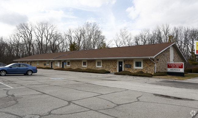
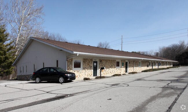
Property Record
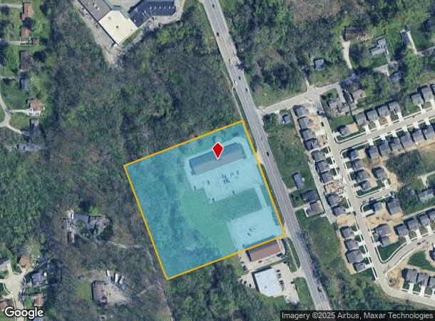
7780 Michigan Rd, Indianapolis, IN 46268
NEARBY LISTINGS FOR SALE OR LEASE
Property Detail
7780 Michigan Rd
49-03-29-121-021.000-674
PT E1/2 NW1/4 S29 T17 R3 BEG 465.3 E & 1000 SE OF NW COR P.O.B. SW584.03 SE511.4 NE584.04 NW276.4 SW50 NW175 NE50 NW60 TO BEG 6.66AC
Medicalbuilding
Marion
AE
Indiana
18097C0039F
6.66 AC
2023
Park 100
2024
Indianapolis
310201
Indianapolis-Carmel-Anderson, IN
12,296 SF
DEMOGRAPHICS near 7780 Michigan Rd
1 Mile
3 Mile
5 Mile
2024 Total Population
10,963
67,111
160,462
2029 Population
10,727
66,174
160,568
Pop Growth 2024-2029
(2.15%)
(1.40%)
+ 0.07%
Average Age
37
39
39
2024 Total Households
4,840
28,595
67,305
HH Growth 2024-2029
(2.29%)
(1.55%)
(0.14%)
Median Household Inc
$55,899
$65,047
$73,931
Avg Household Size
2.20
2.30
2.30
2024 Avg HH Vehicles
1.00
2.00
2.00
Median Home Value
$178,140
$205,349
$267,995
Median Year Built
1987
1981
1979
Nearby Places
- Restaurants
- Banks
- Shops
- Fitness
- Groceries
PUBLIC TRANSPORTATION
AIRPORT
Indianapolis International
DRIVE
WALK
Distance
Indianapolis International
39 min
21.6 mi
Nearby Properties
Address
Land Use
TOTAL SIZE
Lot Size
Zoning
Address
Land Use
TOTAL SIZE
Lot Size
Zoning
303,520 SF
39.62 AC
ZO01
Address
Land Use
TOTAL SIZE
Lot Size
Zoning
278,637 SF
43.98 AC
ZO01
Address
Land Use
TOTAL SIZE
Lot Size
Zoning
18,569 SF
9.57 AC
ZO01
Address
Land Use
TOTAL SIZE
Lot Size
Zoning
967,690 SF
59.63 AC
ZO01
Address
Land Use
TOTAL SIZE
Lot Size
Zoning
2,544 SF
37.75 AC
ZO01
Address
Land Use
TOTAL SIZE
Lot Size
Zoning
4,267 SF
21.06 AC
ZO01
Address
Land Use
TOTAL SIZE
Lot Size
Zoning
168,710 SF
5.24 AC
ZO01
Address
Land Use
TOTAL SIZE
Lot Size
Zoning
68,990 SF
188.21 AC
ZO01
Address
Land Use
TOTAL SIZE
Lot Size
Zoning
1,904 SF
45.69 AC
ZO01
Address
Land Use
TOTAL SIZE
Lot Size
Zoning
9,076 SF
18 AC
ZO01
Address
Land Use
TOTAL SIZE
Lot Size
Zoning
204,544 SF
12.80 AC
ZO01
Address
Land Use
TOTAL SIZE
Lot Size
Zoning
521,092 SF
23.46 AC
ZO01
Address
Land Use
TOTAL SIZE
Lot Size
Zoning
89,245 SF
45.14 AC
ZO01
Address
Land Use
TOTAL SIZE
Lot Size
Zoning
359,121 SF
0.06 AC
ZO01
Address
Land Use
TOTAL SIZE
Lot Size
Zoning
512,730 SF
21.80 AC
ZO01
Address
Land Use
TOTAL SIZE
Lot Size
Zoning
742,342 SF
27.69 AC
ZO01
Address
Land Use
TOTAL SIZE
Lot Size
Zoning
12,023 SF
48.47 AC
ZO01
Address
Land Use
TOTAL SIZE
Lot Size
Zoning
18,768 SF
45.36 AC
ZO01
Address
Land Use
TOTAL SIZE
Lot Size
Zoning
2,103 SF
11.67 AC
ZO01
Address
Land Use
TOTAL SIZE
Lot Size
Zoning
110,373 SF
47.98 AC
ZO01
Address
Land Use
TOTAL SIZE
Lot Size
Zoning
3,829 SF
24.98 AC
ZO01
Address
Land Use
TOTAL SIZE
Lot Size
Zoning
6,306 SF
33.65 AC
ZO01
Address
Land Use
TOTAL SIZE
Lot Size
Zoning
108,872 SF
30 AC
Address
Land Use
TOTAL SIZE
Lot Size
Zoning
179,586 SF
10.23 AC
ZO01
Address
Land Use
TOTAL SIZE
Lot Size
Zoning
6,266 SF
19.01 AC
ZO01
Address
Land Use
TOTAL SIZE
Lot Size
Zoning
89,704 SF
28.63 AC
ZO01
Address
Land Use
TOTAL SIZE
Lot Size
Zoning
158,292 SF
7.88 AC
ZO01
Address
Land Use
TOTAL SIZE
Lot Size
Zoning
4,463 SF
29.49 AC
ZO01
Address
Land Use
TOTAL SIZE
Lot Size
Zoning
155,919 SF
28.92 AC
Address
Land Use
TOTAL SIZE
Lot Size
Zoning
29,662 SF
17.96 AC
ZO01
The World's #1 Commercial Real Estate Marketplace
Connect with us
© 2025 CoStar Group
The information above has been obtained from sources believed reliable. While we do not doubt its accuracy we have not verified it and make no guarantee, warranty or representation about it. It is your responsibility to independently confirm its accuracy and completeness. Any projections, opinions, assumptions, or estimates used are for example only and do not represent the current or future performance of the property. The value of this transaction to you depends on tax and other factors which should be evaluated by your tax, financial, and legal advisors. You and your advisors should conduct a careful, independent investigation of the property to determine to your satisfaction the suitability of the property for your needs.