Property Record
7777 Normandy Blvd, Jacksonville, FL 32221
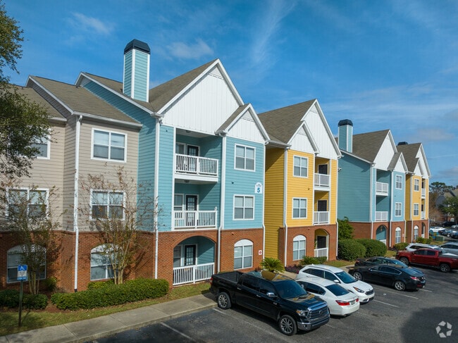


Property Detail
7777 Normandy Blvd
007639-0020
16-43 26-2S-25E 17.12 BIVINS S/D PT LOTS 1,2 PT HOGANS SETTLEMENT RD CLD BY PETITION NO 427RECD O/R 18078-932
Multifamilydwelling
Duval
PUD
Florida
AE The base floodplain where base flood elevations are provided. AE Zones are now used on new format FIRMs instead of A1-A30 Zones.
1,2
2025
17.17 AC
2026
Rolling Hills
012000
Jacksonville (Florida)
321,547 SF
Jacksonville, FL
NEARBY LISTINGS FOR SALE OR LEASE
DEMOGRAPHICS near 7777 Normandy Blvd
1 mile
3 mile
5 mile
2025 Total Population
7,232
69,398
173,667
2030 Population
7,618
73,673
184,702
Pop Growth 2025-2030
+ 5.34%
+ 6.16%
+ 6.35%
Average Age
42
38
38
2025 Total Households
2,755
26,275
68,293
HH Growth 2025-2030
+ 5.55%
+ 6.48%
+ 6.63%
Median Household Inc
$66,751
$60,277
$63,077
Avg Household Size
2.50
2.60
2.50
2025 Avg HH Vehicles
2.00
2.00
2.00
Median Home Value
$233,429
$230,886
$261,269
Median Year Built
1974
1978
1976
Nearby Places
Map Layers
Map Styles
 Street
 Aerial
Transit
 Traffic
 Biking
Places
Listings with unknown addresses are not visible on the map
- Restaurants
- Banks
- Shops
- Fitness
- Groceries
PUBLIC TRANSPORTATION
COMMUTER RAIL
Jacksonville (Silver Meteor - Amtrak, Silver Star - Amtrak)
Drive
Walk
Distance
Jacksonville (Silver Meteor - Amtrak, Silver Star - Amtrak)
15 min
8.2 mi
AIRPORT
Jacksonville International
Drive
Walk
Distance
Jacksonville International
28 min
18.7 mi
Freight Ports
Jacksonville Port
Drive
Walk
Distance
Jacksonville Port
21 min
11.9 mi
Nearby Properties
Address
Land Use
TOTAL SIZE
Lot Size
Zoning
Address
Land Use
TOTAL SIZE
Lot Size
Zoning
744,280 SF
53.40 AC
RMD-D
Address
Land Use
TOTAL SIZE
Lot Size
Zoning
185,662 SF
1,416.80 AC
PBF-3
Address
Land Use
TOTAL SIZE
Lot Size
Zoning
505,748 SF
94.71 AC
IL
Address
Land Use
TOTAL SIZE
Lot Size
Zoning
290,599 SF
27.84 AC
RMD-D
Address
Land Use
TOTAL SIZE
Lot Size
Zoning
179,916 SF
12.19 AC
RMD-D
Address
Land Use
TOTAL SIZE
Lot Size
Zoning
310,972 SF
19.91 AC
RMD-D
Address
Land Use
TOTAL SIZE
Lot Size
Zoning
233,363 SF
20.36 AC
PUD
Address
Land Use
TOTAL SIZE
Lot Size
Zoning
509,686 SF
43.32 AC
IL
Address
Land Use
TOTAL SIZE
Lot Size
Zoning
139,435 SF
7.15 AC
CCG-2
Address
Land Use
TOTAL SIZE
Lot Size
Zoning
129,506 SF
21.68 AC
CCG-2
Address
Land Use
TOTAL SIZE
Lot Size
Zoning
481,686 SF
43.54 AC
IL
Address
Land Use
TOTAL SIZE
Lot Size
Zoning
64,013 SF
8.37 AC
PUD
Address
Land Use
TOTAL SIZE
Lot Size
Zoning
196,790 SF
12.62 AC
RMD-D
Address
Land Use
TOTAL SIZE
Lot Size
Zoning
206,513 SF
9.83 AC
RMD-D
Address
Land Use
TOTAL SIZE
Lot Size
Zoning
169,370 SF
10.87 AC
RMD-D
Address
Land Use
TOTAL SIZE
Lot Size
Zoning
209,480 SF
22.42 AC
CCG-1
Address
Land Use
TOTAL SIZE
Lot Size
Zoning
114,316 SF
20.57 AC
IL
Address
Land Use
TOTAL SIZE
Lot Size
Zoning
170,550 SF
7.48 AC
IL
Address
Land Use
TOTAL SIZE
Lot Size
Zoning
167,854 SF
8.01 AC
IL
Address
Land Use
TOTAL SIZE
Lot Size
Zoning
269,178 SF
129.93 AC
PBF-2
Address
Land Use
TOTAL SIZE
Lot Size
Zoning
96,410 SF
4.11 AC
IH
Address
Land Use
TOTAL SIZE
Lot Size
Zoning
48,720 SF
9.38 AC
PUD
Address
Land Use
TOTAL SIZE
Lot Size
Zoning
225,339 SF
28.72 AC
CCG-1
Address
Land Use
TOTAL SIZE
Lot Size
Zoning
123,684 SF
13.85 AC
PUD
Address
Land Use
TOTAL SIZE
Lot Size
Zoning
136,029 SF
4.96 AC
RMD-D
Address
Land Use
TOTAL SIZE
Lot Size
Zoning
75,247 SF
14.90 AC
CCG-1
Address
Land Use
TOTAL SIZE
Lot Size
Zoning
197,792 SF
17.56 AC
RMD-D
Address
Land Use
TOTAL SIZE
Lot Size
Zoning
130,339 SF
8.07 AC
RMD-D
Address
Land Use
TOTAL SIZE
Lot Size
Zoning
98,541 SF
8.68 AC
CCG-2
The World's #1 Commercial Real Estate Marketplace
Connect with us
© 2026 CoStar Group
The information above has been obtained from sources believed reliable. While we do not doubt its accuracy we have not verified it and make no guarantee, warranty or representation about it. It is your responsibility to independently confirm its accuracy and completeness. Any projections, opinions, assumptions, or estimates used are for example only and do not represent the current or future performance of the property. The value of this transaction to you depends on tax and other factors which should be evaluated by your tax, financial, and legal advisors. You and your advisors should conduct a careful, independent investigation of the property to determine to your satisfaction the suitability of the property for your needs.