Property Record
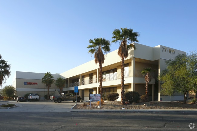
77810 Las Montanas Rd, Palm Desert, CA 92211


NEARBY LISTINGS FOR SALE OR LEASE
Property Detail
77810 Las Montanas Rd
626-420-029
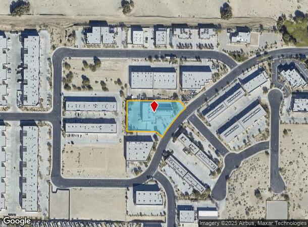
1.49 ACRES IN PAR 29 PM 202/035 PM 29715-1
Lightindustrial
Riverside
X
California
06065C1620G
29
2024
1.49 AC
2025
Coachella Valley
044520
Inland Empire (California)
18,118 SF
Riverside-San Bernardino-Ontario, CA
DEMOGRAPHICS near 77810 Las Montanas Rd
1 Mile
3 Mile
5 Mile
2024 Total Population
5,549
50,803
126,086
2029 Population
6,076
55,796
137,644
Pop Growth 2024-2029
+ 9.50%
+ 9.83%
+ 9.17%
Average Age
55
52
50
2024 Total Households
2,747
23,662
55,102
HH Growth 2024-2029
+ 9.06%
+ 9.78%
+ 9.22%
Median Household Inc
$67,211
$81,623
$79,261
Avg Household Size
2.00
2.10
2.20
2024 Avg HH Vehicles
2.00
2.00
2.00
Median Home Value
$513,572
$571,682
$520,668
Median Year Built
1993
1993
1993
Nearby Places
Map Layers
Map Styles
 Street
 Aerial
- Restaurants
- Banks
- Shops
- Fitness
- Groceries
PUBLIC TRANSPORTATION
AIRPORT
Palm Springs International
DRIVE
WALK
Distance
Palm Springs International
21 min
15.6 mi
Freight Ports
Port of San Diego
DRIVE
WALK
Distance
Port of San Diego
167 min
139.7 mi
SALE & LEASE HISTORY
LISTING DATE
SALE/LEASE

Sep 15, 2025
For Lease
Jan 20, 2021
For Lease
Feb 14, 2017
For Lease
Feb 05, 2021
For Lease
Nearby Properties
Address
Land Use
TOTAL SIZE
Lot Size
Zoning
Address
Land Use
TOTAL SIZE
Lot Size
Zoning
110,000 SF
39.46 AC
Address
Land Use
TOTAL SIZE
Lot Size
Zoning
32,576 SF
19.40 AC
CBOOK
Address
Land Use
TOTAL SIZE
Lot Size
Zoning
160,365 SF
6.98 AC
PC2
Address
Land Use
TOTAL SIZE
Lot Size
Zoning
110,354 SF
14.15 AC
RH
Address
Land Use
TOTAL SIZE
Lot Size
Zoning
166,750 SF
10.69 AC
PR-5
Address
Land Use
TOTAL SIZE
Lot Size
Zoning
284,977 SF
23.95 AC
Address
Land Use
TOTAL SIZE
Lot Size
Zoning
139,456 SF
8.02 AC
R-3
Address
Land Use
TOTAL SIZE
Lot Size
Zoning
208,171 SF
16.83 AC
CBOOK
Address
Land Use
TOTAL SIZE
Lot Size
Zoning
96,384 SF
9.90 AC
SPZONE
Address
Land Use
TOTAL SIZE
Lot Size
Zoning
131,298 SF
10.06 AC
CPS
Address
Land Use
TOTAL SIZE
Lot Size
Zoning
158,234 SF
7.38 AC
IP
Address
Land Use
TOTAL SIZE
Lot Size
Zoning
70,397 SF
3.20 AC
M
Address
Land Use
TOTAL SIZE
Lot Size
Zoning
38,644 SF
18.57 AC
Address
Land Use
TOTAL SIZE
Lot Size
Zoning
53,250 SF
6.62 AC
Address
Land Use
TOTAL SIZE
Lot Size
Zoning
45,962 SF
5.62 AC
Address
Land Use
TOTAL SIZE
Lot Size
Zoning
110,235 SF
8.42 AC
Address
Land Use
TOTAL SIZE
Lot Size
Zoning
106,160 SF
9.02 AC
MIX
Address
Land Use
TOTAL SIZE
Lot Size
Zoning
26,000 SF
1.96 AC
Address
Land Use
TOTAL SIZE
Lot Size
Zoning
85,102 SF
61.12 AC
Address
Land Use
TOTAL SIZE
Lot Size
Zoning
59,416 SF
3.38 AC
W2
Address
Land Use
TOTAL SIZE
Lot Size
Zoning
16,588 SF
3.80 AC
R2A3500
Address
Land Use
TOTAL SIZE
Lot Size
Zoning
18,348 SF
5.92 AC
R3
Address
Land Use
TOTAL SIZE
Lot Size
Zoning
49,530 SF
5.61 AC
Address
Land Use
TOTAL SIZE
Lot Size
Zoning
58,771 SF
3.41 AC
Address
Land Use
TOTAL SIZE
Lot Size
Zoning
35,324 SF
4.06 AC
Address
Land Use
TOTAL SIZE
Lot Size
Zoning
20,222 SF
9.18 AC
Address
Land Use
TOTAL SIZE
Lot Size
Zoning
55,944 SF
2.93 AC
Address
Land Use
TOTAL SIZE
Lot Size
Zoning
31,059 SF
2.84 AC
A1
Address
Land Use
TOTAL SIZE
Lot Size
Zoning
8,151 SF
2.05 AC
The World's #1 Commercial Real Estate Marketplace
Connect with us
© 2025 CoStar Group
The information above has been obtained from sources believed reliable. While we do not doubt its accuracy we have not verified it and make no guarantee, warranty or representation about it. It is your responsibility to independently confirm its accuracy and completeness. Any projections, opinions, assumptions, or estimates used are for example only and do not represent the current or future performance of the property. The value of this transaction to you depends on tax and other factors which should be evaluated by your tax, financial, and legal advisors. You and your advisors should conduct a careful, independent investigation of the property to determine to your satisfaction the suitability of the property for your needs.