Property Record
779 Riverside St, Portland, ME 04103
NEARBY LISTINGS FOR SALE OR LEASE
Property Detail
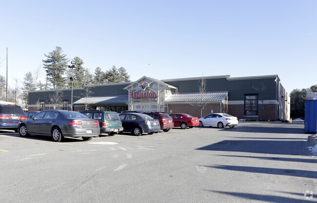
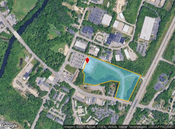
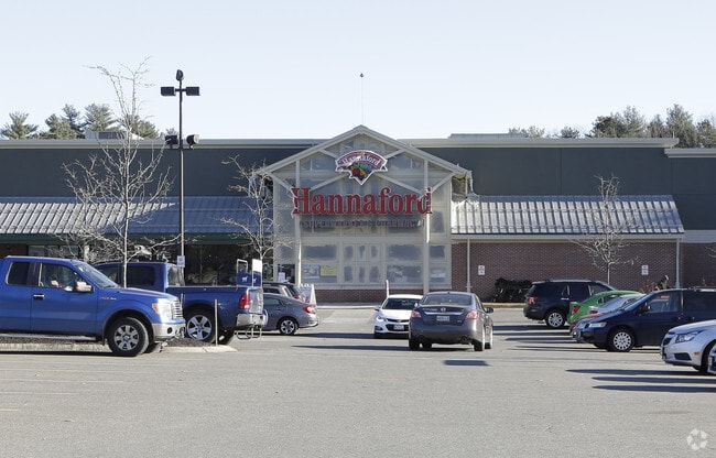
779 Riverside St
Storebuilding
Cumberland
X
Maine
23005C0679F
11.58 AC
2024
SW Cumberland County
2024
Portland/South Portland
002200
Portland-South Portland, ME
35,802 SF
PTLD-000327A-000000-A012001
DEMOGRAPHICS near 779 Riverside St
1 Mile
3 Mile
5 Mile
2024 Total Population
4,920
47,485
101,913
2029 Population
5,045
48,779
105,276
Pop Growth 2024-2029
+ 2.54%
+ 2.73%
+ 3.30%
Average Age
39
42
41
2024 Total Households
1,930
20,464
46,616
HH Growth 2024-2029
+ 2.59%
+ 2.76%
+ 3.47%
Median Household Inc
$76,719
$79,573
$71,490
Avg Household Size
2.50
2.20
2.10
2024 Avg HH Vehicles
2.00
2.00
2.00
Median Home Value
$317,640
$365,061
$395,454
Median Year Built
1973
1964
1958
Nearby Places
Map Layers
Map Styles
 Street
 Aerial
- Restaurants
- Banks
- Shops
- Fitness
- Groceries
PUBLIC TRANSPORTATION
COMMUTER RAIL
Portland (Downeaster - Amtrak)
DRIVE
WALK
Distance
Portland (Downeaster - Amtrak)
9 min
4.8 mi
AIRPORT
Portland International Jetport
DRIVE
WALK
Distance
Portland International Jetport
13 min
5.7 mi
Freight Ports
Portland, ME
DRIVE
WALK
Distance
Portland, ME
10 min
5.8 mi
Nearby Properties
Address
Land Use
TOTAL SIZE
Lot Size
Zoning
Address
Land Use
TOTAL SIZE
Lot Size
Zoning
10.08 AC
Address
Land Use
TOTAL SIZE
Lot Size
Zoning
55.70 AC
14
Address
Land Use
TOTAL SIZE
Lot Size
Zoning
135,968 SF
7.02 AC
Address
Land Use
TOTAL SIZE
Lot Size
Zoning
141,420 SF
11.27 AC
TIF
Address
Land Use
TOTAL SIZE
Lot Size
Zoning
25.12 AC
Address
Land Use
TOTAL SIZE
Lot Size
Zoning
173,617 SF
15.28 AC
Address
Land Use
TOTAL SIZE
Lot Size
Zoning
125,719 SF
18.79 AC
Address
Land Use
TOTAL SIZE
Lot Size
Zoning
139,588 SF
0.85 AC
16
Address
Land Use
TOTAL SIZE
Lot Size
Zoning
78,396 SF
8.60 AC
Address
Land Use
TOTAL SIZE
Lot Size
Zoning
17.95 AC
11
Address
Land Use
TOTAL SIZE
Lot Size
Zoning
19.08 AC
Address
Land Use
TOTAL SIZE
Lot Size
Zoning
152,378 SF
29.34 AC
21
Address
Land Use
TOTAL SIZE
Lot Size
Zoning
9.23 AC
Address
Land Use
TOTAL SIZE
Lot Size
Zoning
137,037 SF
18.32 AC
Address
Land Use
TOTAL SIZE
Lot Size
Zoning
33.07 AC
Address
Land Use
TOTAL SIZE
Lot Size
Zoning
206,165 SF
25.75 AC
Address
Land Use
TOTAL SIZE
Lot Size
Zoning
10.84 AC
Address
Land Use
TOTAL SIZE
Lot Size
Zoning
115 SF
19.07 AC
Address
Land Use
TOTAL SIZE
Lot Size
Zoning
11.94 AC
Address
Land Use
TOTAL SIZE
Lot Size
Zoning
10.16 AC
Address
Land Use
TOTAL SIZE
Lot Size
Zoning
87,942 SF
Address
Land Use
TOTAL SIZE
Lot Size
Zoning
12.10 AC
Address
Land Use
TOTAL SIZE
Lot Size
Zoning
19.86 AC
Address
Land Use
TOTAL SIZE
Lot Size
Zoning
136 SF
11.76 AC
Address
Land Use
TOTAL SIZE
Lot Size
Zoning
104,761 SF
14.73 AC
Address
Land Use
TOTAL SIZE
Lot Size
Zoning
88,887 SF
21.44 AC
Address
Land Use
TOTAL SIZE
Lot Size
Zoning
11.96 AC
Address
Land Use
TOTAL SIZE
Lot Size
Zoning
90,848 SF
15.75 AC
11
Address
Land Use
TOTAL SIZE
Lot Size
Zoning
83,509 SF
7.34 AC
17
Address
Land Use
TOTAL SIZE
Lot Size
Zoning
164 SF
12.48 AC
The World's #1 Commercial Real Estate Marketplace
Connect with us
© 2025 CoStar Group
The information above has been obtained from sources believed reliable. While we do not doubt its accuracy we have not verified it and make no guarantee, warranty or representation about it. It is your responsibility to independently confirm its accuracy and completeness. Any projections, opinions, assumptions, or estimates used are for example only and do not represent the current or future performance of the property. The value of this transaction to you depends on tax and other factors which should be evaluated by your tax, financial, and legal advisors. You and your advisors should conduct a careful, independent investigation of the property to determine to your satisfaction the suitability of the property for your needs.