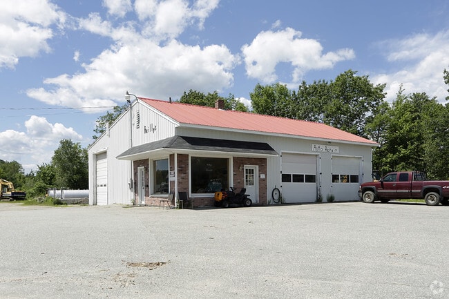
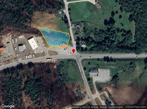
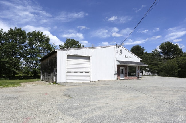
Property Record
779 Us Route 202, North Monmouth, ME 04265
NEARBY LISTINGS FOR SALE OR LEASE
Property Detail
779 Us Route 202
MONM-000040-000000-000005
Kennebec
Servicestation
Maine
X
5
23001C0150E
0.84 AC
2024
Maine South & Augusta
2024
Other Market Areas
013000
Augusta-Waterville, ME
2,400 SF
DEMOGRAPHICS near 779 Us Route 202
1 Mile
3 Mile
5 Mile
2024 Total Population
615
3,001
8,951
2029 Population
638
3,112
9,305
Pop Growth 2024-2029
+ 3.74%
+ 3.70%
+ 3.95%
Average Age
43
43
43
2024 Total Households
250
1,223
3,762
HH Growth 2024-2029
+ 3.60%
+ 3.84%
+ 4.09%
Median Household Inc
$81,521
$82,557
$74,642
Avg Household Size
2.30
2.40
2.30
2024 Avg HH Vehicles
2.00
2.00
2.00
Median Home Value
$183,636
$213,801
$229,036
Median Year Built
1983
1983
1980
Nearby Places
Map Layers
Map Styles
 Street
 Aerial
- Restaurants
- Banks
- Shops
- Fitness
- Groceries
Nearby Properties
Address
Land Use
TOTAL SIZE
Lot Size
Zoning
Address
Land Use
TOTAL SIZE
Lot Size
Zoning
232,995 SF
54.40 AC
MIX
Address
Land Use
TOTAL SIZE
Lot Size
Zoning
46,529 SF
19.30 AC
Address
Land Use
TOTAL SIZE
Lot Size
Zoning
Address
Land Use
TOTAL SIZE
Lot Size
Zoning
13.61 AC
Address
Land Use
TOTAL SIZE
Lot Size
Zoning
12,558 SF
2.70 AC
Address
Land Use
TOTAL SIZE
Lot Size
Zoning
Address
Land Use
TOTAL SIZE
Lot Size
Zoning
Address
Land Use
TOTAL SIZE
Lot Size
Zoning
61,850 SF
22.21 AC
Address
Land Use
TOTAL SIZE
Lot Size
Zoning
14,360 SF
1.24 AC
GC
Address
Land Use
TOTAL SIZE
Lot Size
Zoning
5,976 SF
5.60 AC
Address
Land Use
TOTAL SIZE
Lot Size
Zoning
8.29 AC
Address
Land Use
TOTAL SIZE
Lot Size
Zoning
13,718 SF
5.30 AC
RU
Address
Land Use
TOTAL SIZE
Lot Size
Zoning
26,984 SF
10 AC
Address
Land Use
TOTAL SIZE
Lot Size
Zoning
3,168 SF
1.97 AC
GC
Address
Land Use
TOTAL SIZE
Lot Size
Zoning
2,788 SF
19.53 AC
MIX
Address
Land Use
TOTAL SIZE
Lot Size
Zoning
5,835 SF
18.95 AC
MIX
Address
Land Use
TOTAL SIZE
Lot Size
Zoning
2.90 AC
Address
Land Use
TOTAL SIZE
Lot Size
Zoning
Address
Land Use
TOTAL SIZE
Lot Size
Zoning
20,400 SF
3.10 AC
GC
Address
Land Use
TOTAL SIZE
Lot Size
Zoning
3,708 SF
0.52 AC
Address
Land Use
TOTAL SIZE
Lot Size
Zoning
7,304 SF
4 AC
Address
Land Use
TOTAL SIZE
Lot Size
Zoning
5,824 SF
4 AC
GC
Address
Land Use
TOTAL SIZE
Lot Size
Zoning
2,396 SF
4.30 AC
Address
Land Use
TOTAL SIZE
Lot Size
Zoning
1,944 SF
1 AC
Address
Land Use
TOTAL SIZE
Lot Size
Zoning
4,038 SF
0.42 AC
Address
Land Use
TOTAL SIZE
Lot Size
Zoning
1.50 AC
Address
Land Use
TOTAL SIZE
Lot Size
Zoning
3,093 SF
3.90 AC
Address
Land Use
TOTAL SIZE
Lot Size
Zoning
5,800 SF
2.87 AC
MIX
Address
Land Use
TOTAL SIZE
Lot Size
Zoning
9,808 SF
5.80 AC
MIX
Address
Land Use
TOTAL SIZE
Lot Size
Zoning
10,080 SF
0.77 AC
The World's #1 Commercial Real Estate Marketplace
Connect with us
© 2025 CoStar Group
The information above has been obtained from sources believed reliable. While we do not doubt its accuracy we have not verified it and make no guarantee, warranty or representation about it. It is your responsibility to independently confirm its accuracy and completeness. Any projections, opinions, assumptions, or estimates used are for example only and do not represent the current or future performance of the property. The value of this transaction to you depends on tax and other factors which should be evaluated by your tax, financial, and legal advisors. You and your advisors should conduct a careful, independent investigation of the property to determine to your satisfaction the suitability of the property for your needs.