Property Record
7790 Tessman Rd, San Antonio, TX 78219
NEARBY LISTINGS FOR SALE OR LEASE
-
-
View all San Antonio listings for sale on LoopNet.com
Property Detail
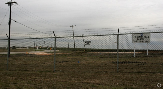
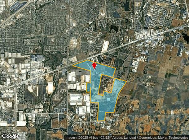
7790 Tessman Rd
San Antonio-New Braunfels, TX
Conv A/S Code
17995-000-0200
NCB 17995 P-4, 6A, 7, 7A, 7B, 7C, 7D, 7E, 7F, 13, 13A, 13B, 13C, 20 NCB 17994 BLK TR-A, B, C,C1, P-11, 11A, & LOT 36 CB 5100 P-3, 4, 13, 13A, 20, 24A, 25D, & 26A ABS 665 2012-MERGED PER CR# 25996
Officebuilding
Bexar
AE
Texas
48029C0440H
20
2024
852.16 AC
2025
South
131504
San Antonio
16,647 SF
DEMOGRAPHICS near 7790 Tessman Rd
1 Mile
3 Mile
5 Mile
2024 Total Population
5,231
52,352
163,155
2029 Population
5,639
56,004
174,701
Pop Growth 2024-2029
+ 7.80%
+ 6.98%
+ 7.08%
Average Age
32
34
35
2024 Total Households
1,599
17,153
54,163
HH Growth 2024-2029
+ 7.94%
+ 7.11%
+ 7.19%
Median Household Inc
$91,044
$60,901
$57,871
Avg Household Size
3.20
3.00
2.90
2024 Avg HH Vehicles
2.00
2.00
2.00
Median Home Value
$216,618
$172,854
$169,253
Median Year Built
2010
1999
1990
Nearby Places
Map Layers
Map Styles
 Street
 Aerial
- Restaurants
- Banks
- Shops
- Fitness
- Groceries
PUBLIC TRANSPORTATION
COMMUTER RAIL
San Antonio Amtrak Station (Sunset Limited - Amtrak, Texas Eagle - Amtrak)
DRIVE
WALK
Distance
San Antonio Amtrak Station (Sunset Limited - Amtrak, Texas Eagle - Amtrak)
18 min
9.1 mi
AIRPORT
San Antonio International
DRIVE
WALK
Distance
San Antonio International
26 min
15.3 mi
Freight Ports
Calhoun Port
DRIVE
WALK
Distance
Calhoun Port
175 min
142.5 mi
Nearby Properties
Address
Land Use
TOTAL SIZE
Lot Size
Zoning
Address
Land Use
TOTAL SIZE
Lot Size
Zoning
545,980 SF
125.36 AC
Address
Land Use
TOTAL SIZE
Lot Size
Zoning
434,029 SF
109.87 AC
Address
Land Use
TOTAL SIZE
Lot Size
Zoning
690,500 SF
16.96 AC
Address
Land Use
TOTAL SIZE
Lot Size
Zoning
278,406 SF
13.39 AC
Address
Land Use
TOTAL SIZE
Lot Size
Zoning
435,592 SF
31.43 AC
Address
Land Use
TOTAL SIZE
Lot Size
Zoning
Address
Land Use
TOTAL SIZE
Lot Size
Zoning
35.76 AC
Address
Land Use
TOTAL SIZE
Lot Size
Zoning
42.04 AC
Address
Land Use
TOTAL SIZE
Lot Size
Zoning
387,440 SF
27.71 AC
Address
Land Use
TOTAL SIZE
Lot Size
Zoning
252,465 SF
37.40 AC
Address
Land Use
TOTAL SIZE
Lot Size
Zoning
230,659 SF
15.48 AC
Address
Land Use
TOTAL SIZE
Lot Size
Zoning
74.65 AC
Address
Land Use
TOTAL SIZE
Lot Size
Zoning
41.63 AC
Address
Land Use
TOTAL SIZE
Lot Size
Zoning
325,434 SF
21.47 AC
Address
Land Use
TOTAL SIZE
Lot Size
Zoning
258,063 SF
24.55 AC
Address
Land Use
TOTAL SIZE
Lot Size
Zoning
391,863 SF
24.43 AC
Address
Land Use
TOTAL SIZE
Lot Size
Zoning
306,000 SF
20.23 AC
Address
Land Use
TOTAL SIZE
Lot Size
Zoning
14.14 AC
Address
Land Use
TOTAL SIZE
Lot Size
Zoning
251,680 SF
15.52 AC
Address
Land Use
TOTAL SIZE
Lot Size
Zoning
224,840 SF
17.27 AC
Address
Land Use
TOTAL SIZE
Lot Size
Zoning
199,280 SF
11.50 AC
Address
Land Use
TOTAL SIZE
Lot Size
Zoning
18.35 AC
Address
Land Use
TOTAL SIZE
Lot Size
Zoning
17.47 AC
Address
Land Use
TOTAL SIZE
Lot Size
Zoning
12.55 AC
Address
Land Use
TOTAL SIZE
Lot Size
Zoning
141,955 SF
121.60 AC
Address
Land Use
TOTAL SIZE
Lot Size
Zoning
361,780 SF
19.99 AC
Address
Land Use
TOTAL SIZE
Lot Size
Zoning
24.75 AC
Address
Land Use
TOTAL SIZE
Lot Size
Zoning
178,262 SF
33.28 AC
Address
Land Use
TOTAL SIZE
Lot Size
Zoning
161,880 SF
12.33 AC
The World's #1 Commercial Real Estate Marketplace
Connect with us
© 2025 CoStar Group
The information above has been obtained from sources believed reliable. While we do not doubt its accuracy we have not verified it and make no guarantee, warranty or representation about it. It is your responsibility to independently confirm its accuracy and completeness. Any projections, opinions, assumptions, or estimates used are for example only and do not represent the current or future performance of the property. The value of this transaction to you depends on tax and other factors which should be evaluated by your tax, financial, and legal advisors. You and your advisors should conduct a careful, independent investigation of the property to determine to your satisfaction the suitability of the property for your needs.