Property Record
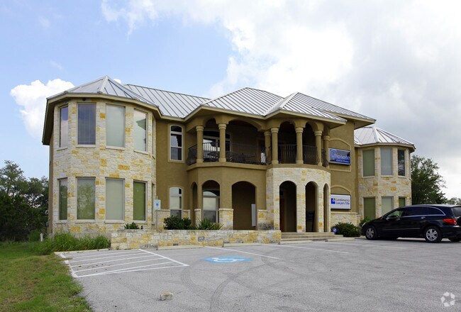
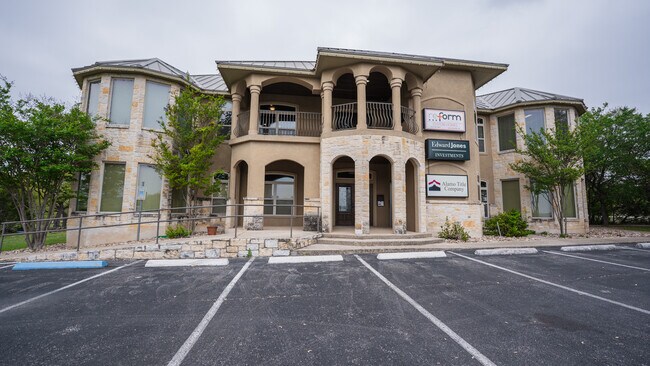
7790 Us Highway 281 N, Spring Branch, TX 78070


Property Detail
7790 Us Highway 281 N
San Antonio-New Braunfels, TX
RIVER CROSSING 5, LOT 873
45-0712-0873-00
Comal
Commercialnec
Texas
B and X Area of moderate flood hazard, usually the area between the limits of the 100-year and 500-year floods.
873
2024
1.05 AC
2025
Comal County
310703
San Antonio
4,894 SF
NEARBY LISTINGS FOR SALE OR LEASE
DEMOGRAPHICS near 7790 Us Highway 281 N
1 mile
3 mile
5 mile
2025 Total Population
835
7,060
17,187
2030 Population
974
8,223
20,144
Pop Growth 2025-2030
+ 16.65%
+ 16.47%
+ 17.20%
Average Age
44
44
43
2025 Total Households
303
2,556
6,275
HH Growth 2025-2030
+ 16.83%
+ 16.55%
+ 17.31%
Median Household Inc
$165,277
$141,078
$123,020
Avg Household Size
2.70
2.70
2.70
2025 Avg HH Vehicles
3.00
3.00
2.00
Median Home Value
$710,227
$696,335
$654,737
Median Year Built
2007
2005
2006
Nearby Places
Map Layers
Map Styles
 Street
 Aerial
Layers
 Traffic
 Biking
Places
Listings with unknown addresses are not visible on the map
- Restaurants
- Banks
- Shops
- Fitness
- Groceries
PUBLIC TRANSPORTATION
AIRPORT
San Antonio International
Drive
Walk
Distance
San Antonio International
29 min
24.1 mi
SALE & LEASE HISTORY
LISTING DATE
SALE/LEASE

Apr 14, 2025
For Lease
Nearby Properties
Address
Land Use
TOTAL SIZE
Lot Size
Zoning
Address
Land Use
TOTAL SIZE
Lot Size
Zoning
53,381 SF
15.01 AC
Address
Land Use
TOTAL SIZE
Lot Size
Zoning
1,800 SF
6.12 AC
Address
Land Use
TOTAL SIZE
Lot Size
Zoning
3,200 SF
2.26 AC
Address
Land Use
TOTAL SIZE
Lot Size
Zoning
99,412 SF
8.01 AC
Address
Land Use
TOTAL SIZE
Lot Size
Zoning
30,398 SF
5.49 AC
Address
Land Use
TOTAL SIZE
Lot Size
Zoning
23,561 SF
122.24 AC
Address
Land Use
TOTAL SIZE
Lot Size
Zoning
1,792 SF
5 AC
Address
Land Use
TOTAL SIZE
Lot Size
Zoning
10,968 SF
20 AC
Address
Land Use
TOTAL SIZE
Lot Size
Zoning
8,470 SF
6.17 AC
Address
Land Use
TOTAL SIZE
Lot Size
Zoning
9,796 SF
2.81 AC
Address
Land Use
TOTAL SIZE
Lot Size
Zoning
20,000 SF
12.24 AC
Address
Land Use
TOTAL SIZE
Lot Size
Zoning
153.87 AC
Address
Land Use
TOTAL SIZE
Lot Size
Zoning
10,881 SF
2.94 AC
Address
Land Use
TOTAL SIZE
Lot Size
Zoning
3,828 SF
5.02 AC
Address
Land Use
TOTAL SIZE
Lot Size
Zoning
40.32 AC
Address
Land Use
TOTAL SIZE
Lot Size
Zoning
10,238 SF
4.99 AC
Address
Land Use
TOTAL SIZE
Lot Size
Zoning
17,121 SF
5.03 AC
Address
Land Use
TOTAL SIZE
Lot Size
Zoning
5,118 SF
2.93 AC
Address
Land Use
TOTAL SIZE
Lot Size
Zoning
17,500 SF
2.83 AC
Address
Land Use
TOTAL SIZE
Lot Size
Zoning
3,040 SF
9.10 AC
Address
Land Use
TOTAL SIZE
Lot Size
Zoning
1,488 SF
51.22 AC
Address
Land Use
TOTAL SIZE
Lot Size
Zoning
21,334 SF
2 AC
Address
Land Use
TOTAL SIZE
Lot Size
Zoning
9,856 SF
1.90 AC
Address
Land Use
TOTAL SIZE
Lot Size
Zoning
18,027 SF
4 AC
Address
Land Use
TOTAL SIZE
Lot Size
Zoning
16,123 SF
1.79 AC
Address
Land Use
TOTAL SIZE
Lot Size
Zoning
10,128 SF
1.61 AC
Address
Land Use
TOTAL SIZE
Lot Size
Zoning
6,638 SF
1.70 AC
Address
Land Use
TOTAL SIZE
Lot Size
Zoning
Address
Land Use
TOTAL SIZE
Lot Size
Zoning
4,958 SF
2.13 AC
Address
Land Use
TOTAL SIZE
Lot Size
Zoning
10,560 SF
0.51 AC
The World's #1 Commercial Real Estate Marketplace
Connect with us
© 2026 CoStar Group
The information above has been obtained from sources believed reliable. While we do not doubt its accuracy we have not verified it and make no guarantee, warranty or representation about it. It is your responsibility to independently confirm its accuracy and completeness. Any projections, opinions, assumptions, or estimates used are for example only and do not represent the current or future performance of the property. The value of this transaction to you depends on tax and other factors which should be evaluated by your tax, financial, and legal advisors. You and your advisors should conduct a careful, independent investigation of the property to determine to your satisfaction the suitability of the property for your needs.