Property Record
7795 Se 63Rd Ct, Ocala, FL 34472

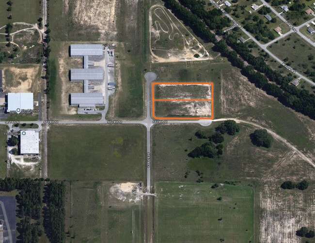
Property Detail
7795 Se 63Rd Ct
Ocala, FL
SEC 07 TWP 16 RGE 23 PLAT BOOK 007 PAGE 163 BASELINE COMMERCE CENTER UNIT 1-A BLK B LOT 20
37500-002-19
MARION
Commercialacreage
Florida
PUD
20
B and X Area of moderate flood hazard, usually the area between the limits of the 100-year and 500-year floods.
2.16 AC
2025
Outlying Marion County
2025
Ocala
0011031063
NEARBY LISTINGS FOR SALE OR LEASE
DEMOGRAPHICS near 7795 Se 63Rd Ct
1 mile
3 mile
5 mile
2025 Total Population
4,511
36,868
77,930
2030 Population
5,103
41,784
88,127
Pop Growth 2025-2030
+ 13.12%
+ 13.33%
+ 13.08%
Average Age
37
39
41
2025 Total Households
1,563
13,901
30,029
HH Growth 2025-2030
+ 13.31%
+ 13.72%
+ 13.41%
Median Household Inc
$56,936
$60,732
$65,293
Avg Household Size
2.80
2.60
2.60
2025 Avg HH Vehicles
2.00
2.00
2.00
Median Home Value
$244,697
$240,816
$251,899
Median Year Built
2001
1996
1993
Nearby Places
Map Layers
Map Styles
 Street
 Aerial
Layers
 Traffic
 Biking
Places
Listings with unknown addresses are not visible on the map
- Restaurants
- Banks
- Shops
- Fitness
- Groceries
SALE & LEASE HISTORY
LISTING DATE
SALE/LEASE

Aug 04, 2025
For Sale
Nearby Properties
Address
Land Use
TOTAL SIZE
Lot Size
Zoning
Address
Land Use
TOTAL SIZE
Lot Size
Zoning
211,884 SF
80 AC
GU
Address
Land Use
TOTAL SIZE
Lot Size
Zoning
188,132 SF
35.86 AC
B4
Address
Land Use
TOTAL SIZE
Lot Size
Zoning
64,086 SF
28.11 AC
A1
Address
Land Use
TOTAL SIZE
Lot Size
Zoning
71,791 SF
10.86 AC
B2
Address
Land Use
TOTAL SIZE
Lot Size
Zoning
97,177 SF
23.01 AC
R3
Address
Land Use
TOTAL SIZE
Lot Size
Zoning
680,069 SF
62.96 AC
B5
Address
Land Use
TOTAL SIZE
Lot Size
Zoning
11,692 SF
503.98 AC
GU
Address
Land Use
TOTAL SIZE
Lot Size
Zoning
1,800 SF
954.07 AC
A1
Address
Land Use
TOTAL SIZE
Lot Size
Zoning
60,710 SF
66.65 AC
A1
Address
Land Use
TOTAL SIZE
Lot Size
Zoning
3,004 SF
218.74 AC
RPD
Address
Land Use
TOTAL SIZE
Lot Size
Zoning
82,479 SF
20.10 AC
GU
Address
Land Use
TOTAL SIZE
Lot Size
Zoning
83,881 SF
16.60 AC
A1
Address
Land Use
TOTAL SIZE
Lot Size
Zoning
54,297 SF
6.32 AC
B2
Address
Land Use
TOTAL SIZE
Lot Size
Zoning
97,570 SF
13.29 AC
B2
Address
Land Use
TOTAL SIZE
Lot Size
Zoning
26,020 SF
10.46 AC
B2
Address
Land Use
TOTAL SIZE
Lot Size
Zoning
69,860 SF
5.05 AC
B2
Address
Land Use
TOTAL SIZE
Lot Size
Zoning
682 SF
468.13 AC
A1
Address
Land Use
TOTAL SIZE
Lot Size
Zoning
93,120 SF
34.47 AC
PUD
Address
Land Use
TOTAL SIZE
Lot Size
Zoning
66,190 SF
6.41 AC
B5
Address
Land Use
TOTAL SIZE
Lot Size
Zoning
68,186 SF
6.20 AC
B5
Address
Land Use
TOTAL SIZE
Lot Size
Zoning
37,862 SF
6.78 AC
R1
Address
Land Use
TOTAL SIZE
Lot Size
Zoning
99,544 SF
10 AC
M2
Address
Land Use
TOTAL SIZE
Lot Size
Zoning
64,319 SF
7.60 AC
B2
Address
Land Use
TOTAL SIZE
Lot Size
Zoning
20,040 SF
2.77 AC
B4
Address
Land Use
TOTAL SIZE
Lot Size
Zoning
45,000 SF
2.11 AC
B4
Address
Land Use
TOTAL SIZE
Lot Size
Zoning
23,865 SF
90.97 AC
GU
Address
Land Use
TOTAL SIZE
Lot Size
Zoning
60,978 SF
6.88 AC
PUD
Address
Land Use
TOTAL SIZE
Lot Size
Zoning
20,242 SF
4.23 AC
B4
Address
Land Use
TOTAL SIZE
Lot Size
Zoning
34,277 SF
14.94 AC
B5
Address
Land Use
TOTAL SIZE
Lot Size
Zoning
40,000 SF
4.06 AC
M1
The World's #1 Commercial Real Estate Marketplace
Connect with us
© 2026 CoStar Group
The information above has been obtained from sources believed reliable. While we do not doubt its accuracy we have not verified it and make no guarantee, warranty or representation about it. It is your responsibility to independently confirm its accuracy and completeness. Any projections, opinions, assumptions, or estimates used are for example only and do not represent the current or future performance of the property. The value of this transaction to you depends on tax and other factors which should be evaluated by your tax, financial, and legal advisors. You and your advisors should conduct a careful, independent investigation of the property to determine to your satisfaction the suitability of the property for your needs.