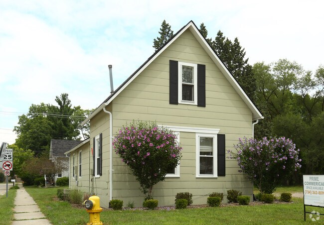
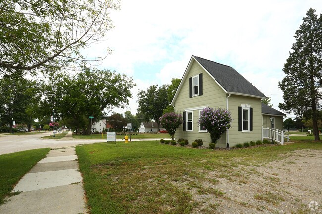
Property Record
7796 Macomb St, Grosse Ile, MI 48138
NEARBY LISTINGS FOR SALE OR LEASE
Property Detail
7796 Macomb St
Detroit-Warren-Dearborn, MI
Horace Grays
73-028-01-0010-003
552D10A1 THE S 70FT OF THE E 48FT OF LOT 10 EAST SIDE HORACE GRAYS SUB PC 552 L4 P39 WCR
Manufacturinglight
Wayne
X
Michigan
26163C0419F
10
2024
0.08 AC
2025
Downriver South
596200
Detroit
702 SF
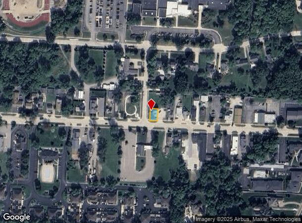
DEMOGRAPHICS near 7796 Macomb St
1 Mile
3 Mile
5 Mile
2024 Total Population
2,944
16,199
58,191
2029 Population
2,835
15,546
55,769
Pop Growth 2024-2029
(3.70%)
(4.03%)
(4.16%)
Average Age
46
46
44
2024 Total Households
1,215
6,997
25,166
HH Growth 2024-2029
(3.70%)
(4.07%)
(4.21%)
Median Household Inc
$118,224
$96,654
$75,332
Avg Household Size
2.40
2.30
2.30
2024 Avg HH Vehicles
2.00
2.00
2.00
Median Home Value
$361,254
$277,253
$200,513
Median Year Built
1975
1967
1967
Nearby Places
Map Layers
Map Styles
 Street
 Aerial
- Restaurants
- Banks
- Shops
- Fitness
- Groceries
PUBLIC TRANSPORTATION
AIRPORT
Detroit Metro Wayne County
DRIVE
WALK
Distance
Detroit Metro Wayne County
36 min
19.3 mi
Windsor International
DRIVE
WALK
Distance
Windsor International
56 min
33.7 mi
Freight Ports
DRIVE
WALK
Distance
63 min
45.1 mi
Nearby Properties
Address
Land Use
TOTAL SIZE
Lot Size
Zoning
Address
Land Use
TOTAL SIZE
Lot Size
Zoning
2,651,867 SF
137.23 AC
I-3
Address
Land Use
TOTAL SIZE
Lot Size
Zoning
155,600 SF
83.84 AC
R1
Address
Land Use
TOTAL SIZE
Lot Size
Zoning
2,160 SF
334.88 AC
I1
Address
Land Use
TOTAL SIZE
Lot Size
Zoning
143,496 SF
3.73 AC
RM-2
Address
Land Use
TOTAL SIZE
Lot Size
Zoning
62,039 SF
Address
Land Use
TOTAL SIZE
Lot Size
Zoning
40,136 SF
42.97 AC
R-1-D
Address
Land Use
TOTAL SIZE
Lot Size
Zoning
133.65 AC
MU REDEV
Address
Land Use
TOTAL SIZE
Lot Size
Zoning
354,969 SF
23.78 AC
I2
Address
Land Use
TOTAL SIZE
Lot Size
Zoning
35,518 SF
1.21 AC
B2
Address
Land Use
TOTAL SIZE
Lot Size
Zoning
3,500 SF
106.18 AC
R-1-D
Address
Land Use
TOTAL SIZE
Lot Size
Zoning
109.60 AC
R-1-D
Address
Land Use
TOTAL SIZE
Lot Size
Zoning
103,950 SF
5.04 AC
R1-ONE
Address
Land Use
TOTAL SIZE
Lot Size
Zoning
9,876 SF
Address
Land Use
TOTAL SIZE
Lot Size
Zoning
163,633 SF
8.52 AC
PD
Address
Land Use
TOTAL SIZE
Lot Size
Zoning
27,473 SF
2.36 AC
MSD
Address
Land Use
TOTAL SIZE
Lot Size
Zoning
39,060 SF
88.70 AC
Address
Land Use
TOTAL SIZE
Lot Size
Zoning
11,259 SF
5.89 AC
R-1-B
Address
Land Use
TOTAL SIZE
Lot Size
Zoning
53,292 SF
1.86 AC
RM-2
Address
Land Use
TOTAL SIZE
Lot Size
Zoning
13,833 SF
1.63 AC
B3
Address
Land Use
TOTAL SIZE
Lot Size
Zoning
4,099 SF
12.30 AC
R-1-B
Address
Land Use
TOTAL SIZE
Lot Size
Zoning
46,650 SF
5.10 AC
I-1
Address
Land Use
TOTAL SIZE
Lot Size
Zoning
1,080 SF
10.13 AC
RM2
Address
Land Use
TOTAL SIZE
Lot Size
Zoning
20,806 SF
Address
Land Use
TOTAL SIZE
Lot Size
Zoning
20,806 SF
Address
Land Use
TOTAL SIZE
Lot Size
Zoning
27,311 SF
2.86 AC
RM-1
Address
Land Use
TOTAL SIZE
Lot Size
Zoning
117,003 SF
29.29 AC
R1
Address
Land Use
TOTAL SIZE
Lot Size
Zoning
29,465 SF
3.05 AC
I2
Address
Land Use
TOTAL SIZE
Lot Size
Zoning
10,965 SF
0.75 AC
MSD
Address
Land Use
TOTAL SIZE
Lot Size
Zoning
90,445 SF
20.56 AC
R1
Address
Land Use
TOTAL SIZE
Lot Size
Zoning
51,816 SF
3.39 AC
I2
The World's #1 Commercial Real Estate Marketplace
Connect with us
© 2025 CoStar Group
The information above has been obtained from sources believed reliable. While we do not doubt its accuracy we have not verified it and make no guarantee, warranty or representation about it. It is your responsibility to independently confirm its accuracy and completeness. Any projections, opinions, assumptions, or estimates used are for example only and do not represent the current or future performance of the property. The value of this transaction to you depends on tax and other factors which should be evaluated by your tax, financial, and legal advisors. You and your advisors should conduct a careful, independent investigation of the property to determine to your satisfaction the suitability of the property for your needs.