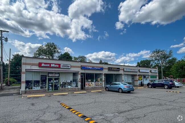
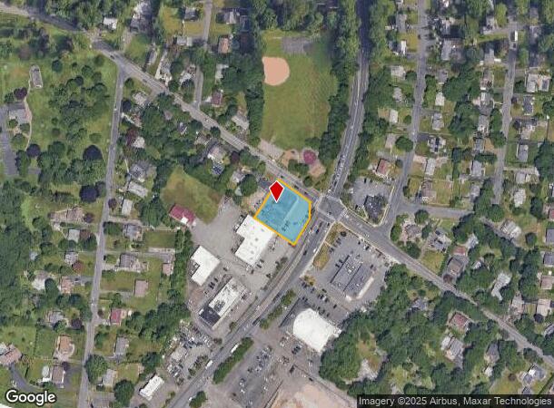
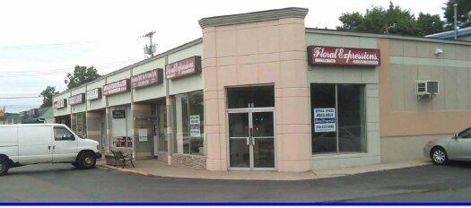
Property Record
121 Oak Tree Rd, Tappan, NY 10983
NEARBY LISTINGS FOR SALE OR LEASE
Property Detail
121 Oak Tree Rd
392489-077-015-0001-023-000-0000
60/48/454/8
Commercialnec
Rockland
X
New York
34003C0114H
23.0
2023
0.49 AC
2024
Orangetown
013401
Northern New Jersey
9,707 SF
New York-Jersey City-White Plains, NY-NJ
DEMOGRAPHICS near 121 Oak Tree Rd
1 Mile
3 Mile
5 Mile
2024 Total Population
8,503
40,542
147,362
2029 Population
8,462
40,518
146,461
Pop Growth 2024-2029
(0.48%)
(0.06%)
(0.61%)
Average Age
43
43
43
2024 Total Households
2,887
13,906
52,635
HH Growth 2024-2029
(0.55%)
(0.08%)
(0.72%)
Median Household Inc
$122,450
$130,131
$141,339
Avg Household Size
2.90
2.80
2.70
2024 Avg HH Vehicles
2.00
2.00
2.00
Median Home Value
$593,006
$692,957
$692,060
Median Year Built
1962
1967
1961
Nearby Places
Map Layers
Map Styles
 Street
 Aerial
- Restaurants
- Banks
- Shops
- Fitness
- Groceries
PUBLIC TRANSPORTATION
AIRPORT
Westchester County
DRIVE
WALK
Distance
Westchester County
34 min
22.7 mi
LaGuardia
DRIVE
WALK
Distance
LaGuardia
41 min
25.2 mi
Newark Liberty International
DRIVE
WALK
Distance
Newark Liberty International
37 min
27.8 mi
Freight Ports
NY - Red Hook Container Terminal
DRIVE
WALK
Distance
NY - Red Hook Container Terminal
51 min
30.0 mi
SALE & LEASE HISTORY
LISTING DATE
SALE/LEASE

Sep 25, 2016
For Lease
Oct 24, 2016
For Lease
Nearby Properties
Address
Land Use
TOTAL SIZE
Lot Size
Zoning
Address
Land Use
TOTAL SIZE
Lot Size
Zoning
1,125 SF
542.62 AC
RA
Address
Land Use
TOTAL SIZE
Lot Size
Zoning
229.55 AC
P
Address
Land Use
TOTAL SIZE
Lot Size
Zoning
134.16 AC
RA
Address
Land Use
TOTAL SIZE
Lot Size
Zoning
97,600 SF
136.28 AC
R-40
Address
Land Use
TOTAL SIZE
Lot Size
Zoning
220,594 SF
22.30 AC
R-40
Address
Land Use
TOTAL SIZE
Lot Size
Zoning
237,408 SF
14.97 AC
R-40
Address
Land Use
TOTAL SIZE
Lot Size
Zoning
8.08 AC
C
Address
Land Use
TOTAL SIZE
Lot Size
Zoning
845.02 AC
Address
Land Use
TOTAL SIZE
Lot Size
Zoning
35,631 SF
8.60 AC
LI
Address
Land Use
TOTAL SIZE
Lot Size
Zoning
47.14 AC
P
Address
Land Use
TOTAL SIZE
Lot Size
Zoning
6.72 AC
C
Address
Land Use
TOTAL SIZE
Lot Size
Zoning
48.19 AC
P
Address
Land Use
TOTAL SIZE
Lot Size
Zoning
191,950 SF
43.03 AC
RA25
Address
Land Use
TOTAL SIZE
Lot Size
Zoning
15.23 AC
C
Address
Land Use
TOTAL SIZE
Lot Size
Zoning
2.80 AC
R10
Address
Land Use
TOTAL SIZE
Lot Size
Zoning
8 AC
AH1CC
Address
Land Use
TOTAL SIZE
Lot Size
Zoning
62,728 SF
14.49 AC
RA15
Address
Land Use
TOTAL SIZE
Lot Size
Zoning
5.96 AC
Address
Land Use
TOTAL SIZE
Lot Size
Zoning
41.23 AC
P
Address
Land Use
TOTAL SIZE
Lot Size
Zoning
231,978 SF
48.30 AC
R-40
Address
Land Use
TOTAL SIZE
Lot Size
Zoning
191,148 SF
32.26 AC
R-40
Address
Land Use
TOTAL SIZE
Lot Size
Zoning
40.47 AC
DISTRICTN
Address
Land Use
TOTAL SIZE
Lot Size
Zoning
114,520 SF
6.71 AC
R4
Address
Land Use
TOTAL SIZE
Lot Size
Zoning
47,432 SF
9.81 AC
RG
Address
Land Use
TOTAL SIZE
Lot Size
Zoning
8.42 AC
LI
Address
Land Use
TOTAL SIZE
Lot Size
Zoning
4,938 SF
119 AC
Address
Land Use
TOTAL SIZE
Lot Size
Zoning
161.33 AC
P
Address
Land Use
TOTAL SIZE
Lot Size
Zoning
88.81 AC
R40
Address
Land Use
TOTAL SIZE
Lot Size
Zoning
70,532 SF
4.39 AC
DISTRICTN
Address
Land Use
TOTAL SIZE
Lot Size
Zoning
10.33 AC
The World's #1 Commercial Real Estate Marketplace
Connect with us
© 2025 CoStar Group
The information above has been obtained from sources believed reliable. While we do not doubt its accuracy we have not verified it and make no guarantee, warranty or representation about it. It is your responsibility to independently confirm its accuracy and completeness. Any projections, opinions, assumptions, or estimates used are for example only and do not represent the current or future performance of the property. The value of this transaction to you depends on tax and other factors which should be evaluated by your tax, financial, and legal advisors. You and your advisors should conduct a careful, independent investigation of the property to determine to your satisfaction the suitability of the property for your needs.