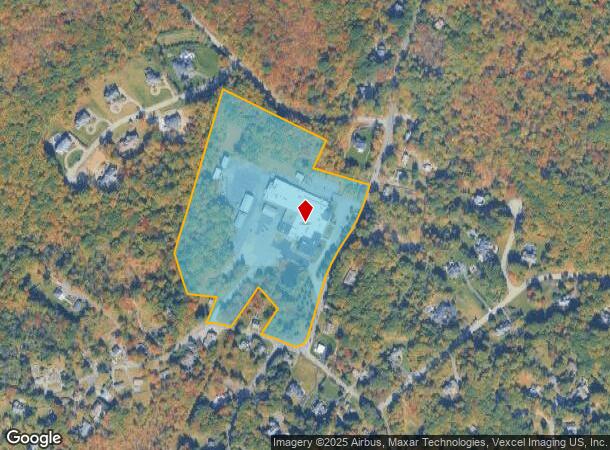
Property Record
78 Boonton Ave, Boonton, NJ 07005

NEARBY LISTINGS FOR SALE OR LEASE
Property Detail
78 Boonton Ave
Newark, NJ
Township/Montville
21-00001-0000-00029
Morris
Industrialgeneral
New Jersey
2024
29
2025
24.54 AC
040804
Eastern Morris
91,880 SF
Northern New Jersey
DEMOGRAPHICS near 78 Boonton Ave
1 Mile
3 Mile
5 Mile
2024 Total Population
1,157
24,609
86,012
2029 Population
1,158
24,588
86,060
Pop Growth 2024-2029
+ 0.09%
(0.09%)
+ 0.06%
Average Age
43
43
44
2024 Total Households
389
9,043
32,202
HH Growth 2024-2029
0.00%
(0.04%)
+ 0.07%
Median Household Inc
$192,261
$126,022
$121,482
Avg Household Size
3.00
2.70
2.60
2024 Avg HH Vehicles
3.00
2.00
2.00
Median Home Value
$722,222
$620,107
$565,695
Median Year Built
1972
1971
1969
Nearby Places
Map Layers
Map Styles
 Street
 Aerial
- Restaurants
- Banks
- Shops
- Fitness
- Groceries
PUBLIC TRANSPORTATION
COMMUTER RAIL
Boonton (Montclair-Boonton Line - NJ Transit Commuter Rail (NJ Transit))
DRIVE
WALK
Distance
Boonton (Montclair-Boonton Line - NJ Transit Commuter Rail (NJ Transit))
4 min
2.9 mi
Towaco (Montclair-Boonton Line - NJ Transit Commuter Rail (NJ Transit))
DRIVE
WALK
Distance
Towaco (Montclair-Boonton Line - NJ Transit Commuter Rail (NJ Transit))
9 min
4.5 mi
AIRPORT
Newark Liberty International
DRIVE
WALK
Distance
Newark Liberty International
39 min
30.6 mi
LaGuardia
DRIVE
WALK
Distance
LaGuardia
58 min
39.6 mi
Freight Ports
Port Newark Container Terminal
DRIVE
WALK
Distance
Port Newark Container Terminal
42 min
30.6 mi
Nearby Properties
Address
Land Use
TOTAL SIZE
Lot Size
Zoning
Address
Land Use
TOTAL SIZE
Lot Size
Zoning
98,228 SF
16.66 AC
I-1
Address
Land Use
TOTAL SIZE
Lot Size
Zoning
132,411 SF
24.87 AC
B-5
Address
Land Use
TOTAL SIZE
Lot Size
Zoning
Address
Land Use
TOTAL SIZE
Lot Size
Zoning
10 AC
RASH
Address
Land Use
TOTAL SIZE
Lot Size
Zoning
50,948 SF
5.60 AC
C-1
Address
Land Use
TOTAL SIZE
Lot Size
Zoning
18.05 AC
OB
Address
Land Use
TOTAL SIZE
Lot Size
Zoning
44,390 SF
2.06 AC
I-2
Address
Land Use
TOTAL SIZE
Lot Size
Zoning
88,819 SF
80.33 AC
R-1A
Address
Land Use
TOTAL SIZE
Lot Size
Zoning
76,160 SF
12.83 AC
I2
Address
Land Use
TOTAL SIZE
Lot Size
Zoning
39,470 SF
4.65 AC
B-3
Address
Land Use
TOTAL SIZE
Lot Size
Zoning
114,540 SF
2.57 AC
OB2B
Address
Land Use
TOTAL SIZE
Lot Size
Zoning
14.58 AC
R-30
Address
Land Use
TOTAL SIZE
Lot Size
Zoning
4,948 SF
11.23 AC
R-40
Address
Land Use
TOTAL SIZE
Lot Size
Zoning
122,022 SF
19.09 AC
R-2A
Address
Land Use
TOTAL SIZE
Lot Size
Zoning
2.22 AC
OB-2
Address
Land Use
TOTAL SIZE
Lot Size
Zoning
26.36 AC
R
Address
Land Use
TOTAL SIZE
Lot Size
Zoning
18,352 SF
4.19 AC
OB2A
Address
Land Use
TOTAL SIZE
Lot Size
Zoning
9.90 AC
R43
Address
Land Use
TOTAL SIZE
Lot Size
Zoning
110,160 SF
10.46 AC
I1A
Address
Land Use
TOTAL SIZE
Lot Size
Zoning
5.30 AC
R-3B
Address
Land Use
TOTAL SIZE
Lot Size
Zoning
1.73 AC
B1A
Address
Land Use
TOTAL SIZE
Lot Size
Zoning
111,800 SF
11.37 AC
I-1
Address
Land Use
TOTAL SIZE
Lot Size
Zoning
24,500 SF
3.31 AC
I2
Address
Land Use
TOTAL SIZE
Lot Size
Zoning
66,000 SF
9.39 AC
I-1
Address
Land Use
TOTAL SIZE
Lot Size
Zoning
879.26 AC
R
Address
Land Use
TOTAL SIZE
Lot Size
Zoning
89.80 AC
R120
Address
Land Use
TOTAL SIZE
Lot Size
Zoning
54,960 SF
14.20 AC
I-1
Address
Land Use
TOTAL SIZE
Lot Size
Zoning
56,280 SF
3.88 AC
OB2A
Address
Land Use
TOTAL SIZE
Lot Size
Zoning
34,704 SF
7.79 AC
OB2A
The World's #1 Commercial Real Estate Marketplace
Connect with us
© 2026 CoStar Group
The information above has been obtained from sources believed reliable. While we do not doubt its accuracy we have not verified it and make no guarantee, warranty or representation about it. It is your responsibility to independently confirm its accuracy and completeness. Any projections, opinions, assumptions, or estimates used are for example only and do not represent the current or future performance of the property. The value of this transaction to you depends on tax and other factors which should be evaluated by your tax, financial, and legal advisors. You and your advisors should conduct a careful, independent investigation of the property to determine to your satisfaction the suitability of the property for your needs.