Property Record
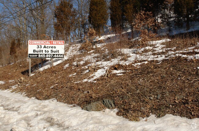
200 State Route 299, Highland, NY 12528


Current Lease Availabilities
NEARBY LISTINGS FOR SALE OR LEASE
Property Detail
200 State Route 299
3200-087.002-0002-021.230-0000
Ulster
Commercialacreage
New York
X
21.230
36111C0780E
6.10 AC
2025
Newburgh/Kingston
2024
Other Market Areas
953700
Kingston, NY
DEMOGRAPHICS near 200 State Route 299
1 Mile
3 Mile
5 Mile
2024 Total Population
870
8,055
60,223
2029 Population
868
8,041
60,144
Pop Growth 2024-2029
(0.23%)
(0.17%)
(0.13%)
Average Age
43
43
39
2024 Total Households
337
3,201
21,737
HH Growth 2024-2029
0.00%
(0.19%)
(0.13%)
Median Household Inc
$86,842
$94,599
$64,175
Avg Household Size
2.50
2.40
2.30
2024 Avg HH Vehicles
2.00
2.00
2.00
Median Home Value
$274,712
$331,231
$280,222
Median Year Built
1973
1975
1964
Nearby Places
Map Layers
Map Styles
 Street
 Aerial
- Restaurants
- Banks
- Shops
- Fitness
- Groceries
PUBLIC TRANSPORTATION
COMMUTER RAIL
Poughkeepsie Station (Hudson Line - Metro-North Commuter Railroad Company (Metro-North))
DRIVE
WALK
Distance
Poughkeepsie Station (Hudson Line - Metro-North Commuter Railroad Company (Metro-North))
15 min
6.8 mi
AIRPORT
New York Stewart International
DRIVE
WALK
Distance
New York Stewart International
36 min
25.3 mi
Freight Ports
Albany, NY Port
DRIVE
WALK
Distance
Albany, NY Port
87 min
70.8 mi
Nearby Properties
Address
Land Use
TOTAL SIZE
Lot Size
Zoning
Address
Land Use
TOTAL SIZE
Lot Size
Zoning
66,193 SF
5.57 AC
R1
Address
Land Use
TOTAL SIZE
Lot Size
Zoning
89.30 AC
R2
Address
Land Use
TOTAL SIZE
Lot Size
Zoning
124,321 SF
25.17 AC
LB
Address
Land Use
TOTAL SIZE
Lot Size
Zoning
124,668 SF
29.60 AC
Address
Land Use
TOTAL SIZE
Lot Size
Zoning
6,636 SF
16.90 AC
GB
Address
Land Use
TOTAL SIZE
Lot Size
Zoning
5,665 SF
510.60 AC
R40
Address
Land Use
TOTAL SIZE
Lot Size
Zoning
265.20 AC
R1
Address
Land Use
TOTAL SIZE
Lot Size
Zoning
96,600 SF
58.30 AC
A15
Address
Land Use
TOTAL SIZE
Lot Size
Zoning
3.50 AC
R2
Address
Land Use
TOTAL SIZE
Lot Size
Zoning
97,100 SF
5.80 AC
LI
Address
Land Use
TOTAL SIZE
Lot Size
Zoning
2,450 SF
15.70 AC
DB
Address
Land Use
TOTAL SIZE
Lot Size
Zoning
5,882 SF
33.70 AC
LI
Address
Land Use
TOTAL SIZE
Lot Size
Zoning
82,330 SF
31.80 AC
GB
Address
Land Use
TOTAL SIZE
Lot Size
Zoning
4,608 SF
41.10 AC
TR1
Address
Land Use
TOTAL SIZE
Lot Size
Zoning
15,000 SF
5.60 AC
Address
Land Use
TOTAL SIZE
Lot Size
Zoning
6,000 SF
2.30 AC
R1/4
Address
Land Use
TOTAL SIZE
Lot Size
Zoning
6,600 SF
10.40 AC
LI
Address
Land Use
TOTAL SIZE
Lot Size
Zoning
371.40 AC
R1
Address
Land Use
TOTAL SIZE
Lot Size
Zoning
8,928 SF
5.60 AC
R14
Address
Land Use
TOTAL SIZE
Lot Size
Zoning
41.40 AC
I1
Address
Land Use
TOTAL SIZE
Lot Size
Zoning
105.81 AC
Address
Land Use
TOTAL SIZE
Lot Size
Zoning
19,200 SF
1.70 AC
Address
Land Use
TOTAL SIZE
Lot Size
Zoning
26,800 SF
3.60 AC
CB
Address
Land Use
TOTAL SIZE
Lot Size
Zoning
31,800 SF
4.60 AC
MF10
Address
Land Use
TOTAL SIZE
Lot Size
Zoning
8,920 SF
3.90 AC
DB
Address
Land Use
TOTAL SIZE
Lot Size
Zoning
20,878 SF
2.90 AC
GB
Address
Land Use
TOTAL SIZE
Lot Size
Zoning
25,758 SF
5.90 AC
R14
Address
Land Use
TOTAL SIZE
Lot Size
Zoning
6,120 SF
2.70 AC
R12
Address
Land Use
TOTAL SIZE
Lot Size
Zoning
10,250 SF
2.20 AC
R14
Address
Land Use
TOTAL SIZE
Lot Size
Zoning
4,950 SF
1.15 AC
GB
The World's #1 Commercial Real Estate Marketplace
Connect with us
© 2026 CoStar Group
The information above has been obtained from sources believed reliable. While we do not doubt its accuracy we have not verified it and make no guarantee, warranty or representation about it. It is your responsibility to independently confirm its accuracy and completeness. Any projections, opinions, assumptions, or estimates used are for example only and do not represent the current or future performance of the property. The value of this transaction to you depends on tax and other factors which should be evaluated by your tax, financial, and legal advisors. You and your advisors should conduct a careful, independent investigation of the property to determine to your satisfaction the suitability of the property for your needs.