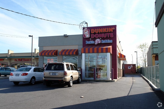
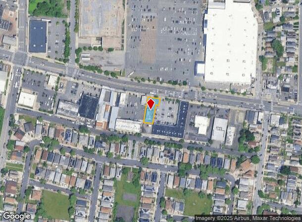
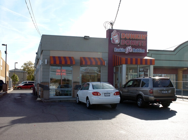
Property Record
78 Waldorf Way, Hampstead, NC 28443
NEARBY LISTINGS FOR SALE OR LEASE
Property Detail
78 Waldorf Way
01685-0088
Staten Island
Storebuilding
New York
X
88
3604970168F
0.23 AC
2024
Staten Island
2025
Long Island (New York)
031901
New York-Jersey City-White Plains, NY-NJ
1,974 SF
DEMOGRAPHICS near 78 Waldorf Way
1 Mile
3 Mile
5 Mile
2024 Total Population
36,054
200,165
559,843
2029 Population
35,258
194,096
546,817
Pop Growth 2024-2029
(2.21%)
(3.03%)
(2.33%)
Average Age
38
39
40
2024 Total Households
11,561
66,358
195,516
HH Growth 2024-2029
(2.24%)
(3.14%)
(2.40%)
Median Household Inc
$79,163
$78,228
$72,354
Avg Household Size
3.00
2.90
2.80
2024 Avg HH Vehicles
1.00
1.00
1.00
Median Home Value
$462,226
$568,273
$530,350
Median Year Built
1978
1967
1964
Nearby Places
- Restaurants
- Banks
- Shops
- Fitness
- Groceries
PUBLIC TRANSPORTATION
COMMUTER RAIL
Elizabeth (North Jersey Coast Line - NJ Transit Commuter Rail (NJ Transit), Northeast Corridor Line - NJ Transit Commuter Rail (NJ Transit))
DRIVE
WALK
Distance
Elizabeth (North Jersey Coast Line - NJ Transit Commuter Rail (NJ Transit), Northeast Corridor Line - NJ Transit Commuter Rail (NJ Transit))
9 min
4.8 mi
North Elizabeth (North Jersey Coast Line - NJ Transit Commuter Rail (NJ Transit), Northeast Corridor Line - NJ Transit Commuter Rail (NJ Transit))
DRIVE
WALK
Distance
North Elizabeth (North Jersey Coast Line - NJ Transit Commuter Rail (NJ Transit), Northeast Corridor Line - NJ Transit Commuter Rail (NJ Transit))
12 min
6.6 mi
AIRPORT
Newark Liberty International
DRIVE
WALK
Distance
Newark Liberty International
18 min
11.0 mi
LaGuardia
DRIVE
WALK
Distance
LaGuardia
44 min
26.1 mi
John F Kennedy International
DRIVE
WALK
Distance
John F Kennedy International
43 min
28.8 mi
Freight Ports
New York Container Terminal
DRIVE
WALK
Distance
New York Container Terminal
3 min
1.7 mi
Nearby Properties
Address
Land Use
TOTAL SIZE
Lot Size
Zoning
Address
Land Use
TOTAL SIZE
Lot Size
Zoning
28.40 AC
Address
Land Use
TOTAL SIZE
Lot Size
Zoning
633,280 SF
202.90 AC
R3-2
Address
Land Use
TOTAL SIZE
Lot Size
Zoning
4,450,000 SF
95.24 AC
Address
Land Use
TOTAL SIZE
Lot Size
Zoning
Address
Land Use
TOTAL SIZE
Lot Size
Zoning
686,130 SF
189.62 AC
R3-2
Address
Land Use
TOTAL SIZE
Lot Size
Zoning
70.39 AC
Address
Land Use
TOTAL SIZE
Lot Size
Zoning
16.63 AC
Address
Land Use
TOTAL SIZE
Lot Size
Zoning
2.21 AC
Address
Land Use
TOTAL SIZE
Lot Size
Zoning
149.68 AC
Address
Land Use
TOTAL SIZE
Lot Size
Zoning
51.62 AC
Address
Land Use
TOTAL SIZE
Lot Size
Zoning
91,760 SF
210.43 AC
M3-1
Address
Land Use
TOTAL SIZE
Lot Size
Zoning
Address
Land Use
TOTAL SIZE
Lot Size
Zoning
3,500,000 SF
11.97 AC
MRC2
Address
Land Use
TOTAL SIZE
Lot Size
Zoning
51.61 AC
Address
Land Use
TOTAL SIZE
Lot Size
Zoning
39.64 AC
Address
Land Use
TOTAL SIZE
Lot Size
Zoning
566,000 SF
103.31 AC
R3-2
Address
Land Use
TOTAL SIZE
Lot Size
Zoning
6,188,000 SF
8.18 AC
Address
Land Use
TOTAL SIZE
Lot Size
Zoning
1 SF
20 AC
Address
Land Use
TOTAL SIZE
Lot Size
Zoning
11.14 AC
Address
Land Use
TOTAL SIZE
Lot Size
Zoning
855,000 SF
48.74 AC
M3-1
Address
Land Use
TOTAL SIZE
Lot Size
Zoning
10 SF
9.18 AC
Address
Land Use
TOTAL SIZE
Lot Size
Zoning
1.72 AC
Address
Land Use
TOTAL SIZE
Lot Size
Zoning
27.71 AC
Address
Land Use
TOTAL SIZE
Lot Size
Zoning
1,502 SF
0.69 AC
C-1
Address
Land Use
TOTAL SIZE
Lot Size
Zoning
24.19 AC
Address
Land Use
TOTAL SIZE
Lot Size
Zoning
131.25 AC
PARK
Address
Land Use
TOTAL SIZE
Lot Size
Zoning
23.77 AC
Address
Land Use
TOTAL SIZE
Lot Size
Zoning
2.38 AC
Address
Land Use
TOTAL SIZE
Lot Size
Zoning
494,840 SF
34.77 AC
R3-2
Address
Land Use
TOTAL SIZE
Lot Size
Zoning
28.07 AC
The World's #1 Commercial Real Estate Marketplace
Connect with us
© 2025 CoStar Group
The information above has been obtained from sources believed reliable. While we do not doubt its accuracy we have not verified it and make no guarantee, warranty or representation about it. It is your responsibility to independently confirm its accuracy and completeness. Any projections, opinions, assumptions, or estimates used are for example only and do not represent the current or future performance of the property. The value of this transaction to you depends on tax and other factors which should be evaluated by your tax, financial, and legal advisors. You and your advisors should conduct a careful, independent investigation of the property to determine to your satisfaction the suitability of the property for your needs.