Property Record
780 E Valley Rd, Carbondale, CO 81623
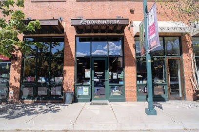
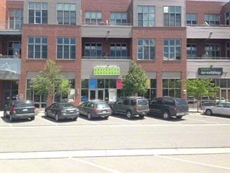
Property Detail
780 E Valley Rd
R065148
Triangle Park Lofts
Commercialcondominium
SUBDIVISION: TRIANGLE PARK LOFTS UNIT: R-306
X
Eagle
08037C0739E
Colorado
2024
0.02 AC
2025
Colorado Ski Area
000301
Other Market Areas
1,214 SF
Edwards, CO
NEARBY LISTINGS FOR SALE OR LEASE
-
-
View all Carbondale listings for sale on LoopNet.com
DEMOGRAPHICS near 780 E Valley Rd
1 mile
3 mile
5 mile
2024 Total Population
4,108
8,148
11,775
2029 Population
4,151
8,158
11,763
Pop Growth 2024-2029
+ 1.05%
+ 0.12%
(0.10%)
Average Age
38
39
39
2024 Total Households
1,511
2,906
4,329
HH Growth 2024-2029
+ 0.73%
(0.21%)
(0.46%)
Median Household Inc
$106,960
$115,026
$112,164
Avg Household Size
2.60
2.70
2.60
2024 Avg HH Vehicles
2.00
2.00
2.00
Median Home Value
$688,078
$768,581
$811,441
Median Year Built
1996
1994
1993
Nearby Places
Map Layers
Map Styles
 Street
 Aerial
Transit
 Traffic
 Biking
Places
Listings with unknown addresses are not visible on the map
- Restaurants
- Banks
- Shops
- Fitness
- Groceries
PUBLIC TRANSPORTATION
AIRPORT
Aspen-Pitkin County/Sardy Field
Drive
Walk
Distance
Aspen-Pitkin County/Sardy Field
34 min
20.5 mi
Eagle County Regional
Drive
Walk
Distance
Eagle County Regional
69 min
46.4 mi
Freight Ports
Tulsa Port Of Catoosa
Drive
Walk
Distance
Tulsa Port Of Catoosa
944 min
885.8 mi
SALE & LEASE HISTORY
LISTING DATE
SALE/LEASE

Jun 24, 2024
For Sale
Nearby Properties
Address
Land Use
TOTAL SIZE
Lot Size
Zoning
Address
Land Use
TOTAL SIZE
Lot Size
Zoning
79,656 SF
0.78 AC
Address
Land Use
TOTAL SIZE
Lot Size
Zoning
0.84 AC
Address
Land Use
TOTAL SIZE
Lot Size
Zoning
119,519 SF
104.84 AC
Address
Land Use
TOTAL SIZE
Lot Size
Zoning
70,558 SF
0.94 AC
Address
Land Use
TOTAL SIZE
Lot Size
Zoning
54,856 SF
1.75 AC
Address
Land Use
TOTAL SIZE
Lot Size
Zoning
18,057 SF
0.95 AC
Address
Land Use
TOTAL SIZE
Lot Size
Zoning
37,590 SF
0.49 AC
Address
Land Use
TOTAL SIZE
Lot Size
Zoning
18,583 SF
0.18 AC
Address
Land Use
TOTAL SIZE
Lot Size
Zoning
15,690 SF
0.15 AC
Address
Land Use
TOTAL SIZE
Lot Size
Zoning
43,109 SF
3.06 AC
Address
Land Use
TOTAL SIZE
Lot Size
Zoning
64,470 SF
6.12 AC
Address
Land Use
TOTAL SIZE
Lot Size
Zoning
106,372 SF
2.05 AC
Address
Land Use
TOTAL SIZE
Lot Size
Zoning
21,262 SF
119.47 AC
Address
Land Use
TOTAL SIZE
Lot Size
Zoning
141,116 SF
0.92 AC
Address
Land Use
TOTAL SIZE
Lot Size
Zoning
33,530 SF
3 AC
Address
Land Use
TOTAL SIZE
Lot Size
Zoning
27,520 SF
1.46 AC
Address
Land Use
TOTAL SIZE
Lot Size
Zoning
26,218 SF
1.41 AC
Address
Land Use
TOTAL SIZE
Lot Size
Zoning
8,732 SF
Address
Land Use
TOTAL SIZE
Lot Size
Zoning
47,421 SF
1.25 AC
Address
Land Use
TOTAL SIZE
Lot Size
Zoning
31,925 SF
0.21 AC
Address
Land Use
TOTAL SIZE
Lot Size
Zoning
8,600 SF
3.21 AC
Address
Land Use
TOTAL SIZE
Lot Size
Zoning
12,203 SF
0.91 AC
Address
Land Use
TOTAL SIZE
Lot Size
Zoning
8,782 SF
7.45 AC
Address
Land Use
TOTAL SIZE
Lot Size
Zoning
55,571 SF
0.95 AC
Address
Land Use
TOTAL SIZE
Lot Size
Zoning
21,495 SF
1.44 AC
Address
Land Use
TOTAL SIZE
Lot Size
Zoning
15,190 SF
1.43 AC
Address
Land Use
TOTAL SIZE
Lot Size
Zoning
13,100 SF
2.37 AC
Address
Land Use
TOTAL SIZE
Lot Size
Zoning
34,591 SF
1.40 AC
Address
Land Use
TOTAL SIZE
Lot Size
Zoning
11,967 SF
0.75 AC
Address
Land Use
TOTAL SIZE
Lot Size
Zoning
44,408 SF
0.59 AC
The World's #1 Commercial Real Estate Marketplace
Connect with us
© 2026 CoStar Group
The information above has been obtained from sources believed reliable. While we do not doubt its accuracy we have not verified it and make no guarantee, warranty or representation about it. It is your responsibility to independently confirm its accuracy and completeness. Any projections, opinions, assumptions, or estimates used are for example only and do not represent the current or future performance of the property. The value of this transaction to you depends on tax and other factors which should be evaluated by your tax, financial, and legal advisors. You and your advisors should conduct a careful, independent investigation of the property to determine to your satisfaction the suitability of the property for your needs.