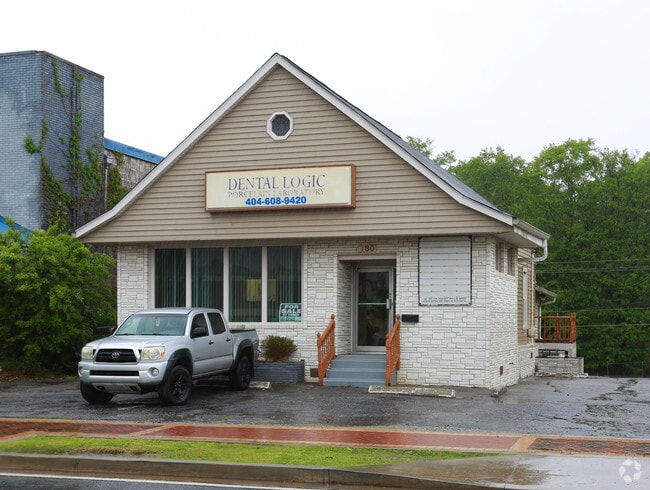
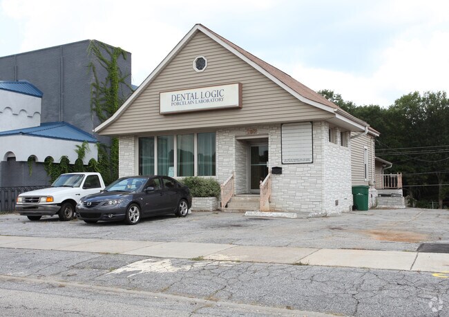
Property Record
780 Main St, Forest Park, GA 30297
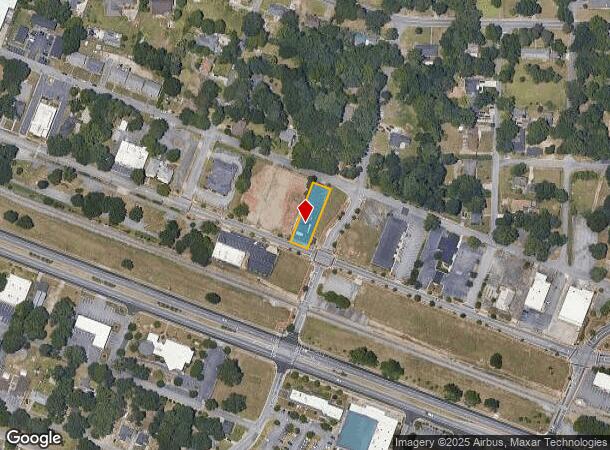
NEARBY LISTINGS FOR SALE OR LEASE
Property Detail
780 Main St
Atlanta-Sandy Springs-Roswell, GA
Forest Park
13-0050B-00K-003
COMMERCIAL
Medicalbuilding
Clayton
X
Georgia
13063C0076F
12
2024
0.28 AC
2024
North Clayton/Airport
040302
Atlanta
1,343 SF
DEMOGRAPHICS near 780 Main St
1 Mile
3 Mile
5 Mile
2024 Total Population
10,368
50,445
158,363
2029 Population
10,354
50,613
159,321
Pop Growth 2024-2029
(0.14%)
+ 0.33%
+ 0.60%
Average Age
37
35
35
2024 Total Households
3,727
17,555
58,217
HH Growth 2024-2029
0.00%
+ 0.57%
+ 0.70%
Median Household Inc
$32,835
$41,124
$44,796
Avg Household Size
2.70
2.80
2.60
2024 Avg HH Vehicles
2.00
2.00
2.00
Median Home Value
$124,717
$135,345
$155,535
Median Year Built
1963
1972
1980
Nearby Places
Map Layers
Map Styles
 Street
 Aerial
- Restaurants
- Banks
- Shops
- Fitness
- Groceries
PUBLIC TRANSPORTATION
AIRPORT
Hartsfield - Jackson Atlanta International
DRIVE
WALK
Distance
Hartsfield - Jackson Atlanta International
11 min
5.0 mi
Freight Ports
Georgia Ports - Savannah
DRIVE
WALK
Distance
Georgia Ports - Savannah
267 min
238.1 mi
SALE & LEASE HISTORY
LISTING DATE
SALE/LEASE

May 07, 2018
For Sale
Nearby Properties
Address
Land Use
TOTAL SIZE
Lot Size
Zoning
Address
Land Use
TOTAL SIZE
Lot Size
Zoning
666,576 SF
63.38 AC
I
Address
Land Use
TOTAL SIZE
Lot Size
Zoning
318.25 AC
HI
Address
Land Use
TOTAL SIZE
Lot Size
Zoning
873,223 SF
60.88 AC
I
Address
Land Use
TOTAL SIZE
Lot Size
Zoning
42,671 SF
56.11 AC
I
Address
Land Use
TOTAL SIZE
Lot Size
Zoning
20,964 SF
70.93 AC
I
Address
Land Use
TOTAL SIZE
Lot Size
Zoning
513,124 SF
19.05 AC
I2
Address
Land Use
TOTAL SIZE
Lot Size
Zoning
596 SF
57.40 AC
RM
Address
Land Use
TOTAL SIZE
Lot Size
Zoning
848,420 SF
48.96 AC
I
Address
Land Use
TOTAL SIZE
Lot Size
Zoning
210,538 SF
101.40 AC
X
Address
Land Use
TOTAL SIZE
Lot Size
Zoning
198 SF
32.10 AC
RM
Address
Land Use
TOTAL SIZE
Lot Size
Zoning
298,264 SF
0.90 AC
C
Address
Land Use
TOTAL SIZE
Lot Size
Zoning
212,048 SF
110.06 AC
HI
Address
Land Use
TOTAL SIZE
Lot Size
Zoning
387 SF
32.53 AC
RM
Address
Land Use
TOTAL SIZE
Lot Size
Zoning
168 SF
32.25 AC
RM
Address
Land Use
TOTAL SIZE
Lot Size
Zoning
218 SF
17.30 AC
RM
Address
Land Use
TOTAL SIZE
Lot Size
Zoning
167,008 SF
36.21 AC
HI
Address
Land Use
TOTAL SIZE
Lot Size
Zoning
105,260 SF
12.67 AC
C
Address
Land Use
TOTAL SIZE
Lot Size
Zoning
402,544 SF
20.43 AC
I1
Address
Land Use
TOTAL SIZE
Lot Size
Zoning
1,740 SF
16.35 AC
MVEDU
Address
Land Use
TOTAL SIZE
Lot Size
Zoning
371,336 SF
29.50 AC
I
Address
Land Use
TOTAL SIZE
Lot Size
Zoning
44,365 SF
17.77 AC
M
Address
Land Use
TOTAL SIZE
Lot Size
Zoning
474,830 SF
28.39 AC
I1
Address
Land Use
TOTAL SIZE
Lot Size
Zoning
96,028 SF
21.02 AC
I
Address
Land Use
TOTAL SIZE
Lot Size
Zoning
42.50 AC
HI
Address
Land Use
TOTAL SIZE
Lot Size
Zoning
108 SF
11.62 AC
C
Address
Land Use
TOTAL SIZE
Lot Size
Zoning
365,298 SF
22.51 AC
I
Address
Land Use
TOTAL SIZE
Lot Size
Zoning
308,683 SF
41.30 AC
C
Address
Land Use
TOTAL SIZE
Lot Size
Zoning
250 SF
13.40 AC
C
Address
Land Use
TOTAL SIZE
Lot Size
Zoning
169,832 SF
13.35 AC
I
Address
Land Use
TOTAL SIZE
Lot Size
Zoning
232 SF
21.38 AC
C
The World's #1 Commercial Real Estate Marketplace
Connect with us
© 2025 CoStar Group
The information above has been obtained from sources believed reliable. While we do not doubt its accuracy we have not verified it and make no guarantee, warranty or representation about it. It is your responsibility to independently confirm its accuracy and completeness. Any projections, opinions, assumptions, or estimates used are for example only and do not represent the current or future performance of the property. The value of this transaction to you depends on tax and other factors which should be evaluated by your tax, financial, and legal advisors. You and your advisors should conduct a careful, independent investigation of the property to determine to your satisfaction the suitability of the property for your needs.