Property Record
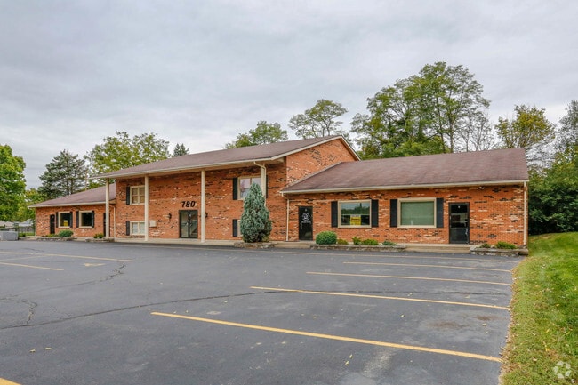
780 Nilles Rd, Fairfield, OH 45014
NEARBY LISTINGS FOR SALE OR LEASE
Property Detail
780 Nilles Rd
A0700-040-000-132
Nilles Rd Office Condo
Officecondo
UNIT B NILLES RD OFFICE CONDO SEE TIF PCL 127T - N TOWN CENTER TIF
AE
Butler
39017C0308F
Ohio
2024
0.11 AC
2024
Butler County
010904
Cincinnati/Dayton
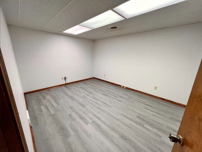
601 SF
Cincinnati, OH-KY-IN
DEMOGRAPHICS near 780 Nilles Rd
1 Mile
3 Mile
5 Mile
2024 Total Population
9,985
58,730
146,565
2029 Population
10,075
59,283
148,302
Pop Growth 2024-2029
+ 0.90%
+ 0.94%
+ 1.19%
Average Age
43
40
39
2024 Total Households
4,179
23,398
56,922
HH Growth 2024-2029
+ 0.86%
+ 0.89%
+ 1.33%
Median Household Inc
$64,725
$64,497
$62,294
Avg Household Size
2.30
2.40
2.50
2024 Avg HH Vehicles
2.00
2.00
2.00
Median Home Value
$181,296
$171,282
$168,599
Median Year Built
1971
1973
1973
Nearby Places
Map Layers
Map Styles
 Street
 Aerial
- Restaurants
- Banks
- Shops
- Fitness
- Groceries
PUBLIC TRANSPORTATION
AIRPORT
Cincinnati/Northern Kentucky International
DRIVE
WALK
Distance
Cincinnati/Northern Kentucky International
58 min
41.1 mi
Freight Ports
Port of Toledo
DRIVE
WALK
Distance
Port of Toledo
232 min
195.4 mi
SALE & LEASE HISTORY
LISTING DATE
SALE/LEASE

Sep 25, 2016
For Lease
Nov 18, 2022
For Sale
Mar 04, 2019
For Lease
Jan 10, 2023
For Lease
Nearby Properties
Address
Land Use
TOTAL SIZE
Lot Size
Zoning
Address
Land Use
TOTAL SIZE
Lot Size
Zoning
1,602,242 SF
36.46 AC
Address
Land Use
TOTAL SIZE
Lot Size
Zoning
40,006 SF
17.23 AC
Address
Land Use
TOTAL SIZE
Lot Size
Zoning
38,880 SF
20.93 AC
Address
Land Use
TOTAL SIZE
Lot Size
Zoning
1,363,493 SF
75.28 AC
Address
Land Use
TOTAL SIZE
Lot Size
Zoning
14,559 SF
27.50 AC
Address
Land Use
TOTAL SIZE
Lot Size
Zoning
52,548 SF
39.18 AC
Address
Land Use
TOTAL SIZE
Lot Size
Zoning
54.77 AC
Address
Land Use
TOTAL SIZE
Lot Size
Zoning
28.47 AC
Address
Land Use
TOTAL SIZE
Lot Size
Zoning
357,452 SF
26.77 AC
Address
Land Use
TOTAL SIZE
Lot Size
Zoning
279,161 SF
28.02 AC
Address
Land Use
TOTAL SIZE
Lot Size
Zoning
28,343 SF
35.08 AC
Address
Land Use
TOTAL SIZE
Lot Size
Zoning
183,864 SF
25.85 AC
Address
Land Use
TOTAL SIZE
Lot Size
Zoning
22.02 AC
Address
Land Use
TOTAL SIZE
Lot Size
Zoning
150,620 SF
13.73 AC
Address
Land Use
TOTAL SIZE
Lot Size
Zoning
462,994 SF
25.63 AC
Address
Land Use
TOTAL SIZE
Lot Size
Zoning
333,379 SF
22.22 AC
Address
Land Use
TOTAL SIZE
Lot Size
Zoning
469,454 SF
36.44 AC
Address
Land Use
TOTAL SIZE
Lot Size
Zoning
143,569 SF
10.43 AC
Address
Land Use
TOTAL SIZE
Lot Size
Zoning
158,332 SF
16.96 AC
Address
Land Use
TOTAL SIZE
Lot Size
Zoning
323,799 SF
29.59 AC
Address
Land Use
TOTAL SIZE
Lot Size
Zoning
174,444 SF
16.16 AC
Address
Land Use
TOTAL SIZE
Lot Size
Zoning
67,916 SF
13.73 AC
Address
Land Use
TOTAL SIZE
Lot Size
Zoning
144,922 SF
3.91 AC
Address
Land Use
TOTAL SIZE
Lot Size
Zoning
123,662 SF
2.86 AC
Address
Land Use
TOTAL SIZE
Lot Size
Zoning
147,619 SF
11.83 AC
Address
Land Use
TOTAL SIZE
Lot Size
Zoning
146,980 SF
9.82 AC
Address
Land Use
TOTAL SIZE
Lot Size
Zoning
229,447 SF
26.06 AC
Address
Land Use
TOTAL SIZE
Lot Size
Zoning
89,401 SF
Address
Land Use
TOTAL SIZE
Lot Size
Zoning
48,664 SF
13.63 AC
Address
Land Use
TOTAL SIZE
Lot Size
Zoning
23.61 AC
RPUD
The World's #1 Commercial Real Estate Marketplace
Connect with us
© 2025 CoStar Group
The information above has been obtained from sources believed reliable. While we do not doubt its accuracy we have not verified it and make no guarantee, warranty or representation about it. It is your responsibility to independently confirm its accuracy and completeness. Any projections, opinions, assumptions, or estimates used are for example only and do not represent the current or future performance of the property. The value of this transaction to you depends on tax and other factors which should be evaluated by your tax, financial, and legal advisors. You and your advisors should conduct a careful, independent investigation of the property to determine to your satisfaction the suitability of the property for your needs.