Property Record
780 Remick Blvd, Springboro, OH 45066


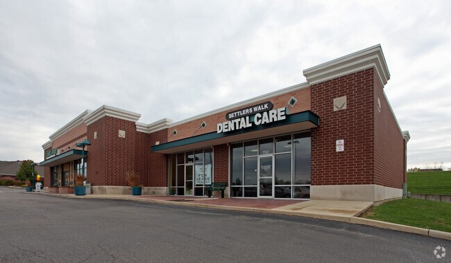
Property Detail
780 Remick Blvd
04-09-371-043
REMICK
Regionalshoppingcenterormallwithanchorstore
WARREN
B and X Area of moderate flood hazard, usually the area between the limits of the 100-year and 500-year floods.
Ohio
2024
1.58 AC
2025
Outlying Warren County
030504
Cincinnati/Dayton
11,424 SF
Cincinnati, OH-KY-IN
NEARBY LISTINGS FOR SALE OR LEASE
DEMOGRAPHICS near 780 Remick Blvd
1 mile
3 mile
5 mile
2025 Total Population
6,265
45,066
111,335
2030 Population
6,544
46,123
113,139
Pop Growth 2025-2030
+ 4.45%
+ 2.35%
+ 1.62%
Average Age
40
40
41
2025 Total Households
2,269
17,278
45,247
HH Growth 2025-2030
+ 4.50%
+ 2.15%
+ 1.37%
Median Household Inc
$121,530
$112,570
$92,417
Avg Household Size
2.70
2.60
2.40
2025 Avg HH Vehicles
2.00
2.00
2.00
Median Home Value
$372,868
$351,741
$316,943
Median Year Built
1996
1994
1987
Nearby Places
Map Layers
Map Styles
 Street
 Aerial
Layers
 Traffic
 Biking
Places
Listings with unknown addresses are not visible on the map
- Restaurants
- Banks
- Shops
- Fitness
- Groceries
PUBLIC TRANSPORTATION
AIRPORT
James M Cox Dayton International
Drive
Walk
Distance
James M Cox Dayton International
38 min
26.5 mi
SALE & LEASE HISTORY
LISTING DATE
SALE/LEASE

Jun 08, 2017
For Lease
Nearby Properties
Address
Land Use
TOTAL SIZE
Lot Size
Zoning
Address
Land Use
TOTAL SIZE
Lot Size
Zoning
2,908 SF
16.01 AC
Address
Land Use
TOTAL SIZE
Lot Size
Zoning
446,592 SF
4.33 AC
Address
Land Use
TOTAL SIZE
Lot Size
Zoning
142,758 SF
11.15 AC
Address
Land Use
TOTAL SIZE
Lot Size
Zoning
507,846 SF
23.90 AC
Address
Land Use
TOTAL SIZE
Lot Size
Zoning
39,404 SF
55.59 AC
Address
Land Use
TOTAL SIZE
Lot Size
Zoning
36,570 SF
20.29 AC
Address
Land Use
TOTAL SIZE
Lot Size
Zoning
64,121 SF
21.21 AC
Address
Land Use
TOTAL SIZE
Lot Size
Zoning
203,556 SF
10.69 AC
Address
Land Use
TOTAL SIZE
Lot Size
Zoning
162,036 SF
9.81 AC
Address
Land Use
TOTAL SIZE
Lot Size
Zoning
16.05 AC
Address
Land Use
TOTAL SIZE
Lot Size
Zoning
56.81 AC
R1
Address
Land Use
TOTAL SIZE
Lot Size
Zoning
4,578 SF
10.81 AC
Address
Land Use
TOTAL SIZE
Lot Size
Zoning
64,364 SF
26.01 AC
Address
Land Use
TOTAL SIZE
Lot Size
Zoning
20,093 SF
11.15 AC
Address
Land Use
TOTAL SIZE
Lot Size
Zoning
209,894 SF
5.41 AC
Address
Land Use
TOTAL SIZE
Lot Size
Zoning
11,260 SF
6.32 AC
Address
Land Use
TOTAL SIZE
Lot Size
Zoning
Address
Land Use
TOTAL SIZE
Lot Size
Zoning
122,344 SF
2.17 AC
Address
Land Use
TOTAL SIZE
Lot Size
Zoning
41,424 SF
50.03 AC
Address
Land Use
TOTAL SIZE
Lot Size
Zoning
55,611 SF
9.56 AC
Address
Land Use
TOTAL SIZE
Lot Size
Zoning
214,266 SF
47.41 AC
Address
Land Use
TOTAL SIZE
Lot Size
Zoning
134,021 SF
23.51 AC
Address
Land Use
TOTAL SIZE
Lot Size
Zoning
122,344 SF
4.10 AC
Address
Land Use
TOTAL SIZE
Lot Size
Zoning
77,623 SF
20.69 AC
Address
Land Use
TOTAL SIZE
Lot Size
Zoning
66,650 SF
14.98 AC
Address
Land Use
TOTAL SIZE
Lot Size
Zoning
11,847 SF
5.96 AC
Address
Land Use
TOTAL SIZE
Lot Size
Zoning
70,217 SF
12.25 AC
Address
Land Use
TOTAL SIZE
Lot Size
Zoning
1,848 SF
50.22 AC
Address
Land Use
TOTAL SIZE
Lot Size
Zoning
487,924 SF
22.33 AC
Address
Land Use
TOTAL SIZE
Lot Size
Zoning
85,514 SF
3.20 AC
The World's #1 Commercial Real Estate Marketplace
Connect with us
© 2026 CoStar Group
The information above has been obtained from sources believed reliable. While we do not doubt its accuracy we have not verified it and make no guarantee, warranty or representation about it. It is your responsibility to independently confirm its accuracy and completeness. Any projections, opinions, assumptions, or estimates used are for example only and do not represent the current or future performance of the property. The value of this transaction to you depends on tax and other factors which should be evaluated by your tax, financial, and legal advisors. You and your advisors should conduct a careful, independent investigation of the property to determine to your satisfaction the suitability of the property for your needs.