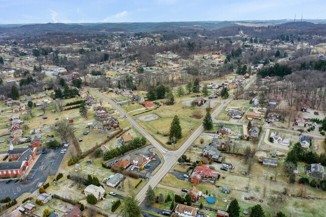
Property Record
708 State Route 130, Trafford, PA 15085
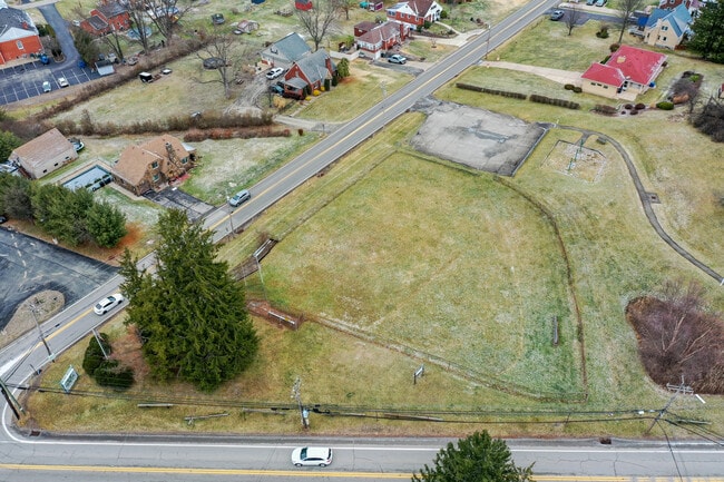
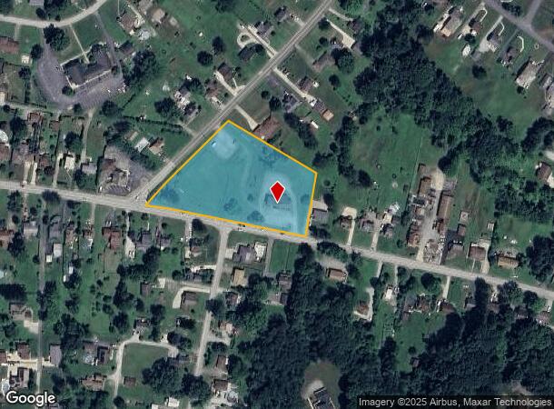
This Property Is For Sale
NEARBY LISTINGS FOR SALE OR LEASE
Property Detail
708 State Route 130
55-02-15-0-102
SCH BLDG
Commercialofficeresidentialmixeduse
Westmoreland
X
Pennsylvania
42003C0413H
3 AC
2025
Westmoreland County
2025
Pittsburgh
802301
Pittsburgh, PA
2,510 SF
DEMOGRAPHICS near 708 State Route 130
1 mile
3 mile
5 mile
2024 Total Population
3,858
21,541
93,570
2029 Population
3,846
21,215
92,220
Pop Growth 2024-2029
(0.31%)
(1.51%)
(1.44%)
Average Age
45
45
44
2024 Total Households
1,524
8,890
40,833
HH Growth 2024-2029
(0.39%)
(1.57%)
(1.49%)
Median Household Inc
$83,611
$83,065
$74,820
Avg Household Size
2.50
2.40
2.20
2024 Avg HH Vehicles
2.00
2.00
2.00
Median Home Value
$226,342
$218,079
$194,796
Median Year Built
1959
1963
1967
Nearby Places
Map Layers
Map Styles
 Street
 Aerial
Transit
 Traffic
 Biking
Places
Listings with unknown addresses are not visible on the map
- Restaurants
- Banks
- Shops
- Fitness
- Groceries
PUBLIC TRANSPORTATION
AIRPORT
Arnold Palmer Regional
Drive
Walk
Distance
Arnold Palmer Regional
39 min
21.9 mi
Pittsburgh International
Drive
Walk
Distance
Pittsburgh International
54 min
35.0 mi
Freight Ports
Port of Baltimore
Drive
Walk
Distance
Port of Baltimore
275 min
231.1 mi
Nearby Properties
Address
Land Use
TOTAL SIZE
Lot Size
Zoning
Address
Land Use
TOTAL SIZE
Lot Size
Zoning
58.87 AC
Address
Land Use
TOTAL SIZE
Lot Size
Zoning
Address
Land Use
TOTAL SIZE
Lot Size
Zoning
Address
Land Use
TOTAL SIZE
Lot Size
Zoning
41.59 AC
Address
Land Use
TOTAL SIZE
Lot Size
Zoning
Address
Land Use
TOTAL SIZE
Lot Size
Zoning
Address
Land Use
TOTAL SIZE
Lot Size
Zoning
4.84 AC
Address
Land Use
TOTAL SIZE
Lot Size
Zoning
Address
Land Use
TOTAL SIZE
Lot Size
Zoning
1,608 SF
24.76 AC
Address
Land Use
TOTAL SIZE
Lot Size
Zoning
10.18 AC
Address
Land Use
TOTAL SIZE
Lot Size
Zoning
Address
Land Use
TOTAL SIZE
Lot Size
Zoning
Address
Land Use
TOTAL SIZE
Lot Size
Zoning
Address
Land Use
TOTAL SIZE
Lot Size
Zoning
Address
Land Use
TOTAL SIZE
Lot Size
Zoning
Address
Land Use
TOTAL SIZE
Lot Size
Zoning
50.23 AC
Address
Land Use
TOTAL SIZE
Lot Size
Zoning
Address
Land Use
TOTAL SIZE
Lot Size
Zoning
Address
Land Use
TOTAL SIZE
Lot Size
Zoning
27.48 AC
Address
Land Use
TOTAL SIZE
Lot Size
Zoning
Address
Land Use
TOTAL SIZE
Lot Size
Zoning
189.30 AC
Address
Land Use
TOTAL SIZE
Lot Size
Zoning
Address
Land Use
TOTAL SIZE
Lot Size
Zoning
Address
Land Use
TOTAL SIZE
Lot Size
Zoning
1,620 SF
22.76 AC
Address
Land Use
TOTAL SIZE
Lot Size
Zoning
0.46 AC
Address
Land Use
TOTAL SIZE
Lot Size
Zoning
67.60 AC
Address
Land Use
TOTAL SIZE
Lot Size
Zoning
27.40 AC
Address
Land Use
TOTAL SIZE
Lot Size
Zoning
1,760 SF
126.72 AC
Address
Land Use
TOTAL SIZE
Lot Size
Zoning
14.42 AC
Address
Land Use
TOTAL SIZE
Lot Size
Zoning
6,737 SF
4.87 AC
The World's #1 Commercial Real Estate Marketplace
Connect with us
© 2026 CoStar Group
The information above has been obtained from sources believed reliable. While we do not doubt its accuracy we have not verified it and make no guarantee, warranty or representation about it. It is your responsibility to independently confirm its accuracy and completeness. Any projections, opinions, assumptions, or estimates used are for example only and do not represent the current or future performance of the property. The value of this transaction to you depends on tax and other factors which should be evaluated by your tax, financial, and legal advisors. You and your advisors should conduct a careful, independent investigation of the property to determine to your satisfaction the suitability of the property for your needs.