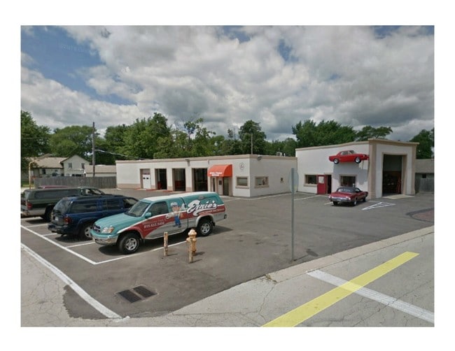
Property Record
7800 N 2Nd St, Machesney Park, IL 61115

NEARBY LISTINGS FOR SALE OR LEASE
Property Detail
7800 N 2Nd St
Rockford, IL
North Park Sub
08-31-104-020
NORTH PARK SUB PT SEC 31-45-2 + SEC 36-45-1 LOTS 25 + 26 + 027 BLOCK 002
Commercialnec
Winnebago
X
Illinois
17201C0258E
25
2024
0.31 AC
2024
I-39 Corr/Winnebago Cnty
000103
Chicago
4,627 SF
DEMOGRAPHICS near 7800 N 2Nd St
1 Mile
3 Mile
5 Mile
2024 Total Population
9,351
51,041
123,010
2029 Population
9,230
50,150
121,319
Pop Growth 2024-2029
(1.29%)
(1.75%)
(1.37%)
Average Age
40
42
41
2024 Total Households
3,848
21,679
51,437
HH Growth 2024-2029
(1.35%)
(1.79%)
(1.45%)
Median Household Inc
$54,904
$55,682
$56,464
Avg Household Size
2.40
2.30
2.30
2024 Avg HH Vehicles
2.00
2.00
2.00
Median Home Value
$91,982
$135,063
$141,007
Median Year Built
1965
1971
1968
Nearby Places
Map Layers
Map Styles
 Street
 Aerial
- Restaurants
- Banks
- Shops
- Fitness
- Groceries
PUBLIC TRANSPORTATION
AIRPORT
Chicago/Rockford International
DRIVE
WALK
Distance
Chicago/Rockford International
26 min
14.2 mi
Freight Ports
Port Milwaukee
DRIVE
WALK
Distance
Port Milwaukee
106 min
88.0 mi
SALE & LEASE HISTORY
LISTING DATE
SALE/LEASE

Jan 31, 2025
For Sale
Aug 05, 2019
For Sale
Nearby Properties
Address
Land Use
TOTAL SIZE
Lot Size
Zoning
Address
Land Use
TOTAL SIZE
Lot Size
Zoning
189,000 SF
56.75 AC
IL - INDUS
Address
Land Use
TOTAL SIZE
Lot Size
Zoning
105,664 SF
13.34 AC
Address
Land Use
TOTAL SIZE
Lot Size
Zoning
212,200 SF
21 AC
C3
Address
Land Use
TOTAL SIZE
Lot Size
Zoning
256,236 SF
29.33 AC
R3
Address
Land Use
TOTAL SIZE
Lot Size
Zoning
Address
Land Use
TOTAL SIZE
Lot Size
Zoning
106,145 SF
8.54 AC
R3
Address
Land Use
TOTAL SIZE
Lot Size
Zoning
51,580 SF
6.13 AC
Address
Land Use
TOTAL SIZE
Lot Size
Zoning
676,780 SF
32.88 AC
IG
Address
Land Use
TOTAL SIZE
Lot Size
Zoning
112,035 SF
8.79 AC
Address
Land Use
TOTAL SIZE
Lot Size
Zoning
182,391 SF
17.90 AC
R3
Address
Land Use
TOTAL SIZE
Lot Size
Zoning
114,176 SF
4.94 AC
R4
Address
Land Use
TOTAL SIZE
Lot Size
Zoning
175,502 SF
18.15 AC
Address
Land Use
TOTAL SIZE
Lot Size
Zoning
Address
Land Use
TOTAL SIZE
Lot Size
Zoning
151,517 SF
7.52 AC
R3
Address
Land Use
TOTAL SIZE
Lot Size
Zoning
Address
Land Use
TOTAL SIZE
Lot Size
Zoning
125,024 SF
9.91 AC
Address
Land Use
TOTAL SIZE
Lot Size
Zoning
140,085 SF
14.90 AC
Address
Land Use
TOTAL SIZE
Lot Size
Zoning
124,757 SF
13.41 AC
Address
Land Use
TOTAL SIZE
Lot Size
Zoning
373,791 SF
25.40 AC
IL
Address
Land Use
TOTAL SIZE
Lot Size
Zoning
Address
Land Use
TOTAL SIZE
Lot Size
Zoning
78,968 SF
13.65 AC
R2
Address
Land Use
TOTAL SIZE
Lot Size
Zoning
13.45 AC
Address
Land Use
TOTAL SIZE
Lot Size
Zoning
58,526 SF
134.42 AC
RE
Address
Land Use
TOTAL SIZE
Lot Size
Zoning
16,500 SF
10.62 AC
Address
Land Use
TOTAL SIZE
Lot Size
Zoning
645,384 SF
25.22 AC
I1
Address
Land Use
TOTAL SIZE
Lot Size
Zoning
160,937 SF
10 AC
CR
Address
Land Use
TOTAL SIZE
Lot Size
Zoning
57,888 SF
12.37 AC
R2
Address
Land Use
TOTAL SIZE
Lot Size
Zoning
140,888 SF
7.96 AC
Address
Land Use
TOTAL SIZE
Lot Size
Zoning
243,057 SF
21.38 AC
C2
Address
Land Use
TOTAL SIZE
Lot Size
Zoning
103,326 SF
10.52 AC
The World's #1 Commercial Real Estate Marketplace
Connect with us
© 2026 CoStar Group
The information above has been obtained from sources believed reliable. While we do not doubt its accuracy we have not verified it and make no guarantee, warranty or representation about it. It is your responsibility to independently confirm its accuracy and completeness. Any projections, opinions, assumptions, or estimates used are for example only and do not represent the current or future performance of the property. The value of this transaction to you depends on tax and other factors which should be evaluated by your tax, financial, and legal advisors. You and your advisors should conduct a careful, independent investigation of the property to determine to your satisfaction the suitability of the property for your needs.