Property Record
7800 W 207Th St, Bucyrus, KS 66013


NEARBY LISTINGS FOR SALE OR LEASE
-
-
View all Bucyrus listings for sale on LoopNet.com
Property Detail
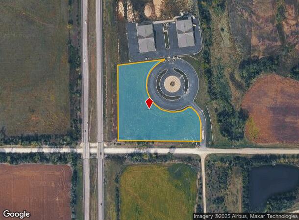
7800 W 207Th St
Kansas City, MO-KS
Stonegate Motorplaza
1P40770000-0001
STONEGATE MOTORPLAZA LT 1
Farms
Johnson
X
Kansas
20091C0143G
1
2024
3.64 AC
2024
South Johnson County
053803
Kansas City
DEMOGRAPHICS near 7800 W 207Th St
1 mile
3 mile
5 mile
2024 Total Population
204
3,588
9,457
2029 Population
211
3,751
10,088
Pop Growth 2024-2029
+ 3.43%
+ 4.54%
+ 6.67%
Average Age
42
42
41
2024 Total Households
72
1,259
3,197
HH Growth 2024-2029
+ 4.17%
+ 4.61%
+ 6.63%
Median Household Inc
$120,833
$124,323
$147,384
Avg Household Size
2.80
2.80
2.90
2024 Avg HH Vehicles
3.00
3.00
3.00
Median Home Value
$485,713
$524,232
$610,996
Median Year Built
1982
1985
1995
Nearby Places
Map Layers
Map Styles
 Street
 Aerial
Transit
 Traffic
 Biking
Places
Listings with unknown addresses are not visible on the map
- Restaurants
- Banks
- Shops
- Fitness
- Groceries
SALE & LEASE HISTORY
LISTING DATE
SALE/LEASE

Jan 24, 2020
For Sale
Nearby Properties
Address
Land Use
TOTAL SIZE
Lot Size
Zoning
Address
Land Use
TOTAL SIZE
Lot Size
Zoning
71,610 SF
6.11 AC
RN1
Address
Land Use
TOTAL SIZE
Lot Size
Zoning
13,187 SF
3.12 AC
RUR
Address
Land Use
TOTAL SIZE
Lot Size
Zoning
24,252 SF
3.91 AC
RN1
Address
Land Use
TOTAL SIZE
Lot Size
Zoning
48,165 SF
5.79 AC
RUR
Address
Land Use
TOTAL SIZE
Lot Size
Zoning
12,112 SF
5.50 AC
RN1
Address
Land Use
TOTAL SIZE
Lot Size
Zoning
163.65 AC
RURJ
Address
Land Use
TOTAL SIZE
Lot Size
Zoning
7,726 SF
4.63 AC
RURJ
Address
Land Use
TOTAL SIZE
Lot Size
Zoning
138.23 AC
RURJ
Address
Land Use
TOTAL SIZE
Lot Size
Zoning
3,456 SF
78.05 AC
RURJ
Address
Land Use
TOTAL SIZE
Lot Size
Zoning
5,600 SF
6.73 AC
PEC3
Address
Land Use
TOTAL SIZE
Lot Size
Zoning
15,374 SF
33.59 AC
RUR
Address
Land Use
TOTAL SIZE
Lot Size
Zoning
23,110 SF
9.94 AC
RUR
Address
Land Use
TOTAL SIZE
Lot Size
Zoning
11,568 SF
3.99 AC
RUR
Address
Land Use
TOTAL SIZE
Lot Size
Zoning
11,320 SF
154.68 AC
RURJ
Address
Land Use
TOTAL SIZE
Lot Size
Zoning
45.23 AC
RUR
Address
Land Use
TOTAL SIZE
Lot Size
Zoning
20,056 SF
11.64 AC
PRB1J
Address
Land Use
TOTAL SIZE
Lot Size
Zoning
19,478 SF
2 AC
PRN-2J
Address
Land Use
TOTAL SIZE
Lot Size
Zoning
16,777 SF
4.83 AC
PRN-2J
Address
Land Use
TOTAL SIZE
Lot Size
Zoning
9,800 SF
15.74 AC
PEC3
Address
Land Use
TOTAL SIZE
Lot Size
Zoning
22,504 SF
3.07 AC
RUR
Address
Land Use
TOTAL SIZE
Lot Size
Zoning
16,108 SF
68.40 AC
RN2
Address
Land Use
TOTAL SIZE
Lot Size
Zoning
8,496 SF
10 AC
RUR
Address
Land Use
TOTAL SIZE
Lot Size
Zoning
13,877 SF
2.53 AC
PRN-2J
Address
Land Use
TOTAL SIZE
Lot Size
Zoning
1,622 SF
2.79 AC
VLDR
Address
Land Use
TOTAL SIZE
Lot Size
Zoning
14,232 SF
12.26 AC
RN1
Address
Land Use
TOTAL SIZE
Lot Size
Zoning
8,816 SF
0.49 AC
PRB1A
Address
Land Use
TOTAL SIZE
Lot Size
Zoning
20,415 SF
4.55 AC
PRB1J
Address
Land Use
TOTAL SIZE
Lot Size
Zoning
20,606 SF
8.90 AC
PRB2
Address
Land Use
TOTAL SIZE
Lot Size
Zoning
3,968 SF
0.94 AC
RN1
Address
Land Use
TOTAL SIZE
Lot Size
Zoning
23,230 SF
6.38 AC
PEC3
The World's #1 Commercial Real Estate Marketplace
Connect with us
© 2026 CoStar Group
The information above has been obtained from sources believed reliable. While we do not doubt its accuracy we have not verified it and make no guarantee, warranty or representation about it. It is your responsibility to independently confirm its accuracy and completeness. Any projections, opinions, assumptions, or estimates used are for example only and do not represent the current or future performance of the property. The value of this transaction to you depends on tax and other factors which should be evaluated by your tax, financial, and legal advisors. You and your advisors should conduct a careful, independent investigation of the property to determine to your satisfaction the suitability of the property for your needs.