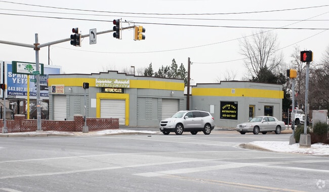
Property Record
7816 Harford Rd, Parkville, MD 21234


Current Lease Availabilities
NEARBY LISTINGS FOR SALE OR LEASE
Property Detail
7816 Harford Rd
Baltimore-Columbia-Towson, MD
Parkville
09-1900002041
LT 14 PT LT 24 PARKVILLE
Storebuilding
Baltimore
X
Maryland
2400100410G
14
2024
0.28 AC
2025
Baltimore County East
492101
Baltimore
18,478 SF
DEMOGRAPHICS near 7816 Harford Rd
1 Mile
3 Mile
5 Mile
2024 Total Population
17,793
151,753
354,717
2029 Population
17,206
146,957
344,545
Pop Growth 2024-2029
(3.30%)
(3.16%)
(2.87%)
Average Age
41
41
40
2024 Total Households
7,276
62,033
141,261
HH Growth 2024-2029
(3.44%)
(3.29%)
(3.00%)
Median Household Inc
$79,473
$71,504
$70,734
Avg Household Size
2.40
2.40
2.40
2024 Avg HH Vehicles
2.00
2.00
2.00
Median Home Value
$234,544
$233,069
$248,540
Median Year Built
1951
1957
1958
Nearby Places
Map Layers
Map Styles
 Street
 Aerial
- Restaurants
- Banks
- Shops
- Fitness
- Groceries
PUBLIC TRANSPORTATION
COMMUTER RAIL
Penn Station (Penn Line - Maryland Area Regional Commuter Trains (The MARC))
DRIVE
WALK
Distance
Penn Station (Penn Line - Maryland Area Regional Commuter Trains (The MARC))
19 min
6.6 mi
Camden Station (Camden Line - Maryland Area Regional Commuter Trains (The MARC))
DRIVE
WALK
Distance
Camden Station (Camden Line - Maryland Area Regional Commuter Trains (The MARC))
24 min
8.2 mi
AIRPORT
Baltimore/Washington International Thurgood Marshall
DRIVE
WALK
Distance
Baltimore/Washington International Thurgood Marshall
38 min
22.7 mi
Freight Ports
Port of Baltimore
DRIVE
WALK
Distance
Port of Baltimore
23 min
7.8 mi
Nearby Properties
Address
Land Use
TOTAL SIZE
Lot Size
Zoning
Address
Land Use
TOTAL SIZE
Lot Size
Zoning
1,704,075 SF
76.16 AC
Address
Land Use
TOTAL SIZE
Lot Size
Zoning
316,273 SF
25.90 AC
H
Address
Land Use
TOTAL SIZE
Lot Size
Zoning
31.22 AC
DR16
Address
Land Use
TOTAL SIZE
Lot Size
Zoning
725,588 SF
43.12 AC
BLCCC
Address
Land Use
TOTAL SIZE
Lot Size
Zoning
46.20 AC
DR105
Address
Land Use
TOTAL SIZE
Lot Size
Zoning
303,115 SF
7.62 AC
R-3
Address
Land Use
TOTAL SIZE
Lot Size
Zoning
30.89 AC
DR16
Address
Land Use
TOTAL SIZE
Lot Size
Zoning
204,974 SF
5.87 AC
DR16
Address
Land Use
TOTAL SIZE
Lot Size
Zoning
19.93 AC
Address
Land Use
TOTAL SIZE
Lot Size
Zoning
7,718 SF
152.79 AC
OS
Address
Land Use
TOTAL SIZE
Lot Size
Zoning
67,938 SF
31.72 AC
BL
Address
Land Use
TOTAL SIZE
Lot Size
Zoning
11.56 AC
DR16
Address
Land Use
TOTAL SIZE
Lot Size
Zoning
15.82 AC
BLCCC
Address
Land Use
TOTAL SIZE
Lot Size
Zoning
41,184 SF
93.14 AC
EC-1
Address
Land Use
TOTAL SIZE
Lot Size
Zoning
190,826 SF
9.89 AC
Address
Land Use
TOTAL SIZE
Lot Size
Zoning
152,884 SF
14.54 AC
BL
Address
Land Use
TOTAL SIZE
Lot Size
Zoning
2.41 AC
DR16
Address
Land Use
TOTAL SIZE
Lot Size
Zoning
11.38 AC
Address
Land Use
TOTAL SIZE
Lot Size
Zoning
14.47 AC
DR16
Address
Land Use
TOTAL SIZE
Lot Size
Zoning
10.51 AC
DR16
Address
Land Use
TOTAL SIZE
Lot Size
Zoning
7.38 AC
DR16
Address
Land Use
TOTAL SIZE
Lot Size
Zoning
14.10 AC
DR16
Address
Land Use
TOTAL SIZE
Lot Size
Zoning
18.58 AC
DR16
Address
Land Use
TOTAL SIZE
Lot Size
Zoning
10.96 AC
DR16
Address
Land Use
TOTAL SIZE
Lot Size
Zoning
111,000 SF
29.85 AC
BM
Address
Land Use
TOTAL SIZE
Lot Size
Zoning
8.37 AC
DR16
Address
Land Use
TOTAL SIZE
Lot Size
Zoning
213,272 SF
16.25 AC
R-5
Address
Land Use
TOTAL SIZE
Lot Size
Zoning
10.47 AC
Address
Land Use
TOTAL SIZE
Lot Size
Zoning
14.23 AC
R-5
Address
Land Use
TOTAL SIZE
Lot Size
Zoning
11.25 AC
DR16
The World's #1 Commercial Real Estate Marketplace
Connect with us
© 2025 CoStar Group
The information above has been obtained from sources believed reliable. While we do not doubt its accuracy we have not verified it and make no guarantee, warranty or representation about it. It is your responsibility to independently confirm its accuracy and completeness. Any projections, opinions, assumptions, or estimates used are for example only and do not represent the current or future performance of the property. The value of this transaction to you depends on tax and other factors which should be evaluated by your tax, financial, and legal advisors. You and your advisors should conduct a careful, independent investigation of the property to determine to your satisfaction the suitability of the property for your needs.