Property Record
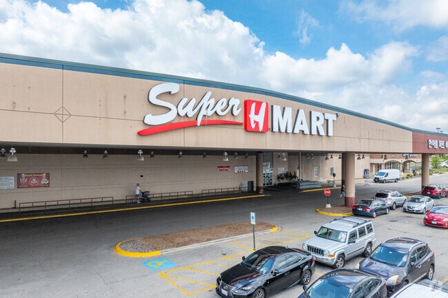
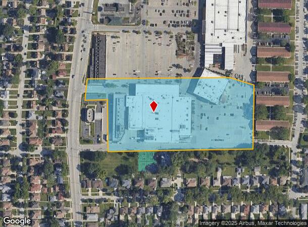
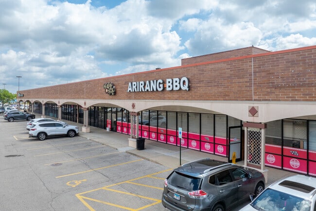
7801 N Waukegan Rd, Niles, IL 60714
NEARBY LISTINGS FOR SALE OR LEASE
Property Detail
7801 N Waukegan Rd
10-30-115-020-0000
Lawrencewood Gardens
Supermarket
Cook
X
Illinois
17031C0243J
8.52 AC
2023
Near North
2024
Chicago
805401
Chicago-Naperville-Elgin, IL-IN-WI
DEMOGRAPHICS near 7801 N Waukegan Rd
1 Mile
3 Mile
5 Mile
2024 Total Population
15,643
166,783
461,383
2029 Population
15,170
161,445
446,405
Pop Growth 2024-2029
(3.02%)
(3.20%)
(3.25%)
Average Age
45
43
43
2024 Total Households
5,803
61,947
173,118
HH Growth 2024-2029
(3.38%)
(3.56%)
(3.57%)
Median Household Inc
$87,661
$95,028
$87,047
Avg Household Size
2.50
2.60
2.60
2024 Avg HH Vehicles
2.00
2.00
2.00
Median Home Value
$340,043
$384,566
$365,955
Median Year Built
1958
1957
1959
Nearby Places
Map Layers
Map Styles
 Street
 Aerial
- Restaurants
- Banks
- Shops
- Fitness
- Groceries
SALE & LEASE HISTORY
LISTING DATE
SALE/LEASE

Jun 07, 2017
For Lease
Jul 03, 2024
For Lease
Nearby Properties
Address
Land Use
TOTAL SIZE
Lot Size
Zoning
Address
Land Use
TOTAL SIZE
Lot Size
Zoning
203,090 SF
7.96 AC
Address
Land Use
TOTAL SIZE
Lot Size
Zoning
24.49 AC
Address
Land Use
TOTAL SIZE
Lot Size
Zoning
39.26 AC
Address
Land Use
TOTAL SIZE
Lot Size
Zoning
188,728 SF
Address
Land Use
TOTAL SIZE
Lot Size
Zoning
10.24 AC
Address
Land Use
TOTAL SIZE
Lot Size
Zoning
414,878 SF
20.79 AC
Address
Land Use
TOTAL SIZE
Lot Size
Zoning
315,373 SF
26.19 AC
Address
Land Use
TOTAL SIZE
Lot Size
Zoning
9.38 AC
PD 1179,PO
Address
Land Use
TOTAL SIZE
Lot Size
Zoning
269,500 SF
11.03 AC
Address
Land Use
TOTAL SIZE
Lot Size
Zoning
103,323 SF
10.65 AC
Address
Land Use
TOTAL SIZE
Lot Size
Zoning
172,500 SF
2.42 AC
Address
Land Use
TOTAL SIZE
Lot Size
Zoning
16.27 AC
Address
Land Use
TOTAL SIZE
Lot Size
Zoning
43,765 SF
2.79 AC
Address
Land Use
TOTAL SIZE
Lot Size
Zoning
486,884 SF
16.41 AC
Address
Land Use
TOTAL SIZE
Lot Size
Zoning
450,768 SF
6.97 AC
Address
Land Use
TOTAL SIZE
Lot Size
Zoning
552,152 SF
7.88 AC
Address
Land Use
TOTAL SIZE
Lot Size
Zoning
231,865 SF
3.16 AC
Address
Land Use
TOTAL SIZE
Lot Size
Zoning
5.60 AC
Address
Land Use
TOTAL SIZE
Lot Size
Zoning
276,112 SF
10.02 AC
Address
Land Use
TOTAL SIZE
Lot Size
Zoning
13.13 AC
Address
Land Use
TOTAL SIZE
Lot Size
Zoning
320,535 SF
12.44 AC
Address
Land Use
TOTAL SIZE
Lot Size
Zoning
166,728 SF
11.79 AC
Address
Land Use
TOTAL SIZE
Lot Size
Zoning
195,849 SF
6.55 AC
Address
Land Use
TOTAL SIZE
Lot Size
Zoning
92,457 SF
4.09 AC
Address
Land Use
TOTAL SIZE
Lot Size
Zoning
629,244 SF
11.07 AC
RS-2
Address
Land Use
TOTAL SIZE
Lot Size
Zoning
424,257 SF
Address
Land Use
TOTAL SIZE
Lot Size
Zoning
122,489 SF
9.92 AC
Address
Land Use
TOTAL SIZE
Lot Size
Zoning
284,708 SF
17.74 AC
Address
Land Use
TOTAL SIZE
Lot Size
Zoning
358,324 SF
16.05 AC
Address
Land Use
TOTAL SIZE
Lot Size
Zoning
333,078 SF
9.15 AC
The World's #1 Commercial Real Estate Marketplace
Connect with us
© 2025 CoStar Group
The information above has been obtained from sources believed reliable. While we do not doubt its accuracy we have not verified it and make no guarantee, warranty or representation about it. It is your responsibility to independently confirm its accuracy and completeness. Any projections, opinions, assumptions, or estimates used are for example only and do not represent the current or future performance of the property. The value of this transaction to you depends on tax and other factors which should be evaluated by your tax, financial, and legal advisors. You and your advisors should conduct a careful, independent investigation of the property to determine to your satisfaction the suitability of the property for your needs.