Property Record
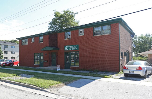
7801 S Roberts Rd, Bridgeview, IL 60455

Property Detail
7801 S Roberts Rd
Chicago-Naperville-Elgin, IL-IN
(STICKNEY)(LAND)(SYNDICATE) SUB OF BLKS 7 & 8 OF HART MANS STICKNEY SUB WH WH SW SEC 25-38-12
18-25-308-001-0000
Cook
Miscellaneous
Illinois
B and X Area of moderate flood hazard, usually the area between the limits of the 100-year and 500-year floods.
9,10
2023
0.30 AC
2025
Near South Cook
820501
Chicago
NEARBY LISTINGS FOR SALE OR LEASE
DEMOGRAPHICS near 7801 S Roberts Rd
1 mile
3 mile
5 mile
2025 Total Population
13,156
107,722
308,331
2030 Population
13,235
108,242
308,782
Pop Growth 2025-2030
+ 0.60%
+ 0.48%
+ 0.15%
Average Age
41
40
41
2025 Total Households
4,824
37,971
110,407
HH Growth 2025-2030
+ 0.41%
+ 0.27%
(0.03%)
Median Household Inc
$62,909
$70,872
$79,128
Avg Household Size
2.70
2.80
2.70
2025 Avg HH Vehicles
2.00
2.00
2.00
Median Home Value
$271,108
$269,395
$277,982
Median Year Built
1970
1970
1965
Nearby Places
Map Layers
Map Styles
 Street
 Aerial
Layers
 Traffic
 Biking
Places
Listings with unknown addresses are not visible on the map
- Restaurants
- Banks
- Shops
- Fitness
- Groceries
PUBLIC TRANSPORTATION
COMMUTER RAIL
Summit Station (Heritage Corridor Line - Northeast Illinois Regional Commuter Railroad (Metra))
Drive
Walk
Distance
Summit Station (Heritage Corridor Line - Northeast Illinois Regional Commuter Railroad (Metra))
9 min
3.5 mi
Willow Springs Station (Heritage Corridor Line - Northeast Illinois Regional Commuter Railroad (Metra))
Drive
Walk
Distance
Willow Springs Station (Heritage Corridor Line - Northeast Illinois Regional Commuter Railroad (Metra))
7 min
3.6 mi
AIRPORT
Chicago Midway International
Drive
Walk
Distance
Chicago Midway International
12 min
6.3 mi
Chicago O'Hare International
Drive
Walk
Distance
Chicago O'Hare International
35 min
24.5 mi
Nearby Properties
Address
Land Use
TOTAL SIZE
Lot Size
Zoning
Address
Land Use
TOTAL SIZE
Lot Size
Zoning
Address
Land Use
TOTAL SIZE
Lot Size
Zoning
72,090 SF
10.19 AC
Address
Land Use
TOTAL SIZE
Lot Size
Zoning
51,762 SF
4 AC
Address
Land Use
TOTAL SIZE
Lot Size
Zoning
111,830 SF
2.16 AC
Address
Land Use
TOTAL SIZE
Lot Size
Zoning
266,580 SF
29.50 AC
Address
Land Use
TOTAL SIZE
Lot Size
Zoning
252,973 SF
11.68 AC
Address
Land Use
TOTAL SIZE
Lot Size
Zoning
61,003 SF
68.78 AC
Address
Land Use
TOTAL SIZE
Lot Size
Zoning
19.48 AC
Address
Land Use
TOTAL SIZE
Lot Size
Zoning
198,190 SF
15 AC
Address
Land Use
TOTAL SIZE
Lot Size
Zoning
16,077 SF
66.23 AC
Address
Land Use
TOTAL SIZE
Lot Size
Zoning
274,900 SF
13.14 AC
Address
Land Use
TOTAL SIZE
Lot Size
Zoning
45,196 SF
1.28 AC
Address
Land Use
TOTAL SIZE
Lot Size
Zoning
397,288 SF
10.18 AC
Address
Land Use
TOTAL SIZE
Lot Size
Zoning
Address
Land Use
TOTAL SIZE
Lot Size
Zoning
28,406 SF
1.42 AC
Address
Land Use
TOTAL SIZE
Lot Size
Zoning
256,416 SF
9.07 AC
Address
Land Use
TOTAL SIZE
Lot Size
Zoning
98,811 SF
10.02 AC
Address
Land Use
TOTAL SIZE
Lot Size
Zoning
8.32 AC
Address
Land Use
TOTAL SIZE
Lot Size
Zoning
202,309 SF
13.02 AC
Address
Land Use
TOTAL SIZE
Lot Size
Zoning
367,185 SF
25 AC
Address
Land Use
TOTAL SIZE
Lot Size
Zoning
1,583,756 SF
78.72 AC
Address
Land Use
TOTAL SIZE
Lot Size
Zoning
350,200 SF
Address
Land Use
TOTAL SIZE
Lot Size
Zoning
3.51 AC
Address
Land Use
TOTAL SIZE
Lot Size
Zoning
80.10 AC
Address
Land Use
TOTAL SIZE
Lot Size
Zoning
301,546 SF
11.59 AC
Address
Land Use
TOTAL SIZE
Lot Size
Zoning
145,018 SF
7.95 AC
Address
Land Use
TOTAL SIZE
Lot Size
Zoning
132,579 SF
9.11 AC
Address
Land Use
TOTAL SIZE
Lot Size
Zoning
332,889 SF
5.85 AC
Address
Land Use
TOTAL SIZE
Lot Size
Zoning
76,891 SF
4.69 AC
Address
Land Use
TOTAL SIZE
Lot Size
Zoning
299,381 SF
9.70 AC
The World's #1 Commercial Real Estate Marketplace
Connect with us
© 2026 CoStar Group
The information above has been obtained from sources believed reliable. While we do not doubt its accuracy we have not verified it and make no guarantee, warranty or representation about it. It is your responsibility to independently confirm its accuracy and completeness. Any projections, opinions, assumptions, or estimates used are for example only and do not represent the current or future performance of the property. The value of this transaction to you depends on tax and other factors which should be evaluated by your tax, financial, and legal advisors. You and your advisors should conduct a careful, independent investigation of the property to determine to your satisfaction the suitability of the property for your needs.