Property Record
7802 Idlewild Rd, Indian Trail, NC 28079
NEARBY LISTINGS FOR SALE OR LEASE
Property Detail
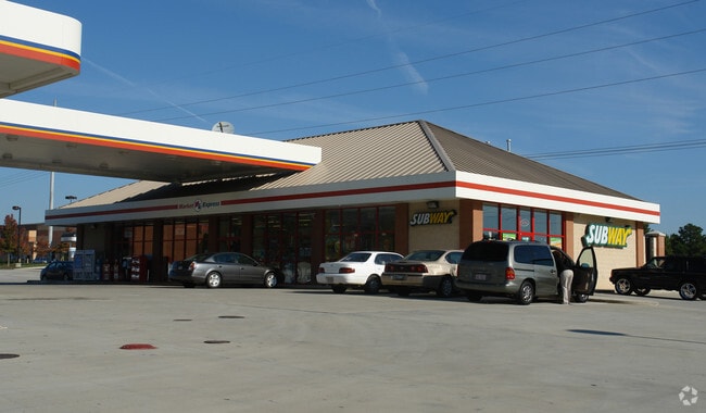
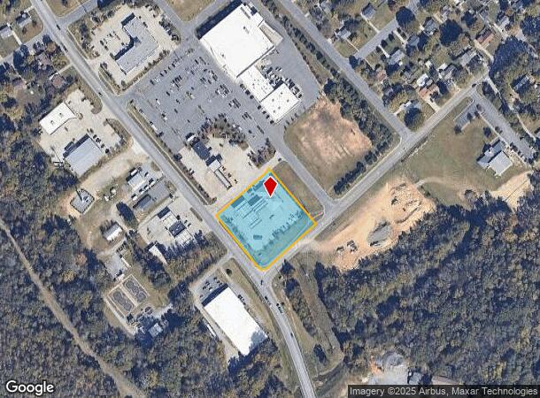
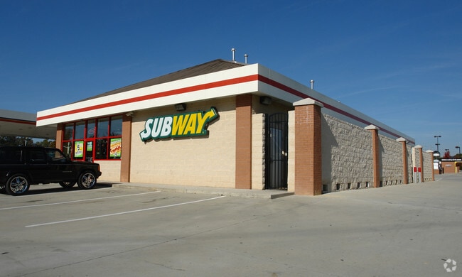
7802 Idlewild Rd
07-060-097-D
Idlewild Commons
Conveniencestore
#4 IDLEWILD COMMONS MP1 OPCI697/OPCJ430
X
Union
3710541900J
North Carolina
2025
1.54 AC
2025
Union County
020310
Charlotte
4,185 SF
Charlotte-Concord-Gastonia, NC-SC
DEMOGRAPHICS near 7802 Idlewild Rd
1 Mile
3 Mile
5 Mile
2024 Total Population
4,795
40,630
90,691
2029 Population
5,355
45,375
100,322
Pop Growth 2024-2029
+ 11.68%
+ 11.68%
+ 10.62%
Average Age
38
39
40
2024 Total Households
1,641
14,129
32,819
HH Growth 2024-2029
+ 11.94%
+ 11.87%
+ 10.67%
Median Household Inc
$78,433
$90,132
$89,046
Avg Household Size
2.90
2.80
2.70
2024 Avg HH Vehicles
2.00
2.00
2.00
Median Home Value
$271,979
$298,999
$315,937
Median Year Built
1997
1999
1999
Nearby Places
Map Layers
Map Styles
 Street
 Aerial
- Restaurants
- Banks
- Shops
- Fitness
- Groceries
PUBLIC TRANSPORTATION
AIRPORT
Concord-Padgett Regional
DRIVE
WALK
Distance
Concord-Padgett Regional
32 min
24.4 mi
Charlotte/Douglas International
DRIVE
WALK
Distance
Charlotte/Douglas International
39 min
24.5 mi
Freight Ports
North Charleston Terminal
DRIVE
WALK
Distance
North Charleston Terminal
238 min
195.3 mi
Nearby Properties
Address
Land Use
TOTAL SIZE
Lot Size
Zoning
Address
Land Use
TOTAL SIZE
Lot Size
Zoning
12.30 AC
SF-1 INDIA
Address
Land Use
TOTAL SIZE
Lot Size
Zoning
18.05 AC
CBD INDIAN
Address
Land Use
TOTAL SIZE
Lot Size
Zoning
27,900 SF
15.59 AC
MFR INDIAN
Address
Land Use
TOTAL SIZE
Lot Size
Zoning
227,659 SF
26.46 AC
MFR INDIAN
Address
Land Use
TOTAL SIZE
Lot Size
Zoning
498,729 SF
78.21 AC
RBD INDIAN
Address
Land Use
TOTAL SIZE
Lot Size
Zoning
75,923 SF
7.29 AC
SF-1 INDIA
Address
Land Use
TOTAL SIZE
Lot Size
Zoning
93,040 SF
16.57 AC
GR STALLIN
Address
Land Use
TOTAL SIZE
Lot Size
Zoning
209,960 SF
26.64 AC
RBD INDIAN
Address
Land Use
TOTAL SIZE
Lot Size
Zoning
96,456 SF
34.88 AC
R-20 STALL
Address
Land Use
TOTAL SIZE
Lot Size
Zoning
86,960 SF
14.13 AC
SF-1 INDIA
Address
Land Use
TOTAL SIZE
Lot Size
Zoning
97,318 SF
27.57 AC
RA-40 UNIO
Address
Land Use
TOTAL SIZE
Lot Size
Zoning
45,053 SF
15.03 AC
RBD INDIAN
Address
Land Use
TOTAL SIZE
Lot Size
Zoning
15.33 AC
Address
Land Use
TOTAL SIZE
Lot Size
Zoning
40,680 SF
15.13 AC
Address
Land Use
TOTAL SIZE
Lot Size
Zoning
36,480 SF
12.21 AC
NRD STALLI
Address
Land Use
TOTAL SIZE
Lot Size
Zoning
52,747 SF
8.05 AC
GR STALLIN
Address
Land Use
TOTAL SIZE
Lot Size
Zoning
47,861 SF
18.65 AC
R-15
Address
Land Use
TOTAL SIZE
Lot Size
Zoning
20,202 SF
3.30 AC
SF-1 INDIA
Address
Land Use
TOTAL SIZE
Lot Size
Zoning
75,951 SF
5.82 AC
LI INDIAN
Address
Land Use
TOTAL SIZE
Lot Size
Zoning
74,932 SF
20.65 AC
R-20 UNION
Address
Land Use
TOTAL SIZE
Lot Size
Zoning
58,335 SF
2.59 AC
GR STALLIN
Address
Land Use
TOTAL SIZE
Lot Size
Zoning
50,111 SF
4.62 AC
GB LAKE PA
Address
Land Use
TOTAL SIZE
Lot Size
Zoning
36,731 SF
7.01 AC
GBD INDIAN
Address
Land Use
TOTAL SIZE
Lot Size
Zoning
164,350 SF
13.63 AC
BC STALLIN
Address
Land Use
TOTAL SIZE
Lot Size
Zoning
49,643 SF
3 AC
CZ COM IND
Address
Land Use
TOTAL SIZE
Lot Size
Zoning
9,762 SF
134.77 AC
R-15 STALL
Address
Land Use
TOTAL SIZE
Lot Size
Zoning
39,780 SF
9.01 AC
LI INDIAN
Address
Land Use
TOTAL SIZE
Lot Size
Zoning
21,934 SF
16.22 AC
RA-40 UNIO
Address
Land Use
TOTAL SIZE
Lot Size
Zoning
7,930 SF
9.23 AC
GR STALLIN
Address
Land Use
TOTAL SIZE
Lot Size
Zoning
43,843 SF
30 AC
SF-1 INDIA
The World's #1 Commercial Real Estate Marketplace
Connect with us
© 2026 CoStar Group
The information above has been obtained from sources believed reliable. While we do not doubt its accuracy we have not verified it and make no guarantee, warranty or representation about it. It is your responsibility to independently confirm its accuracy and completeness. Any projections, opinions, assumptions, or estimates used are for example only and do not represent the current or future performance of the property. The value of this transaction to you depends on tax and other factors which should be evaluated by your tax, financial, and legal advisors. You and your advisors should conduct a careful, independent investigation of the property to determine to your satisfaction the suitability of the property for your needs.