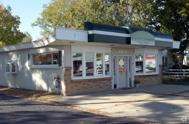
Property Record
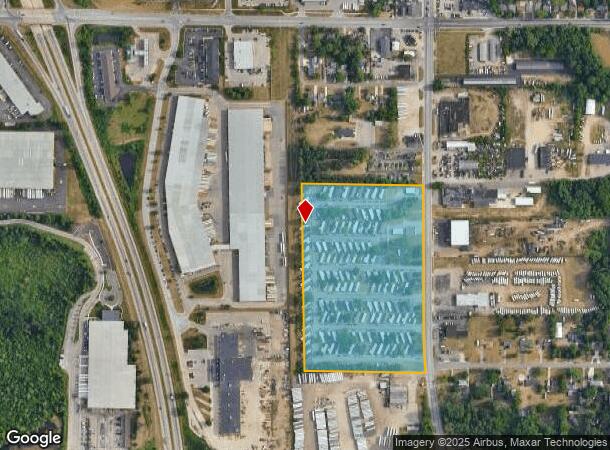
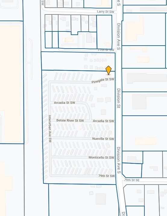
7805 Division Ave S, Grand Rapids, MI 49548
NEARBY LISTINGS FOR SALE OR LEASE
Property Detail
7805 Division Ave S
41-21-13-276-014
N 17 A. OF S 27 A. OF THAT PART OF E 1/2 NE 1/4 LYING E OF FOL DESC LINE COM ON E&W 1/4 LINE 664.5 FT W FROM E 1/4 COR TH N
Commercialnec
Kent
X
Michigan
26005C0125G
17.32 AC
2024
Byron/Gaines
2025
West Michigan
014605
Grand Rapids-Wyoming, MI
3,050 SF
DEMOGRAPHICS near 7805 Division Ave S
1 Mile
3 Mile
5 Mile
2024 Total Population
4,758
46,660
113,725
2029 Population
4,809
47,089
114,943
Pop Growth 2024-2029
+ 1.07%
+ 0.92%
+ 1.07%
Average Age
38
38
38
2024 Total Households
1,750
17,434
41,859
HH Growth 2024-2029
+ 1.09%
+ 0.93%
+ 1.07%
Median Household Inc
$72,306
$70,830
$71,140
Avg Household Size
2.70
2.60
2.70
2024 Avg HH Vehicles
2.00
2.00
2.00
Median Home Value
$235,250
$252,206
$241,134
Median Year Built
1989
1991
1986
Nearby Places
Map Layers
Map Styles
 Street
 Aerial
- Restaurants
- Banks
- Shops
- Fitness
- Groceries
PUBLIC TRANSPORTATION
AIRPORT
Gerald R Ford International
DRIVE
WALK
Distance
Gerald R Ford International
20 min
10.9 mi
Freight Ports
Port Milwaukee
DRIVE
WALK
Distance
Port Milwaukee
306 min
261.1 mi
Nearby Properties
Address
Land Use
TOTAL SIZE
Lot Size
Zoning
Address
Land Use
TOTAL SIZE
Lot Size
Zoning
290,627 SF
Address
Land Use
TOTAL SIZE
Lot Size
Zoning
490,769 SF
42.25 AC
B3
Address
Land Use
TOTAL SIZE
Lot Size
Zoning
295,027 SF
51.42 AC
I3
Address
Land Use
TOTAL SIZE
Lot Size
Zoning
63,788 SF
124.62 AC
D1
Address
Land Use
TOTAL SIZE
Lot Size
Zoning
48.43 AC
PUD-PL UNI
Address
Land Use
TOTAL SIZE
Lot Size
Zoning
487,739 SF
73.87 AC
RR
Address
Land Use
TOTAL SIZE
Lot Size
Zoning
26.94 AC
Address
Land Use
TOTAL SIZE
Lot Size
Zoning
38.98 AC
PUD-PL UNI
Address
Land Use
TOTAL SIZE
Lot Size
Zoning
386,450 SF
29.10 AC
Address
Land Use
TOTAL SIZE
Lot Size
Zoning
465,772 SF
61.95 AC
I1
Address
Land Use
TOTAL SIZE
Lot Size
Zoning
58.30 AC
RA
Address
Land Use
TOTAL SIZE
Lot Size
Zoning
2,593 SF
18 AC
PUD-PL UNI
Address
Land Use
TOTAL SIZE
Lot Size
Zoning
229,572 SF
16.20 AC
PUD-PL UNI
Address
Land Use
TOTAL SIZE
Lot Size
Zoning
720 SF
74.47 AC
R4-MOBILE
Address
Land Use
TOTAL SIZE
Lot Size
Zoning
57,030 SF
17.74 AC
R3-MED RES
Address
Land Use
TOTAL SIZE
Lot Size
Zoning
108,911 SF
10.80 AC
D1
Address
Land Use
TOTAL SIZE
Lot Size
Zoning
16.30 AC
I1
Address
Land Use
TOTAL SIZE
Lot Size
Zoning
1,296 SF
12 AC
PUD-PL UNI
Address
Land Use
TOTAL SIZE
Lot Size
Zoning
30 AC
RS
Address
Land Use
TOTAL SIZE
Lot Size
Zoning
20.53 AC
Address
Land Use
TOTAL SIZE
Lot Size
Zoning
140,742 SF
18.57 AC
D1
Address
Land Use
TOTAL SIZE
Lot Size
Zoning
49.29 AC
R4-MOBILE
Address
Land Use
TOTAL SIZE
Lot Size
Zoning
48.57 AC
RD
Address
Land Use
TOTAL SIZE
Lot Size
Zoning
89,453 SF
9.12 AC
PUD-PL UNI
Address
Land Use
TOTAL SIZE
Lot Size
Zoning
45.66 AC
RD
Address
Land Use
TOTAL SIZE
Lot Size
Zoning
1,356 SF
31.16 AC
R5
Address
Land Use
TOTAL SIZE
Lot Size
Zoning
98,960 SF
6.15 AC
I1
Address
Land Use
TOTAL SIZE
Lot Size
Zoning
Address
Land Use
TOTAL SIZE
Lot Size
Zoning
22.37 AC
Address
Land Use
TOTAL SIZE
Lot Size
Zoning
1.11 AC
PUD-PL UNI
The World's #1 Commercial Real Estate Marketplace
Connect with us
© 2026 CoStar Group
The information above has been obtained from sources believed reliable. While we do not doubt its accuracy we have not verified it and make no guarantee, warranty or representation about it. It is your responsibility to independently confirm its accuracy and completeness. Any projections, opinions, assumptions, or estimates used are for example only and do not represent the current or future performance of the property. The value of this transaction to you depends on tax and other factors which should be evaluated by your tax, financial, and legal advisors. You and your advisors should conduct a careful, independent investigation of the property to determine to your satisfaction the suitability of the property for your needs.