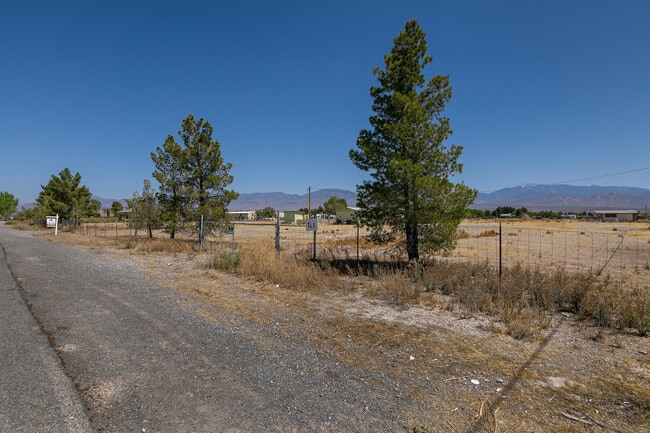
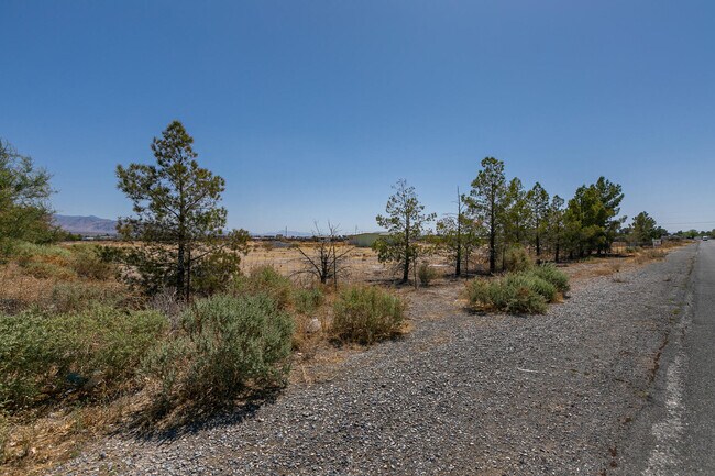
Property Record
781 Big Five Rd, Pahrump, NV 89048

Save to a Folder
{{folder.Name}}
{{folder.ListingIds.length}} Properties
{{folder.ListingIds.length}} Property
Create a New Folder
Property Detail
781 Big Five Rd
35-353-16
T20S R53E S16 F#16505 PARCEL 10 B.2 PORTION OF SE1/4 S16 T20S R53E COMM AT THE E1/4 CORNER OF SEC 16,THENCE S89 4900W ALONG THE N LINE OF THE S1/4 OF SEC 16,A DISTANCE OF 660.11 TO A PT,THENCE S1 1305E A DIST OF 1331.92 TO THE TRUE PT OF BEG;THENCE C
Commercialnec
Nye
CM
Nevada
C and X Area of minimal flood hazard, usually depicted on FIRMs as above the 500-year flood level.
5 AC
2024
Carson City/Nevada Area
2025
Other Market Areas
960414
Pahrump, NV
210 SF
NEARBY LISTINGS FOR SALE OR LEASE
DEMOGRAPHICS near 781 Big Five Rd
1 mile
3 mile
5 mile
2025 Total Population
3,882
17,153
31,504
2030 Population
4,111
18,174
33,160
Pop Growth 2025-2030
+ 5.90%
+ 5.95%
+ 5.26%
Average Age
51
49
49
2025 Total Households
1,825
7,554
13,258
HH Growth 2025-2030
+ 5.92%
+ 5.94%
+ 5.30%
Median Household Inc
$55,842
$54,724
$55,362
Avg Household Size
2.10
2.20
2.30
2025 Avg HH Vehicles
2.00
2.00
2.00
Median Home Value
$288,866
$295,435
$295,572
Median Year Built
1999
1996
1997
Nearby Places
Map Layers
Map Styles
 Street
 Aerial
Layers
 Traffic
 Biking
Places
Listings with unknown addresses are not visible on the map
- Restaurants
- Banks
- Shops
- Fitness
- Groceries
SALE & LEASE HISTORY
LISTING DATE
SALE/LEASE

Jan 25, 2021
For Sale
Nearby Properties
Address
Land Use
TOTAL SIZE
Lot Size
Zoning
Address
Land Use
TOTAL SIZE
Lot Size
Zoning
133,185 SF
41.60 AC
CF
Address
Land Use
TOTAL SIZE
Lot Size
Zoning
76,885 SF
12.53 AC
LI
Address
Land Use
TOTAL SIZE
Lot Size
Zoning
63,853 SF
8.09 AC
GC
Address
Land Use
TOTAL SIZE
Lot Size
Zoning
51,128 SF
24.15 AC
M
Address
Land Use
TOTAL SIZE
Lot Size
Zoning
57,213 SF
6.88 AC
GC
Address
Land Use
TOTAL SIZE
Lot Size
Zoning
156,375 SF
13.60 AC
GC
Address
Land Use
TOTAL SIZE
Lot Size
Zoning
106,309 SF
12.24 AC
GC
Address
Land Use
TOTAL SIZE
Lot Size
Zoning
62,606 SF
1.61 AC
GC
Address
Land Use
TOTAL SIZE
Lot Size
Zoning
77,352 SF
3.17 AC
GC
Address
Land Use
TOTAL SIZE
Lot Size
Zoning
62,279 SF
7.09 AC
GC
Address
Land Use
TOTAL SIZE
Lot Size
Zoning
56,409 SF
5.44 AC
GC
Address
Land Use
TOTAL SIZE
Lot Size
Zoning
6.91 AC
LI
Address
Land Use
TOTAL SIZE
Lot Size
Zoning
4,909 SF
22.10 AC
GC
Address
Land Use
TOTAL SIZE
Lot Size
Zoning
10 SF
2.14 AC
OS
Address
Land Use
TOTAL SIZE
Lot Size
Zoning
39,900 SF
6.24 AC
GC
Address
Land Use
TOTAL SIZE
Lot Size
Zoning
12,000 SF
9.54 AC
CF
Address
Land Use
TOTAL SIZE
Lot Size
Zoning
38,606 SF
10 AC
CF
Address
Land Use
TOTAL SIZE
Lot Size
Zoning
37,163 SF
3.66 AC
GC
Address
Land Use
TOTAL SIZE
Lot Size
Zoning
16,466 SF
2.15 AC
GC
Address
Land Use
TOTAL SIZE
Lot Size
Zoning
33,120 SF
3.13 AC
GC
Address
Land Use
TOTAL SIZE
Lot Size
Zoning
560 SF
5.30 AC
LI
Address
Land Use
TOTAL SIZE
Lot Size
Zoning
33,199 SF
4.40 AC
Address
Land Use
TOTAL SIZE
Lot Size
Zoning
10,280 SF
6.73 AC
Address
Land Use
TOTAL SIZE
Lot Size
Zoning
20,053 SF
4.61 AC
CF
Address
Land Use
TOTAL SIZE
Lot Size
Zoning
10,282 SF
34.27 AC
OS
Address
Land Use
TOTAL SIZE
Lot Size
Zoning
10,733 SF
33.04 AC
TC
Address
Land Use
TOTAL SIZE
Lot Size
Zoning
13,885 SF
2.01 AC
M
Address
Land Use
TOTAL SIZE
Lot Size
Zoning
18,746 SF
5.08 AC
NC
Address
Land Use
TOTAL SIZE
Lot Size
Zoning
6,300 SF
10.99 AC
CF
Address
Land Use
TOTAL SIZE
Lot Size
Zoning
12,160 SF
1.26 AC
M
The World's #1 Commercial Real Estate Marketplace
Connect with us
© 2026 CoStar Group
The information above has been obtained from sources believed reliable. While we do not doubt its accuracy we have not verified it and make no guarantee, warranty or representation about it. It is your responsibility to independently confirm its accuracy and completeness. Any projections, opinions, assumptions, or estimates used are for example only and do not represent the current or future performance of the property. The value of this transaction to you depends on tax and other factors which should be evaluated by your tax, financial, and legal advisors. You and your advisors should conduct a careful, independent investigation of the property to determine to your satisfaction the suitability of the property for your needs.