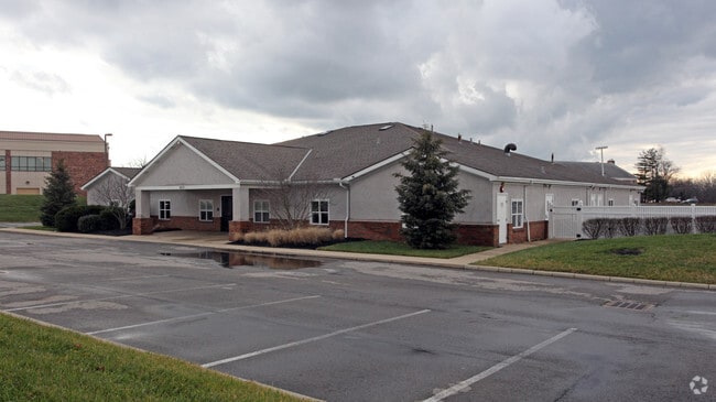
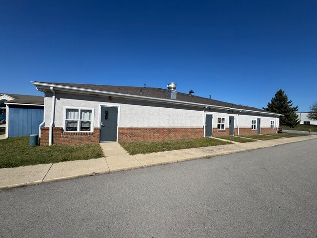
Property Record
7810 Graphics Way, Lewis Center, OH 43035

This Property Is For Sale
Current Lease Availabilities
NEARBY LISTINGS FOR SALE OR LEASE
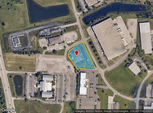
Property Detail
7810 Graphics Way
Columbus, OH
Orangepoint Commerce Park Subdivision
318-234-04-006-005
PART LOT 2955 ORANGEPOINT COMMERCE PARK SUBDIVISION
Daycare
Delaware
X
Ohio
39041C0242K
2955
2024
1.61 AC
2024
Outlying Delaware County
011563
Columbus
9,555 SF
DEMOGRAPHICS near 7810 Graphics Way
1 Mile
3 Mile
5 Mile
2024 Total Population
4,951
50,010
143,105
2029 Population
5,582
56,541
156,289
Pop Growth 2024-2029
+ 12.74%
+ 13.06%
+ 9.21%
Average Age
39
37
38
2024 Total Households
1,829
17,732
52,884
HH Growth 2024-2029
+ 12.90%
+ 13.02%
+ 8.88%
Median Household Inc
$122,618
$129,867
$122,817
Avg Household Size
2.70
2.80
2.70
2024 Avg HH Vehicles
2.00
2.00
2.00
Median Home Value
$353,333
$388,374
$380,064
Median Year Built
2001
2002
1997
Nearby Places
- Restaurants
- Banks
- Shops
- Fitness
- Groceries
PUBLIC TRANSPORTATION
AIRPORT
John Glenn Columbus International
DRIVE
WALK
Distance
John Glenn Columbus International
30 min
20.1 mi
Rickenbacker International
DRIVE
WALK
Distance
Rickenbacker International
45 min
31.5 mi
Freight Ports
Port of Toledo
DRIVE
WALK
Distance
Port of Toledo
161 min
129.4 mi
Nearby Properties
Address
Land Use
TOTAL SIZE
Lot Size
Zoning
Address
Land Use
TOTAL SIZE
Lot Size
Zoning
635,036 SF
45.24 AC
Address
Land Use
TOTAL SIZE
Lot Size
Zoning
519,213 SF
132.66 AC
Address
Land Use
TOTAL SIZE
Lot Size
Zoning
443,308 SF
9 AC
Address
Land Use
TOTAL SIZE
Lot Size
Zoning
44,795 SF
418.88 AC
Address
Land Use
TOTAL SIZE
Lot Size
Zoning
2,140,832 SF
89.50 AC
Address
Land Use
TOTAL SIZE
Lot Size
Zoning
46,994 SF
27.37 AC
Address
Land Use
TOTAL SIZE
Lot Size
Zoning
47,258 SF
50 AC
Address
Land Use
TOTAL SIZE
Lot Size
Zoning
295,163 SF
16.04 AC
Address
Land Use
TOTAL SIZE
Lot Size
Zoning
577,104 SF
31.05 AC
Address
Land Use
TOTAL SIZE
Lot Size
Zoning
116,682 SF
11.43 AC
Address
Land Use
TOTAL SIZE
Lot Size
Zoning
249,917 SF
19.18 AC
Address
Land Use
TOTAL SIZE
Lot Size
Zoning
266,792 SF
9.03 AC
Address
Land Use
TOTAL SIZE
Lot Size
Zoning
154,892 SF
5.86 AC
Address
Land Use
TOTAL SIZE
Lot Size
Zoning
428,656 SF
6.42 AC
Address
Land Use
TOTAL SIZE
Lot Size
Zoning
70,648 SF
15.50 AC
Address
Land Use
TOTAL SIZE
Lot Size
Zoning
219,449 SF
28.68 AC
Address
Land Use
TOTAL SIZE
Lot Size
Zoning
132,804 SF
11.54 AC
Address
Land Use
TOTAL SIZE
Lot Size
Zoning
98,872 SF
14.54 AC
Address
Land Use
TOTAL SIZE
Lot Size
Zoning
174,192 SF
11 AC
Address
Land Use
TOTAL SIZE
Lot Size
Zoning
240,300 SF
12.50 AC
Address
Land Use
TOTAL SIZE
Lot Size
Zoning
165,580 SF
35.69 AC
Address
Land Use
TOTAL SIZE
Lot Size
Zoning
47,763 SF
21.77 AC
Address
Land Use
TOTAL SIZE
Lot Size
Zoning
243,440 SF
12.50 AC
Address
Land Use
TOTAL SIZE
Lot Size
Zoning
183,424 SF
9.21 AC
Address
Land Use
TOTAL SIZE
Lot Size
Zoning
47,996 SF
14.27 AC
Address
Land Use
TOTAL SIZE
Lot Size
Zoning
141,891 SF
43 AC
Address
Land Use
TOTAL SIZE
Lot Size
Zoning
26,534 SF
17.75 AC
Address
Land Use
TOTAL SIZE
Lot Size
Zoning
69.13 AC
Address
Land Use
TOTAL SIZE
Lot Size
Zoning
24,004 SF
20.30 AC
Address
Land Use
TOTAL SIZE
Lot Size
Zoning
153,766 SF
3.98 AC
The World's #1 Commercial Real Estate Marketplace
Connect with us
© 2025 CoStar Group
The information above has been obtained from sources believed reliable. While we do not doubt its accuracy we have not verified it and make no guarantee, warranty or representation about it. It is your responsibility to independently confirm its accuracy and completeness. Any projections, opinions, assumptions, or estimates used are for example only and do not represent the current or future performance of the property. The value of this transaction to you depends on tax and other factors which should be evaluated by your tax, financial, and legal advisors. You and your advisors should conduct a careful, independent investigation of the property to determine to your satisfaction the suitability of the property for your needs.