Property Record
7811 Chambers Rd, San Antonio, TX 78229
NEARBY LISTINGS FOR SALE OR LEASE
Property Detail
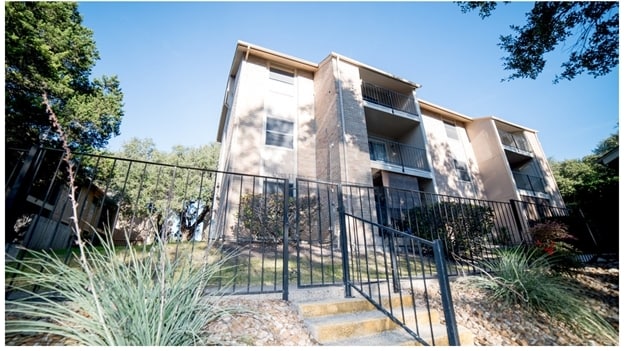
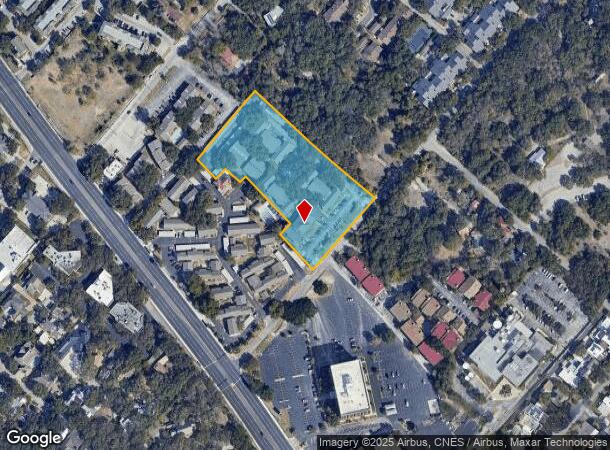
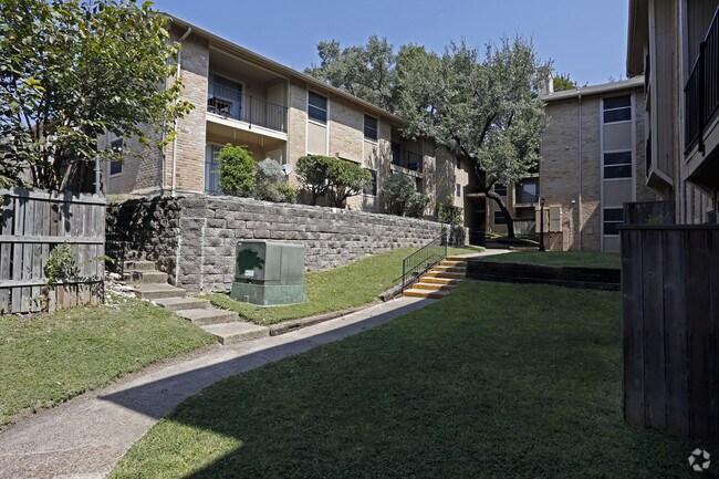
7811 Chambers Rd
San Antonio-New Braunfels, TX
Montebello Subdivision
11623-000-0240
NCB 11623 BLK LOT 24
Multifamilydwelling
Bexar
X
Texas
48029C0240G
24
2024
3.38 AC
2025
Medical Center
181004
San Antonio
84,264 SF
DEMOGRAPHICS near 7811 Chambers Rd
1 mile
3 mile
5 mile
2024 Total Population
20,326
151,910
373,229
2029 Population
21,697
161,720
396,334
Pop Growth 2024-2029
+ 6.75%
+ 6.46%
+ 6.19%
Average Age
34
37
38
2024 Total Households
9,814
67,770
155,241
HH Growth 2024-2029
+ 6.93%
+ 6.77%
+ 6.48%
Median Household Inc
$38,783
$46,895
$51,247
Avg Household Size
2.00
2.20
2.30
2024 Avg HH Vehicles
1.00
1.00
2.00
Median Home Value
$229,574
$193,946
$201,054
Median Year Built
1982
1979
1979
Nearby Places
Map Layers
Map Styles
 Street
 Aerial
Transit
 Traffic
 Biking
Places
Listings with unknown addresses are not visible on the map
- Restaurants
- Banks
- Shops
- Fitness
- Groceries
PUBLIC TRANSPORTATION
COMMUTER RAIL
Drive
Walk
Distance
17 min
9.9 mi
AIRPORT
San Antonio International
Drive
Walk
Distance
San Antonio International
11 min
7.1 mi
Nearby Properties
Address
Land Use
TOTAL SIZE
Lot Size
Zoning
Address
Land Use
TOTAL SIZE
Lot Size
Zoning
1,414,945 SF
16.77 AC
Address
Land Use
TOTAL SIZE
Lot Size
Zoning
4,465,972 SF
231.60 AC
Address
Land Use
TOTAL SIZE
Lot Size
Zoning
609,267 SF
30.47 AC
Address
Land Use
TOTAL SIZE
Lot Size
Zoning
227,586 SF
25.46 AC
Address
Land Use
TOTAL SIZE
Lot Size
Zoning
429,561 SF
25.70 AC
Address
Land Use
TOTAL SIZE
Lot Size
Zoning
331,715 SF
9.04 AC
Address
Land Use
TOTAL SIZE
Lot Size
Zoning
97.47 AC
Address
Land Use
TOTAL SIZE
Lot Size
Zoning
352,231 SF
19.54 AC
Address
Land Use
TOTAL SIZE
Lot Size
Zoning
724,148 SF
18.70 AC
Address
Land Use
TOTAL SIZE
Lot Size
Zoning
278,352 SF
10 AC
Address
Land Use
TOTAL SIZE
Lot Size
Zoning
306,959 SF
15.24 AC
Address
Land Use
TOTAL SIZE
Lot Size
Zoning
482,412 SF
22.97 AC
Address
Land Use
TOTAL SIZE
Lot Size
Zoning
183,249 SF
21.94 AC
Address
Land Use
TOTAL SIZE
Lot Size
Zoning
138.02 AC
Address
Land Use
TOTAL SIZE
Lot Size
Zoning
301,817 SF
12.22 AC
Address
Land Use
TOTAL SIZE
Lot Size
Zoning
227,744 SF
3.99 AC
Address
Land Use
TOTAL SIZE
Lot Size
Zoning
239,623 SF
26.63 AC
Address
Land Use
TOTAL SIZE
Lot Size
Zoning
283,165 SF
12.19 AC
Address
Land Use
TOTAL SIZE
Lot Size
Zoning
506,058 SF
25.23 AC
Address
Land Use
TOTAL SIZE
Lot Size
Zoning
201,339 SF
9.32 AC
Address
Land Use
TOTAL SIZE
Lot Size
Zoning
288,719 SF
14.66 AC
Address
Land Use
TOTAL SIZE
Lot Size
Zoning
495,484 SF
5.81 AC
Address
Land Use
TOTAL SIZE
Lot Size
Zoning
61.64 AC
Address
Land Use
TOTAL SIZE
Lot Size
Zoning
250,174 SF
14.26 AC
Address
Land Use
TOTAL SIZE
Lot Size
Zoning
264,676 SF
11.91 AC
Address
Land Use
TOTAL SIZE
Lot Size
Zoning
320,652 SF
23.86 AC
Address
Land Use
TOTAL SIZE
Lot Size
Zoning
305,379 SF
12.04 AC
Address
Land Use
TOTAL SIZE
Lot Size
Zoning
259,934 SF
9.81 AC
Address
Land Use
TOTAL SIZE
Lot Size
Zoning
229,635 SF
8.21 AC
Address
Land Use
TOTAL SIZE
Lot Size
Zoning
211,045 SF
8.08 AC
The World's #1 Commercial Real Estate Marketplace
Connect with us
© 2026 CoStar Group
The information above has been obtained from sources believed reliable. While we do not doubt its accuracy we have not verified it and make no guarantee, warranty or representation about it. It is your responsibility to independently confirm its accuracy and completeness. Any projections, opinions, assumptions, or estimates used are for example only and do not represent the current or future performance of the property. The value of this transaction to you depends on tax and other factors which should be evaluated by your tax, financial, and legal advisors. You and your advisors should conduct a careful, independent investigation of the property to determine to your satisfaction the suitability of the property for your needs.