Property Record
7811 W Ustick Rd, Boise, ID 83704
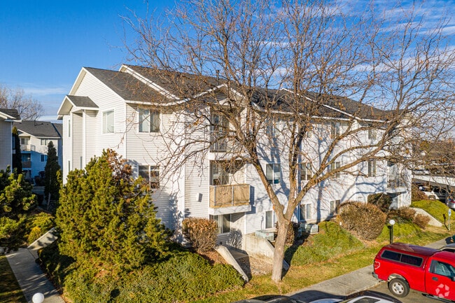

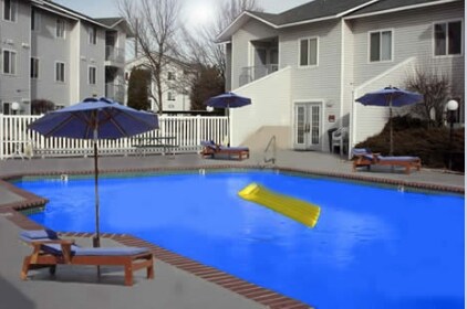
Property Detail
7811 W Ustick Rd
R0539000987
PAR#0987 OF LOTS 9 & 10 ASH PARK AMD #0986-B
Commercialbuilding
ADA
R-3D
Idaho
B and X Area of moderate flood hazard, usually the area between the limits of the 100-year and 500-year floods.
9,10
2025
4.22 AC
2025
West Bench
002318
Boise City/Nampa
84,070 SF
Boise City, ID
NEARBY LISTINGS FOR SALE OR LEASE
DEMOGRAPHICS near 7811 W Ustick Rd
1 mile
3 mile
5 mile
2025 Total Population
14,807
113,341
241,329
2030 Population
15,358
118,216
252,937
Pop Growth 2025-2030
+ 3.72%
+ 4.30%
+ 4.81%
Average Age
42
41
41
2025 Total Households
5,986
47,115
99,637
HH Growth 2025-2030
+ 4.18%
+ 4.73%
+ 5.32%
Median Household Inc
$80,852
$74,469
$79,657
Avg Household Size
2.40
2.30
2.30
2025 Avg HH Vehicles
2.00
2.00
2.00
Median Home Value
$407,461
$445,801
$490,370
Median Year Built
1976
1988
1991
Nearby Places
Map Layers
Map Styles
 Street
 Aerial
Layers
 Traffic
 Biking
Places
Listings with unknown addresses are not visible on the map
- Restaurants
- Banks
- Shops
- Fitness
- Groceries
PUBLIC TRANSPORTATION
AIRPORT
Boise Air Trml/Gowen Field
Drive
Walk
Distance
Boise Air Trml/Gowen Field
29 min
11.0 mi
Freight Ports
Port of Portland
Drive
Walk
Distance
Port of Portland
478 min
430.9 mi
Nearby Properties
Address
Land Use
TOTAL SIZE
Lot Size
Zoning
Address
Land Use
TOTAL SIZE
Lot Size
Zoning
646,787 SF
27.37 AC
C-2D
Address
Land Use
TOTAL SIZE
Lot Size
Zoning
13.90 AC
R-2D
Address
Land Use
TOTAL SIZE
Lot Size
Zoning
386,225 SF
13.46 AC
C-4D/DA
Address
Land Use
TOTAL SIZE
Lot Size
Zoning
334,124 SF
11.21 AC
R-3D
Address
Land Use
TOTAL SIZE
Lot Size
Zoning
4.02 AC
C-2
Address
Land Use
TOTAL SIZE
Lot Size
Zoning
207,033 SF
10.67 AC
L-OD
Address
Land Use
TOTAL SIZE
Lot Size
Zoning
225,032 SF
12.75 AC
R-3D
Address
Land Use
TOTAL SIZE
Lot Size
Zoning
249,800 SF
12.99 AC
C-2D
Address
Land Use
TOTAL SIZE
Lot Size
Zoning
245,000 SF
12.28 AC
R-2D
Address
Land Use
TOTAL SIZE
Lot Size
Zoning
319,052 SF
24.33 AC
C-2D
Address
Land Use
TOTAL SIZE
Lot Size
Zoning
216,950 SF
9.03 AC
R-3D
Address
Land Use
TOTAL SIZE
Lot Size
Zoning
151,285 SF
9.54 AC
R-1C
Address
Land Use
TOTAL SIZE
Lot Size
Zoning
222,379 SF
1.37 AC
M
Address
Land Use
TOTAL SIZE
Lot Size
Zoning
150,584 SF
6.77 AC
M
Address
Land Use
TOTAL SIZE
Lot Size
Zoning
211,039 SF
12.21 AC
C-3D
Address
Land Use
TOTAL SIZE
Lot Size
Zoning
162,432 SF
8.31 AC
R-3D
Address
Land Use
TOTAL SIZE
Lot Size
Zoning
72,579 SF
4.48 AC
M-1D
Address
Land Use
TOTAL SIZE
Lot Size
Zoning
7.16 AC
C-2D
Address
Land Use
TOTAL SIZE
Lot Size
Zoning
203,635 SF
4.76 AC
L-OD
Address
Land Use
TOTAL SIZE
Lot Size
Zoning
176,494 SF
10.16 AC
R-1C
Address
Land Use
TOTAL SIZE
Lot Size
Zoning
290,239 SF
4.73 AC
ZC-243
Address
Land Use
TOTAL SIZE
Lot Size
Zoning
10.32 AC
C-2D
Address
Land Use
TOTAL SIZE
Lot Size
Zoning
292,885 SF
13.76 AC
C-1
Address
Land Use
TOTAL SIZE
Lot Size
Zoning
136,244 SF
8.56 AC
R-3D/DA
Address
Land Use
TOTAL SIZE
Lot Size
Zoning
137,752 SF
5.13 AC
ZC-268
Address
Land Use
TOTAL SIZE
Lot Size
Zoning
127,136 SF
7.59 AC
R-3D
Address
Land Use
TOTAL SIZE
Lot Size
Zoning
91,740 SF
3.63 AC
C-4D
Address
Land Use
TOTAL SIZE
Lot Size
Zoning
124,286 SF
5 AC
R-3
Address
Land Use
TOTAL SIZE
Lot Size
Zoning
323,236 SF
14.77 AC
M-1D
Address
Land Use
TOTAL SIZE
Lot Size
Zoning
93,112 SF
2.73 AC
C-2D
The World's #1 Commercial Real Estate Marketplace
Connect with us
© 2026 CoStar Group
The information above has been obtained from sources believed reliable. While we do not doubt its accuracy we have not verified it and make no guarantee, warranty or representation about it. It is your responsibility to independently confirm its accuracy and completeness. Any projections, opinions, assumptions, or estimates used are for example only and do not represent the current or future performance of the property. The value of this transaction to you depends on tax and other factors which should be evaluated by your tax, financial, and legal advisors. You and your advisors should conduct a careful, independent investigation of the property to determine to your satisfaction the suitability of the property for your needs.