Property Record
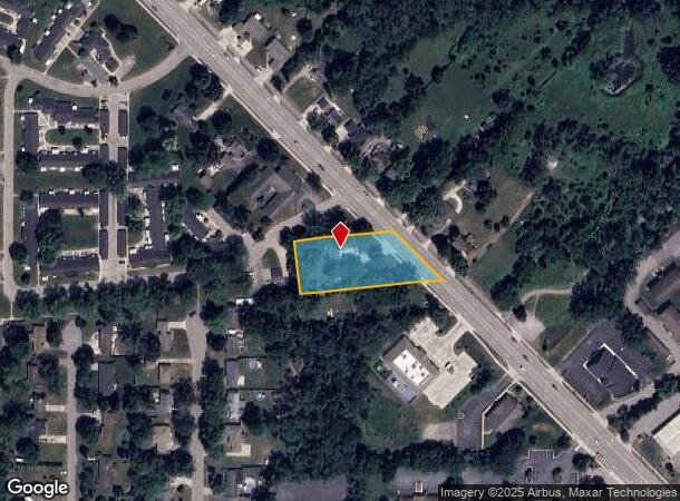
7813 Cottonwood Dr, Jenison, MI 49428


NEARBY LISTINGS FOR SALE OR LEASE
Property Detail
7813 Cottonwood Dr
70-14-13-100-034
PART OF NW 1/4 COM 191175 FT S & S 89D 40M E 7232 FT & N 83D 40M E 75825 FT FROM NW COR TH N 83D 40M E 36806 FT TO CEN OF DR,
Storebuilding
Ottawa
X
Michigan
26081C0391D
0.96 AC
2024
E Ottawa Cnty/Hudsonville
2025
West Michigan
021606
Grand Rapids-Wyoming, MI
2,008 SF
DEMOGRAPHICS near 7813 Cottonwood Dr
1 Mile
3 Mile
5 Mile
2024 Total Population
5,575
46,335
123,823
2029 Population
5,850
47,830
127,663
Pop Growth 2024-2029
+ 4.93%
+ 3.23%
+ 3.10%
Average Age
42
40
38
2024 Total Households
2,429
17,795
46,364
HH Growth 2024-2029
+ 5.19%
+ 3.37%
+ 3.06%
Median Household Inc
$61,195
$74,777
$77,537
Avg Household Size
2.30
2.50
2.60
2024 Avg HH Vehicles
2.00
2.00
2.00
Median Home Value
$214,112
$246,576
$245,384
Median Year Built
1974
1976
1981
Nearby Places
Map Layers
Map Styles
 Street
 Aerial
- Restaurants
- Banks
- Shops
- Fitness
- Groceries
PUBLIC TRANSPORTATION
COMMUTER RAIL
Grand Rapids Vernon J. Ehlers Station (Pere Marquette - Amtrak)
DRIVE
WALK
Distance
Grand Rapids Vernon J. Ehlers Station (Pere Marquette - Amtrak)
12 min
7.8 mi
AIRPORT
Gerald R Ford International
DRIVE
WALK
Distance
Gerald R Ford International
30 min
16.6 mi
Freight Ports
Port Milwaukee
DRIVE
WALK
Distance
Port Milwaukee
297 min
255.6 mi
Nearby Properties
Address
Land Use
TOTAL SIZE
Lot Size
Zoning
Address
Land Use
TOTAL SIZE
Lot Size
Zoning
79.40 AC
C-4
Address
Land Use
TOTAL SIZE
Lot Size
Zoning
12.64 AC
PUD
Address
Land Use
TOTAL SIZE
Lot Size
Zoning
268,440 SF
28.11 AC
HDR
Address
Land Use
TOTAL SIZE
Lot Size
Zoning
230,864 SF
59.58 AC
PUD2
Address
Land Use
TOTAL SIZE
Lot Size
Zoning
269,021 SF
22.89 AC
HDR
Address
Land Use
TOTAL SIZE
Lot Size
Zoning
173,288 SF
4.17 AC
PUD
Address
Land Use
TOTAL SIZE
Lot Size
Zoning
211,138 SF
30.58 AC
C-5
Address
Land Use
TOTAL SIZE
Lot Size
Zoning
293,441 SF
18 AC
I-1
Address
Land Use
TOTAL SIZE
Lot Size
Zoning
222,785 SF
26.69 AC
CS
Address
Land Use
TOTAL SIZE
Lot Size
Zoning
246,880 SF
18.33 AC
I-2
Address
Land Use
TOTAL SIZE
Lot Size
Zoning
14.69 AC
R3-B
Address
Land Use
TOTAL SIZE
Lot Size
Zoning
89,648 SF
3.17 AC
OS-2
Address
Land Use
TOTAL SIZE
Lot Size
Zoning
9.65 AC
R3-B
Address
Land Use
TOTAL SIZE
Lot Size
Zoning
121,602 SF
45.20 AC
I-2
Address
Land Use
TOTAL SIZE
Lot Size
Zoning
9 AC
R3-A
Address
Land Use
TOTAL SIZE
Lot Size
Zoning
60,523 SF
6.48 AC
C-1
Address
Land Use
TOTAL SIZE
Lot Size
Zoning
82,554 SF
5.56 AC
HDR
Address
Land Use
TOTAL SIZE
Lot Size
Zoning
136,766 SF
18.52 AC
B3
Address
Land Use
TOTAL SIZE
Lot Size
Zoning
164,700 SF
19.18 AC
C-5
Address
Land Use
TOTAL SIZE
Lot Size
Zoning
60,980 SF
2.51 AC
PUD
Address
Land Use
TOTAL SIZE
Lot Size
Zoning
135,752 SF
13.86 AC
C-5
Address
Land Use
TOTAL SIZE
Lot Size
Zoning
62,080 SF
2.54 AC
PUD
Address
Land Use
TOTAL SIZE
Lot Size
Zoning
10.71 AC
Address
Land Use
TOTAL SIZE
Lot Size
Zoning
6.77 AC
R3-B
Address
Land Use
TOTAL SIZE
Lot Size
Zoning
45,636 SF
14.11 AC
C-5
Address
Land Use
TOTAL SIZE
Lot Size
Zoning
106,193 SF
10.68 AC
CS
Address
Land Use
TOTAL SIZE
Lot Size
Zoning
54,987 SF
16.50 AC
I-2
Address
Land Use
TOTAL SIZE
Lot Size
Zoning
26,752 SF
4.43 AC
R3-B
Address
Land Use
TOTAL SIZE
Lot Size
Zoning
45,034 SF
5.79 AC
PUD
Address
Land Use
TOTAL SIZE
Lot Size
Zoning
61,464 SF
5.91 AC
C-1
The World's #1 Commercial Real Estate Marketplace
Connect with us
© 2025 CoStar Group
The information above has been obtained from sources believed reliable. While we do not doubt its accuracy we have not verified it and make no guarantee, warranty or representation about it. It is your responsibility to independently confirm its accuracy and completeness. Any projections, opinions, assumptions, or estimates used are for example only and do not represent the current or future performance of the property. The value of this transaction to you depends on tax and other factors which should be evaluated by your tax, financial, and legal advisors. You and your advisors should conduct a careful, independent investigation of the property to determine to your satisfaction the suitability of the property for your needs.