Property Record
7813 First Pl, Bedford, OH 44146


Save to a Folder
{{folder.Name}}
{{folder.ListingIds.length}} Properties
{{folder.ListingIds.length}} Property
Create a New Folder
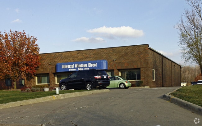
Property Detail
7813 First Pl
795-46-006
68 011C
Publicstorage
CUYAHOGA
I-1
Ohio
B and X Area of moderate flood hazard, usually the area between the limits of the 100-year and 500-year floods.
68
2025
1.01 AC
2025
Bedford/Walton Hills
195700
Cleveland
6,120 SF
Cleveland-Elyria, OH
NEARBY LISTINGS FOR SALE OR LEASE
DEMOGRAPHICS near 7813 First Pl
1 mile
3 mile
5 mile
2025 Total Population
3,760
37,571
131,501
2030 Population
3,727
37,328
130,774
Pop Growth 2025-2030
(0.88%)
(0.65%)
(0.55%)
Average Age
47
44
43
2025 Total Households
1,698
17,220
55,812
HH Growth 2025-2030
(0.88%)
(0.70%)
(0.62%)
Median Household Inc
$65,808
$63,030
$68,431
Avg Household Size
2.20
2.10
2.30
2025 Avg HH Vehicles
2.00
2.00
2.00
Median Home Value
$154,277
$188,183
$217,522
Median Year Built
1962
1965
1965
Nearby Places
Map Layers
Map Styles
 Street
 Aerial
Layers
 Traffic
 Biking
Places
Listings with unknown addresses are not visible on the map
- Restaurants
- Banks
- Shops
- Fitness
- Groceries
PUBLIC TRANSPORTATION
COMMUTER RAIL
Drive
Walk
Distance
16 min
7.2 mi
Drive
Walk
Distance
18 min
7.7 mi
AIRPORT
Cleveland-Hopkins International
Drive
Walk
Distance
Cleveland-Hopkins International
33 min
22.5 mi
Akron-Canton Regional
Drive
Walk
Distance
Akron-Canton Regional
46 min
35.2 mi
SALE & LEASE HISTORY
LISTING DATE
SALE/LEASE

Oct 23, 2019
For Sale
Jun 27, 2019
For Lease
Jun 27, 2019
For Sale
Nearby Properties
Address
Land Use
TOTAL SIZE
Lot Size
Zoning
Address
Land Use
TOTAL SIZE
Lot Size
Zoning
49.31 AC
Address
Land Use
TOTAL SIZE
Lot Size
Zoning
130,621 SF
67.21 AC
I-2
Address
Land Use
TOTAL SIZE
Lot Size
Zoning
202,010 SF
90.68 AC
I-2
Address
Land Use
TOTAL SIZE
Lot Size
Zoning
197,000 SF
42.41 AC
I-2
Address
Land Use
TOTAL SIZE
Lot Size
Zoning
11,808 SF
900.50 AC
1F-2
Address
Land Use
TOTAL SIZE
Lot Size
Zoning
109.65 AC
MUD
Address
Land Use
TOTAL SIZE
Lot Size
Zoning
18.38 AC
R2
Address
Land Use
TOTAL SIZE
Lot Size
Zoning
458,000 SF
35.06 AC
IG
Address
Land Use
TOTAL SIZE
Lot Size
Zoning
32,400 SF
89.36 AC
IG
Address
Land Use
TOTAL SIZE
Lot Size
Zoning
14.95 AC
I-1
Address
Land Use
TOTAL SIZE
Lot Size
Zoning
210,136 SF
21.69 AC
Address
Land Use
TOTAL SIZE
Lot Size
Zoning
302,022 SF
19.04 AC
I-2
Address
Land Use
TOTAL SIZE
Lot Size
Zoning
324,644 SF
15.13 AC
I
Address
Land Use
TOTAL SIZE
Lot Size
Zoning
262,950 SF
26.24 AC
IG
Address
Land Use
TOTAL SIZE
Lot Size
Zoning
20.49 AC
R-1-C
Address
Land Use
TOTAL SIZE
Lot Size
Zoning
69,033 SF
8.85 AC
R-3
Address
Land Use
TOTAL SIZE
Lot Size
Zoning
37.51 AC
I-2
Address
Land Use
TOTAL SIZE
Lot Size
Zoning
247,000 SF
18.44 AC
IG
Address
Land Use
TOTAL SIZE
Lot Size
Zoning
146,006 SF
8.38 AC
R-1
Address
Land Use
TOTAL SIZE
Lot Size
Zoning
14.67 AC
I-2
Address
Land Use
TOTAL SIZE
Lot Size
Zoning
164,157 SF
6.29 AC
BP
Address
Land Use
TOTAL SIZE
Lot Size
Zoning
268,672 SF
25.07 AC
R-3
Address
Land Use
TOTAL SIZE
Lot Size
Zoning
401,401 SF
25.14 AC
IG
Address
Land Use
TOTAL SIZE
Lot Size
Zoning
155,974 SF
5.33 AC
R-3
Address
Land Use
TOTAL SIZE
Lot Size
Zoning
192,371 SF
22.06 AC
B3
Address
Land Use
TOTAL SIZE
Lot Size
Zoning
197,930 SF
14.80 AC
I-2
Address
Land Use
TOTAL SIZE
Lot Size
Zoning
210,600 SF
12.69 AC
I-2
Address
Land Use
TOTAL SIZE
Lot Size
Zoning
60,908 SF
46.85 AC
Address
Land Use
TOTAL SIZE
Lot Size
Zoning
197,000 SF
20.07 AC
I-2
Address
Land Use
TOTAL SIZE
Lot Size
Zoning
41,566 SF
13.01 AC
R-1-D
The World's #1 Commercial Real Estate Marketplace
Connect with us
© 2026 CoStar Group
The information above has been obtained from sources believed reliable. While we do not doubt its accuracy we have not verified it and make no guarantee, warranty or representation about it. It is your responsibility to independently confirm its accuracy and completeness. Any projections, opinions, assumptions, or estimates used are for example only and do not represent the current or future performance of the property. The value of this transaction to you depends on tax and other factors which should be evaluated by your tax, financial, and legal advisors. You and your advisors should conduct a careful, independent investigation of the property to determine to your satisfaction the suitability of the property for your needs.