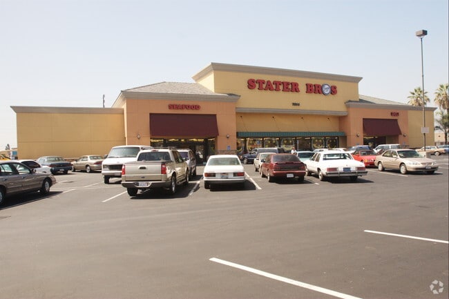
Property Record
7814 Firestone Blvd, Downey, CA 90241


NEARBY LISTINGS FOR SALE OR LEASE
Property Detail
7814 Firestone Blvd
6247-001-013
Santa Gertrudes Rho
Supermarket
RANCHO SANTA GERTRUDES FINALLY CONFIRMED TO J P MCFARLAND AND J G DOWNEY 2.98 MORE OR LESS ACS COM AT INTERSECTION OF NE LINE OF S P R R R/W WITH A LINE PARALLEL WITH AND DIST SE AT R/A 30 FT AND SW AND FOLLOWING RIVES AVE TO BEG
X
Los Angeles
06037C1810F
California
2024
3.01 AC
2025
Mid-Cities
551402
Los Angeles
40,936 SF
Los Angeles-Long Beach-Glendale, CA
DEMOGRAPHICS near 7814 Firestone Blvd
1 Mile
3 Mile
5 Mile
2024 Total Population
32,621
243,501
718,010
2029 Population
31,680
233,434
686,843
Pop Growth 2024-2029
(2.88%)
(4.13%)
(4.34%)
Average Age
38
38
37
2024 Total Households
10,407
68,144
194,742
HH Growth 2024-2029
(3.10%)
(4.31%)
(4.57%)
Median Household Inc
$74,672
$71,749
$67,450
Avg Household Size
3.10
3.50
3.60
2024 Avg HH Vehicles
2.00
2.00
2.00
Median Home Value
$726,447
$667,184
$617,997
Median Year Built
1959
1958
1957
Nearby Places
Map Layers
Map Styles
 Street
 Aerial
- Restaurants
- Banks
- Shops
- Fitness
- Groceries
PUBLIC TRANSPORTATION
COMMUTER RAIL
Commerce (91 Line - Southern California Regional Rail Authority (Metrolink), Orange County Line - Southern California Regional Rail Authority (Metrolink))
DRIVE
WALK
Distance
Commerce (91 Line - Southern California Regional Rail Authority (Metrolink), Orange County Line - Southern California Regional Rail Authority (Metrolink))
10 min
4.8 mi
Norwalk/Santa Fe Springs (91 Line - Southern California Regional Rail Authority (Metrolink), Orange County Line - Southern California Regional Rail Authority (Metrolink))
DRIVE
WALK
Distance
Norwalk/Santa Fe Springs (91 Line - Southern California Regional Rail Authority (Metrolink), Orange County Line - Southern California Regional Rail Authority (Metrolink))
10 min
5.4 mi
AIRPORT
Long Beach (Daugherty Field)
DRIVE
WALK
Distance
Long Beach (Daugherty Field)
21 min
10.2 mi
Los Angeles International
DRIVE
WALK
Distance
Los Angeles International
27 min
18.7 mi
Bob Hope
DRIVE
WALK
Distance
Bob Hope
37 min
27.5 mi
Nearby Properties
Address
Land Use
TOTAL SIZE
Lot Size
Zoning
Address
Land Use
TOTAL SIZE
Lot Size
Zoning
1,339,758 SF
28.53 AC
DOM2-P*
Address
Land Use
TOTAL SIZE
Lot Size
Zoning
313,224 SF
4.41 AC
SGM2*
Address
Land Use
TOTAL SIZE
Lot Size
Zoning
397,549 SF
15.73 AC
CMM2*
Address
Land Use
TOTAL SIZE
Lot Size
Zoning
383,495 SF
11.60 AC
DOR3PUD*
Address
Land Use
TOTAL SIZE
Lot Size
Zoning
730,731 SF
14.89 AC
BFCG*
Address
Land Use
TOTAL SIZE
Lot Size
Zoning
51,000 SF
27.18 AC
SGM3
Address
Land Use
TOTAL SIZE
Lot Size
Zoning
267,736 SF
9.04 AC
BGC4*
Address
Land Use
TOTAL SIZE
Lot Size
Zoning
609,466 SF
19.83 AC
CMM2*
Address
Land Use
TOTAL SIZE
Lot Size
Zoning
371,464 SF
9.28 AC
DOM2-P*
Address
Land Use
TOTAL SIZE
Lot Size
Zoning
332,504 SF
7.76 AC
DOHM
Address
Land Use
TOTAL SIZE
Lot Size
Zoning
875,558 SF
24.08 AC
CMM2*
Address
Land Use
TOTAL SIZE
Lot Size
Zoning
168,548 SF
7.53 AC
CMM2*
Address
Land Use
TOTAL SIZE
Lot Size
Zoning
43,406 SF
5.67 AC
SGM2
Address
Land Use
TOTAL SIZE
Lot Size
Zoning
105,586 SF
9.96 AC
SGM3*
Address
Land Use
TOTAL SIZE
Lot Size
Zoning
298,629 SF
6.93 AC
BGMPD*
Address
Land Use
TOTAL SIZE
Lot Size
Zoning
244,390 SF
12.99 AC
CMM2
Address
Land Use
TOTAL SIZE
Lot Size
Zoning
826,068 SF
21.11 AC
Address
Land Use
TOTAL SIZE
Lot Size
Zoning
289,422 SF
12.43 AC
CMM2*
Address
Land Use
TOTAL SIZE
Lot Size
Zoning
106,028 SF
6.42 AC
DOM2-P*
Address
Land Use
TOTAL SIZE
Lot Size
Zoning
378,720 SF
13.08 AC
SGM3*
Address
Land Use
TOTAL SIZE
Lot Size
Zoning
97,218 SF
9.64 AC
SGM2
Address
Land Use
TOTAL SIZE
Lot Size
Zoning
506,144 SF
19.97 AC
CMM2*
Address
Land Use
TOTAL SIZE
Lot Size
Zoning
196,676 SF
9.80 AC
SGM3
Address
Land Use
TOTAL SIZE
Lot Size
Zoning
122,184 SF
4.03 AC
DOC2*
Address
Land Use
TOTAL SIZE
Lot Size
Zoning
99,674 SF
6.53 AC
DOM2-P*
Address
Land Use
TOTAL SIZE
Lot Size
Zoning
141,377 SF
6.93 AC
PRIG-P*
Address
Land Use
TOTAL SIZE
Lot Size
Zoning
382,083 SF
10.77 AC
CMM1*
Address
Land Use
TOTAL SIZE
Lot Size
Zoning
150,115 SF
10.50 AC
SGM2
Address
Land Use
TOTAL SIZE
Lot Size
Zoning
929,113 SF
18.28 AC
CMM2*
Address
Land Use
TOTAL SIZE
Lot Size
Zoning
624,452 SF
The World's #1 Commercial Real Estate Marketplace
Connect with us
© 2026 CoStar Group
The information above has been obtained from sources believed reliable. While we do not doubt its accuracy we have not verified it and make no guarantee, warranty or representation about it. It is your responsibility to independently confirm its accuracy and completeness. Any projections, opinions, assumptions, or estimates used are for example only and do not represent the current or future performance of the property. The value of this transaction to you depends on tax and other factors which should be evaluated by your tax, financial, and legal advisors. You and your advisors should conduct a careful, independent investigation of the property to determine to your satisfaction the suitability of the property for your needs.