Property Record
7815 S 35Th Ave, Laveen, AZ 85339


NEARBY LISTINGS FOR SALE OR LEASE
Property Detail
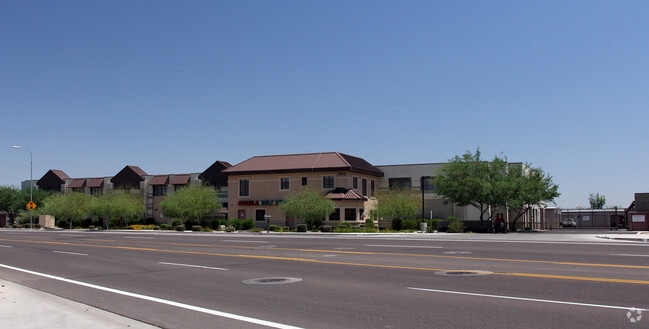
7815 S 35Th Ave
Phoenix-Mesa-Scottsdale, AZ
Aguila Square
300-14-203B
AGUILA SQUARE MCR 693-47
Publicstorage
Maricopa
X
Arizona
04013C2195L
3
2025
3.50 AC
2025
Southwest Phoenix
116612
Phoenix
103,091 SF
DEMOGRAPHICS near 7815 S 35Th Ave
1 Mile
3 Mile
5 Mile
2024 Total Population
11,030
82,814
165,868
2029 Population
11,973
89,693
179,873
Pop Growth 2024-2029
+ 8.55%
+ 8.31%
+ 8.44%
Average Age
33
34
34
2024 Total Households
3,088
23,126
46,938
HH Growth 2024-2029
+ 8.65%
+ 8.44%
+ 8.56%
Median Household Inc
$87,085
$81,241
$68,989
Avg Household Size
3.50
3.50
3.40
2024 Avg HH Vehicles
2.00
2.00
2.00
Median Home Value
$353,732
$335,958
$310,738
Median Year Built
2005
2004
2001
Nearby Places
Map Layers
Map Styles
 Street
 Aerial
- Restaurants
- Banks
- Shops
- Fitness
- Groceries
PUBLIC TRANSPORTATION
AIRPORT
Phoenix Sky Harbor International
DRIVE
WALK
Distance
Phoenix Sky Harbor International
23 min
12.3 mi
Phoenix-Mesa Gateway
DRIVE
WALK
Distance
Phoenix-Mesa Gateway
50 min
33.0 mi
Freight Ports
Port of San Diego
DRIVE
WALK
Distance
Port of San Diego
400 min
357.4 mi
Nearby Properties
Address
Land Use
TOTAL SIZE
Lot Size
Zoning
Address
Land Use
TOTAL SIZE
Lot Size
Zoning
182,984 SF
146.12 AC
I-1
Address
Land Use
TOTAL SIZE
Lot Size
Zoning
33.15 AC
Address
Land Use
TOTAL SIZE
Lot Size
Zoning
392,945 SF
47.26 AC
R-43AG
Address
Land Use
TOTAL SIZE
Lot Size
Zoning
47,597 SF
22.74 AC
R-43
Address
Land Use
TOTAL SIZE
Lot Size
Zoning
367,953 SF
38.18 AC
R-43AG
Address
Land Use
TOTAL SIZE
Lot Size
Zoning
398,815 SF
12.72 AC
C2
Address
Land Use
TOTAL SIZE
Lot Size
Zoning
1,875 SF
7.89 AC
I-1
Address
Land Use
TOTAL SIZE
Lot Size
Zoning
70,951 SF
336.40 AC
R-43AG
Address
Land Use
TOTAL SIZE
Lot Size
Zoning
233,156 SF
15.77 AC
R3A
Address
Land Use
TOTAL SIZE
Lot Size
Zoning
93,310 SF
9.16 AC
R-6
Address
Land Use
TOTAL SIZE
Lot Size
Zoning
95,854 SF
15.11 AC
R-43AG
Address
Land Use
TOTAL SIZE
Lot Size
Zoning
70,152 SF
180.34 AC
RE35
Address
Land Use
TOTAL SIZE
Lot Size
Zoning
91,949 SF
19.14 AC
R-43
Address
Land Use
TOTAL SIZE
Lot Size
Zoning
9,222 SF
171.26 AC
I-1
Address
Land Use
TOTAL SIZE
Lot Size
Zoning
416,645 SF
18.80 AC
M-H
Address
Land Use
TOTAL SIZE
Lot Size
Zoning
219,555 SF
21.25 AC
C2
Address
Land Use
TOTAL SIZE
Lot Size
Zoning
91,063 SF
12 AC
R-43AG
Address
Land Use
TOTAL SIZE
Lot Size
Zoning
101,619 SF
13.71 AC
R-8
Address
Land Use
TOTAL SIZE
Lot Size
Zoning
186,437 SF
17.85 AC
PAD-HD
Address
Land Use
TOTAL SIZE
Lot Size
Zoning
103,111 SF
12.13 AC
R-43
Address
Land Use
TOTAL SIZE
Lot Size
Zoning
139,410 SF
14.41 AC
C-C
Address
Land Use
TOTAL SIZE
Lot Size
Zoning
92,917 SF
14.54 AC
Address
Land Use
TOTAL SIZE
Lot Size
Zoning
164,212 SF
11.81 AC
R-8
Address
Land Use
TOTAL SIZE
Lot Size
Zoning
120,280 SF
12.39 AC
R3
Address
Land Use
TOTAL SIZE
Lot Size
Zoning
8,880 SF
1.99 AC
I-2
Address
Land Use
TOTAL SIZE
Lot Size
Zoning
39,000 SF
3.92 AC
C-C
Address
Land Use
TOTAL SIZE
Lot Size
Zoning
58,603 SF
12.15 AC
R-43AG
Address
Land Use
TOTAL SIZE
Lot Size
Zoning
64,031 SF
14.68 AC
R-43AG
Address
Land Use
TOTAL SIZE
Lot Size
Zoning
63,002 SF
11.61 AC
R-6
Address
Land Use
TOTAL SIZE
Lot Size
Zoning
78,576 SF
8.69 AC
R-10
The World's #1 Commercial Real Estate Marketplace
Connect with us
© 2025 CoStar Group
The information above has been obtained from sources believed reliable. While we do not doubt its accuracy we have not verified it and make no guarantee, warranty or representation about it. It is your responsibility to independently confirm its accuracy and completeness. Any projections, opinions, assumptions, or estimates used are for example only and do not represent the current or future performance of the property. The value of this transaction to you depends on tax and other factors which should be evaluated by your tax, financial, and legal advisors. You and your advisors should conduct a careful, independent investigation of the property to determine to your satisfaction the suitability of the property for your needs.