Property Record
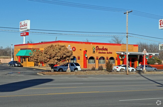
7819 E Admiral Pl, Tulsa, OK 74115

Property Detail
7819 E Admiral Pl
03825-93-02-00090
PRT LTS 6 & 7 BEG SECR LT 6 TH WLY252 TO SWC LT 7 TH NLY260.39 TO SLY R/W EXPY TH SE256.06 TO EL LT 6 TH SLY219.11 POB LESS S30 FOR STS
Restaurantbuilding
Tulsa
CH
Oklahoma
B and X Area of moderate flood hazard, usually the area between the limits of the 100-year and 500-year floods.
6
2025
1.21 AC
2025
North Central Tulsa
006000
Tulsa
2,594 SF
Tulsa, OK
NEARBY LISTINGS FOR SALE OR LEASE
DEMOGRAPHICS near 7819 E Admiral Pl
1 mile
3 mile
5 mile
2025 Total Population
10,295
74,123
187,529
2030 Population
10,639
76,763
194,163
Pop Growth 2025-2030
+ 3.34%
+ 3.56%
+ 3.54%
Average Age
35
37
37
2025 Total Households
3,599
29,209
74,306
HH Growth 2025-2030
+ 3.39%
+ 3.67%
+ 3.68%
Median Household Inc
$50,929
$50,576
$51,745
Avg Household Size
2.70
2.40
2.40
2025 Avg HH Vehicles
2.00
2.00
2.00
Median Home Value
$94,171
$135,136
$156,809
Median Year Built
1955
1959
1964
Nearby Places
Map Layers
Map Styles
 Street
 Aerial
Layers
 Traffic
 Biking
Places
Listings with unknown addresses are not visible on the map
- Restaurants
- Banks
- Shops
- Fitness
- Groceries
PUBLIC TRANSPORTATION
AIRPORT
Tulsa International
Drive
Walk
Distance
Tulsa International
11 min
5.7 mi
Freight Ports
Tulsa Port Of Catoosa
Drive
Walk
Distance
Tulsa Port Of Catoosa
17 min
12.1 mi
Nearby Properties
Address
Land Use
TOTAL SIZE
Lot Size
Zoning
Address
Land Use
TOTAL SIZE
Lot Size
Zoning
1,604,892 SF
208.96 AC
AG
Address
Land Use
TOTAL SIZE
Lot Size
Zoning
609,418 SF
177.77 AC
IM
Address
Land Use
TOTAL SIZE
Lot Size
Zoning
350,741 SF
28.01 AC
CS
Address
Land Use
TOTAL SIZE
Lot Size
Zoning
228.59 AC
IL
Address
Land Use
TOTAL SIZE
Lot Size
Zoning
77,346 SF
8.59 AC
RS3
Address
Land Use
TOTAL SIZE
Lot Size
Zoning
112,556 SF
11.07 AC
CH
Address
Land Use
TOTAL SIZE
Lot Size
Zoning
96,983 SF
5.42 AC
RM2
Address
Land Use
TOTAL SIZE
Lot Size
Zoning
118,824 SF
38.79 AC
IM
Address
Land Use
TOTAL SIZE
Lot Size
Zoning
110.77 AC
IL
Address
Land Use
TOTAL SIZE
Lot Size
Zoning
103,248 SF
8.87 AC
IL
Address
Land Use
TOTAL SIZE
Lot Size
Zoning
36,962 SF
1.23 AC
CH
Address
Land Use
TOTAL SIZE
Lot Size
Zoning
97.68 AC
CH
Address
Land Use
TOTAL SIZE
Lot Size
Zoning
106,270 SF
9.47 AC
RM0
Address
Land Use
TOTAL SIZE
Lot Size
Zoning
92,121 SF
9.34 AC
CS
Address
Land Use
TOTAL SIZE
Lot Size
Zoning
124,648 SF
21.23 AC
IL
Address
Land Use
TOTAL SIZE
Lot Size
Zoning
62,352 SF
4.88 AC
CS
Address
Land Use
TOTAL SIZE
Lot Size
Zoning
117,204 SF
9.79 AC
IM
Address
Land Use
TOTAL SIZE
Lot Size
Zoning
34,356 SF
35.67 AC
RS3
Address
Land Use
TOTAL SIZE
Lot Size
Zoning
35,474 SF
6.11 AC
CM
Address
Land Use
TOTAL SIZE
Lot Size
Zoning
35,406 SF
1.51 AC
CH
Address
Land Use
TOTAL SIZE
Lot Size
Zoning
60,690 SF
3.69 AC
RS3
Address
Land Use
TOTAL SIZE
Lot Size
Zoning
66,324 SF
12.85 AC
CS
Address
Land Use
TOTAL SIZE
Lot Size
Zoning
185,649 SF
56.23 AC
IL
Address
Land Use
TOTAL SIZE
Lot Size
Zoning
101,090 SF
1.70 AC
RS2
Address
Land Use
TOTAL SIZE
Lot Size
Zoning
40,626 SF
2.25 AC
CS
Address
Land Use
TOTAL SIZE
Lot Size
Zoning
55,425 SF
2.96 AC
IL
Address
Land Use
TOTAL SIZE
Lot Size
Zoning
16,641 SF
12.71 AC
AG
Address
Land Use
TOTAL SIZE
Lot Size
Zoning
44,195 SF
5.07 AC
RS3
Address
Land Use
TOTAL SIZE
Lot Size
Zoning
56,531 SF
7.79 AC
RS3
Address
Land Use
TOTAL SIZE
Lot Size
Zoning
50,018 SF
3.91 AC
RS3
The World's #1 Commercial Real Estate Marketplace
Connect with us
© 2026 CoStar Group
The information above has been obtained from sources believed reliable. While we do not doubt its accuracy we have not verified it and make no guarantee, warranty or representation about it. It is your responsibility to independently confirm its accuracy and completeness. Any projections, opinions, assumptions, or estimates used are for example only and do not represent the current or future performance of the property. The value of this transaction to you depends on tax and other factors which should be evaluated by your tax, financial, and legal advisors. You and your advisors should conduct a careful, independent investigation of the property to determine to your satisfaction the suitability of the property for your needs.