Property Record
7819 Hutchins Dr, Cheyenne, WY 82007

NEARBY LISTINGS FOR SALE OR LEASE
Property Detail
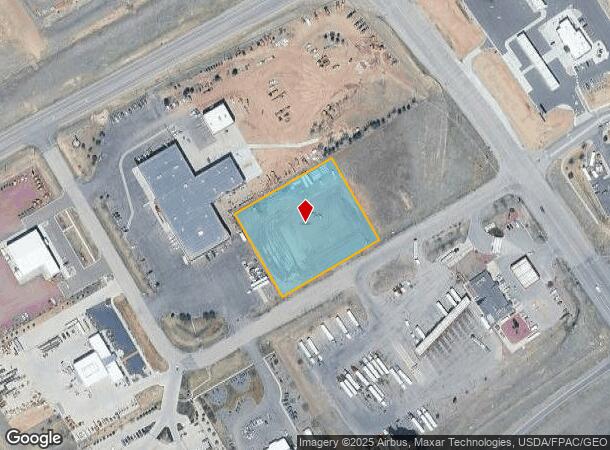
7819 Hutchins Dr
Cheyenne, WY
Campstool, Addition, 2Nd Filing
1-2196-0002-0003-0
CAMPSTOOL ADDITION, 2ND FILING: LOT 3, BLOCK 2
Industrialacreage
Laramie
X
Wyoming
56021C1114F
3
2024
2.08 AC
2025
I-80 Corridor/Cheyenne
002002
Other Market Areas
DEMOGRAPHICS near 7819 Hutchins Dr
1 Mile
3 Mile
5 Mile
2024 Total Population
151
17,484
44,292
2029 Population
155
17,872
45,185
Pop Growth 2024-2029
+ 2.65%
+ 2.22%
+ 2.02%
Average Age
36
38
39
2024 Total Households
53
6,952
18,216
HH Growth 2024-2029
+ 3.77%
+ 2.42%
+ 2.12%
Median Household Inc
$93,749
$73,421
$63,985
Avg Household Size
2.90
2.50
2.40
2024 Avg HH Vehicles
2.00
2.00
2.00
Median Home Value
$368,420
$293,100
$271,297
Median Year Built
2010
1993
1981
Nearby Places
Map Layers
Map Styles
 Street
 Aerial
- Restaurants
- Banks
- Shops
- Fitness
- Groceries
SALE & LEASE HISTORY
LISTING DATE
SALE/LEASE

Oct 23, 2017
For Sale
Jul 07, 2017
For Sale
Nearby Properties
Address
Land Use
TOTAL SIZE
Lot Size
Zoning
Address
Land Use
TOTAL SIZE
Lot Size
Zoning
1,120,931 SF
149.20 AC
Address
Land Use
TOTAL SIZE
Lot Size
Zoning
639,397 SF
67.52 AC
Address
Land Use
TOTAL SIZE
Lot Size
Zoning
243,960 SF
60.52 AC
Address
Land Use
TOTAL SIZE
Lot Size
Zoning
156,244 SF
4.75 AC
Address
Land Use
TOTAL SIZE
Lot Size
Zoning
109,096 SF
4.03 AC
MR2
Address
Land Use
TOTAL SIZE
Lot Size
Zoning
37,714 SF
4.29 AC
Address
Land Use
TOTAL SIZE
Lot Size
Zoning
96,088 SF
8.34 AC
Address
Land Use
TOTAL SIZE
Lot Size
Zoning
73,266 SF
8.08 AC
Address
Land Use
TOTAL SIZE
Lot Size
Zoning
59,223 SF
9.91 AC
HI
Address
Land Use
TOTAL SIZE
Lot Size
Zoning
65,520 SF
8.20 AC
Address
Land Use
TOTAL SIZE
Lot Size
Zoning
135,125 SF
8.87 AC
Address
Land Use
TOTAL SIZE
Lot Size
Zoning
174,000 SF
11.57 AC
MR2
Address
Land Use
TOTAL SIZE
Lot Size
Zoning
82,494 SF
17.27 AC
Address
Land Use
TOTAL SIZE
Lot Size
Zoning
46,705 SF
14.11 AC
HI
Address
Land Use
TOTAL SIZE
Lot Size
Zoning
33,080 SF
8.91 AC
Address
Land Use
TOTAL SIZE
Lot Size
Zoning
131,194 SF
17.67 AC
MR2
Address
Land Use
TOTAL SIZE
Lot Size
Zoning
114,503 SF
11.43 AC
MR2
Address
Land Use
TOTAL SIZE
Lot Size
Zoning
137,934 SF
15.52 AC
HI
Address
Land Use
TOTAL SIZE
Lot Size
Zoning
104,870 SF
6.44 AC
Address
Land Use
TOTAL SIZE
Lot Size
Zoning
66,102 SF
4.96 AC
HR1
Address
Land Use
TOTAL SIZE
Lot Size
Zoning
67,728 SF
34.57 AC
HI
Address
Land Use
TOTAL SIZE
Lot Size
Zoning
23,926 SF
2.21 AC
CB
Address
Land Use
TOTAL SIZE
Lot Size
Zoning
23,232 SF
1.76 AC
MR2
Address
Land Use
TOTAL SIZE
Lot Size
Zoning
50,585 SF
5.83 AC
HI
Address
Land Use
TOTAL SIZE
Lot Size
Zoning
37,188 SF
2.89 AC
CB
Address
Land Use
TOTAL SIZE
Lot Size
Zoning
44,075 SF
13.46 AC
LI
Address
Land Use
TOTAL SIZE
Lot Size
Zoning
33,856 SF
12.40 AC
HI
Address
Land Use
TOTAL SIZE
Lot Size
Zoning
23,400 SF
6.40 AC
HI
Address
Land Use
TOTAL SIZE
Lot Size
Zoning
17,452 SF
1.75 AC
MR2
Address
Land Use
TOTAL SIZE
Lot Size
Zoning
18,460 SF
4.78 AC
CB
The World's #1 Commercial Real Estate Marketplace
Connect with us
© 2026 CoStar Group
The information above has been obtained from sources believed reliable. While we do not doubt its accuracy we have not verified it and make no guarantee, warranty or representation about it. It is your responsibility to independently confirm its accuracy and completeness. Any projections, opinions, assumptions, or estimates used are for example only and do not represent the current or future performance of the property. The value of this transaction to you depends on tax and other factors which should be evaluated by your tax, financial, and legal advisors. You and your advisors should conduct a careful, independent investigation of the property to determine to your satisfaction the suitability of the property for your needs.