Property Record
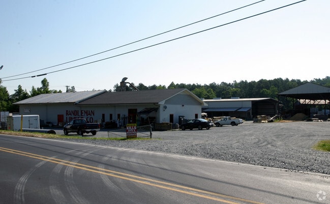
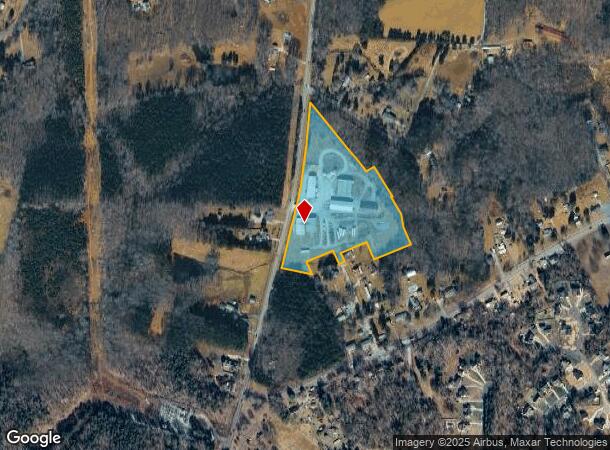
7820 Us Highway 220 Bus N, Randleman, NC 27317
NEARBY LISTINGS FOR SALE OR LEASE
Property Detail
7820 Us Highway 220 Bus N
7766-31-8131
R220;E
Storebuilding
Randolph
AE
North Carolina
3710776600J
10.15 AC
2025
NE Randolph County
2025
Greensboro/Winston-Salem
031305
Greensboro-High Point, NC
4,920 SF
DEMOGRAPHICS near 7820 Us Highway 220 Bus N
1 Mile
3 Mile
5 Mile
2024 Total Population
1,642
9,312
20,791
2029 Population
1,703
9,678
21,667
Pop Growth 2024-2029
+ 3.71%
+ 3.93%
+ 4.21%
Average Age
40
41
41
2024 Total Households
673
3,771
8,313
HH Growth 2024-2029
+ 3.57%
+ 3.82%
+ 4.13%
Median Household Inc
$59,999
$56,354
$56,462
Avg Household Size
2.40
2.50
2.50
2024 Avg HH Vehicles
2.00
2.00
2.00
Median Home Value
$132,125
$137,874
$139,248
Median Year Built
1977
1979
1989
Nearby Places
Map Layers
Map Styles
 Street
 Aerial
- Restaurants
- Banks
- Shops
- Fitness
- Groceries
PUBLIC TRANSPORTATION
AIRPORT
Piedmont Triad International
DRIVE
WALK
Distance
Piedmont Triad International
35 min
24.8 mi
Freight Ports
Port of Wilmington
DRIVE
WALK
Distance
Port of Wilmington
238 min
199.6 mi
Nearby Properties
Address
Land Use
TOTAL SIZE
Lot Size
Zoning
Address
Land Use
TOTAL SIZE
Lot Size
Zoning
188,645 SF
28.68 AC
I-1
Address
Land Use
TOTAL SIZE
Lot Size
Zoning
4,401 SF
41.55 AC
RR
Address
Land Use
TOTAL SIZE
Lot Size
Zoning
63,115 SF
29.70 AC
I-1
Address
Land Use
TOTAL SIZE
Lot Size
Zoning
151,525 SF
16.92 AC
B-2
Address
Land Use
TOTAL SIZE
Lot Size
Zoning
201,008 SF
15.65 AC
I-1
Address
Land Use
TOTAL SIZE
Lot Size
Zoning
151,574 SF
23.07 AC
I-1
Address
Land Use
TOTAL SIZE
Lot Size
Zoning
7,000 SF
21.83 AC
B-1
Address
Land Use
TOTAL SIZE
Lot Size
Zoning
93,000 SF
22.74 AC
I-1
Address
Land Use
TOTAL SIZE
Lot Size
Zoning
98,400 SF
35.71 AC
I-1
Address
Land Use
TOTAL SIZE
Lot Size
Zoning
23,822 SF
7.09 AC
I-1
Address
Land Use
TOTAL SIZE
Lot Size
Zoning
44,988 SF
7.86 AC
B-2
Address
Land Use
TOTAL SIZE
Lot Size
Zoning
45,724 SF
10.96 AC
B-2
Address
Land Use
TOTAL SIZE
Lot Size
Zoning
12,739 SF
3.18 AC
B-1
Address
Land Use
TOTAL SIZE
Lot Size
Zoning
21,940 SF
5.01 AC
B-2
Address
Land Use
TOTAL SIZE
Lot Size
Zoning
10,500 SF
6.52 AC
HC-CD
Address
Land Use
TOTAL SIZE
Lot Size
Zoning
1,740 SF
9.80 AC
R-3
Address
Land Use
TOTAL SIZE
Lot Size
Zoning
73,189 SF
7.49 AC
I-1
Address
Land Use
TOTAL SIZE
Lot Size
Zoning
102,594 SF
9.32 AC
I-1
Address
Land Use
TOTAL SIZE
Lot Size
Zoning
30,886 SF
4.18 AC
I-1
Address
Land Use
TOTAL SIZE
Lot Size
Zoning
85,680 SF
11.51 AC
I-1
Address
Land Use
TOTAL SIZE
Lot Size
Zoning
2,448 SF
7.16 AC
R-3
Address
Land Use
TOTAL SIZE
Lot Size
Zoning
7,048 SF
7.49 AC
R-3
Address
Land Use
TOTAL SIZE
Lot Size
Zoning
5,969 SF
1 AC
B-2
Address
Land Use
TOTAL SIZE
Lot Size
Zoning
30,662 SF
5.51 AC
B-2
Address
Land Use
TOTAL SIZE
Lot Size
Zoning
60,000 SF
19.15 AC
I-1
Address
Land Use
TOTAL SIZE
Lot Size
Zoning
7,129 SF
1.95 AC
B-2
Address
Land Use
TOTAL SIZE
Lot Size
Zoning
12,340 SF
1.62 AC
B-1
Address
Land Use
TOTAL SIZE
Lot Size
Zoning
15,856 SF
3 AC
R-1
Address
Land Use
TOTAL SIZE
Lot Size
Zoning
13,501 SF
6.75 AC
R-1
Address
Land Use
TOTAL SIZE
Lot Size
Zoning
4,197 SF
5 AC
R-1
The World's #1 Commercial Real Estate Marketplace
Connect with us
© 2026 CoStar Group
The information above has been obtained from sources believed reliable. While we do not doubt its accuracy we have not verified it and make no guarantee, warranty or representation about it. It is your responsibility to independently confirm its accuracy and completeness. Any projections, opinions, assumptions, or estimates used are for example only and do not represent the current or future performance of the property. The value of this transaction to you depends on tax and other factors which should be evaluated by your tax, financial, and legal advisors. You and your advisors should conduct a careful, independent investigation of the property to determine to your satisfaction the suitability of the property for your needs.