Property Record
7825 Rosedale Hwy, Bakersfield, CA 93308


NEARBY LISTINGS FOR SALE OR LEASE
Property Detail
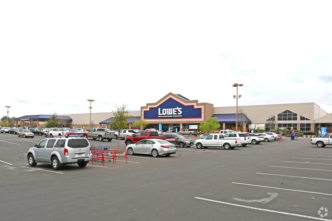
7825 Rosedale Hwy
368-060-82-00-7
SECTION 28 , TOWNSHIP 29 , RANGE 27 , QUARTER NW
Storebuilding
Kern
X
California
06029C1825F
13.84 AC
2024
Northwest Bakersfield
2025
Bakersfield
000507
Bakersfield, CA
117,352 SF
DEMOGRAPHICS near 7825 Rosedale Hwy
1 Mile
3 Mile
5 Mile
2024 Total Population
3,190
79,169
266,881
2029 Population
3,200
79,152
267,009
Pop Growth 2024-2029
+ 0.31%
(0.02%)
+ 0.05%
Average Age
36
38
37
2024 Total Households
1,198
28,640
93,162
HH Growth 2024-2029
+ 0.33%
(0.07%)
+ 0.01%
Median Household Inc
$73,107
$82,953
$69,826
Avg Household Size
2.60
2.70
2.80
2024 Avg HH Vehicles
2.00
2.00
2.00
Median Home Value
$299,999
$340,147
$330,402
Median Year Built
1997
1990
1984
Nearby Places
Map Layers
Map Styles
 Street
 Aerial
- Restaurants
- Banks
- Shops
- Fitness
- Groceries
PUBLIC TRANSPORTATION
COMMUTER RAIL
Bakersfield (San Joaquins - Amtrak)
DRIVE
WALK
Distance
Bakersfield (San Joaquins - Amtrak)
11 min
5.6 mi
AIRPORT
Meadows Field
DRIVE
WALK
Distance
Meadows Field
17 min
6.7 mi
Freight Ports
The Port of Hueneme
DRIVE
WALK
Distance
The Port of Hueneme
157 min
125.1 mi
Nearby Properties
Address
Land Use
TOTAL SIZE
Lot Size
Zoning
Address
Land Use
TOTAL SIZE
Lot Size
Zoning
60.03 AC
M-3
Address
Land Use
TOTAL SIZE
Lot Size
Zoning
3,788 SF
54.09 AC
M3
Address
Land Use
TOTAL SIZE
Lot Size
Zoning
1,200 SF
5.89 AC
M-1
Address
Land Use
TOTAL SIZE
Lot Size
Zoning
85,971 SF
5.31 AC
C-2
Address
Land Use
TOTAL SIZE
Lot Size
Zoning
112,849 SF
5.31 AC
C-2
Address
Land Use
TOTAL SIZE
Lot Size
Zoning
5,850 SF
10.96 AC
C2
Address
Land Use
TOTAL SIZE
Lot Size
Zoning
2,032 SF
11.08 AC
M3
Address
Land Use
TOTAL SIZE
Lot Size
Zoning
6,702 SF
18.75 AC
C-2
Address
Land Use
TOTAL SIZE
Lot Size
Zoning
1 SF
14.26 AC
R-2 PUD
Address
Land Use
TOTAL SIZE
Lot Size
Zoning
386,282 SF
14.05 AC
Address
Land Use
TOTAL SIZE
Lot Size
Zoning
10,064 SF
13.44 AC
R3
Address
Land Use
TOTAL SIZE
Lot Size
Zoning
155,550 SF
18.51 AC
M2
Address
Land Use
TOTAL SIZE
Lot Size
Zoning
253,532 SF
14.69 AC
Address
Land Use
TOTAL SIZE
Lot Size
Zoning
63,428 SF
5.18 AC
C-2
Address
Land Use
TOTAL SIZE
Lot Size
Zoning
41,394 SF
14.74 AC
Address
Land Use
TOTAL SIZE
Lot Size
Zoning
134,728 SF
7.56 AC
R3
Address
Land Use
TOTAL SIZE
Lot Size
Zoning
35,250 SF
10.33 AC
C-2 PCD
Address
Land Use
TOTAL SIZE
Lot Size
Zoning
149,197 SF
8.21 AC
PUD
Address
Land Use
TOTAL SIZE
Lot Size
Zoning
15,027 SF
17.72 AC
C-2
Address
Land Use
TOTAL SIZE
Lot Size
Zoning
161,539 SF
4 AC
CO
Address
Land Use
TOTAL SIZE
Lot Size
Zoning
99,368 SF
6.95 AC
CO
Address
Land Use
TOTAL SIZE
Lot Size
Zoning
233,512 SF
9.19 AC
R-3
Address
Land Use
TOTAL SIZE
Lot Size
Zoning
214,746 SF
14.91 AC
Address
Land Use
TOTAL SIZE
Lot Size
Zoning
138,923 SF
9.97 AC
C-2
Address
Land Use
TOTAL SIZE
Lot Size
Zoning
210,432 SF
13.52 AC
R-2
Address
Land Use
TOTAL SIZE
Lot Size
Zoning
55,532 SF
4.18 AC
CO
Address
Land Use
TOTAL SIZE
Lot Size
Zoning
83,388 SF
3.15 AC
Address
Land Use
TOTAL SIZE
Lot Size
Zoning
71,000 SF
5.89 AC
C-2
Address
Land Use
TOTAL SIZE
Lot Size
Zoning
193,524 SF
2.34 AC
C-O
The World's #1 Commercial Real Estate Marketplace
Connect with us
© 2025 CoStar Group
The information above has been obtained from sources believed reliable. While we do not doubt its accuracy we have not verified it and make no guarantee, warranty or representation about it. It is your responsibility to independently confirm its accuracy and completeness. Any projections, opinions, assumptions, or estimates used are for example only and do not represent the current or future performance of the property. The value of this transaction to you depends on tax and other factors which should be evaluated by your tax, financial, and legal advisors. You and your advisors should conduct a careful, independent investigation of the property to determine to your satisfaction the suitability of the property for your needs.